The right side captures superior scenery on both legs: Mexico City's eastern mountains during departure and Tokyo Bay plus Mount Fuji during arrival. The landing views alone justify the right-side choice for this transpacific route.
Flown MEX to NRT? Did we get it right?
Flight Path
Mexico City to Tokyo is 6,993 miles (11,253 km), a flight of about 13 hours 30 minutes.
The flight path crosses the Pacific Ocean at high altitude (typically 35,000-43,000 feet). Notable midpoint geography includes the Aleutian Islands (far north, usually not visible on standard routing), the North Pacific basin (open ocean, no landmarks), and approach to Japan via the Pacific coast. The aircraft typically enters Japanese airspace over the Pacific east of Tokyo, descending over the Kanto region. No significant landmarks are visible during the 10+ hours of open-ocean flight; the midpoint offers only cloud formations and occasional island chains at extreme distance if routing permits.
Great circle distance and headings ›


Phase by phase
Takeoff from MEX
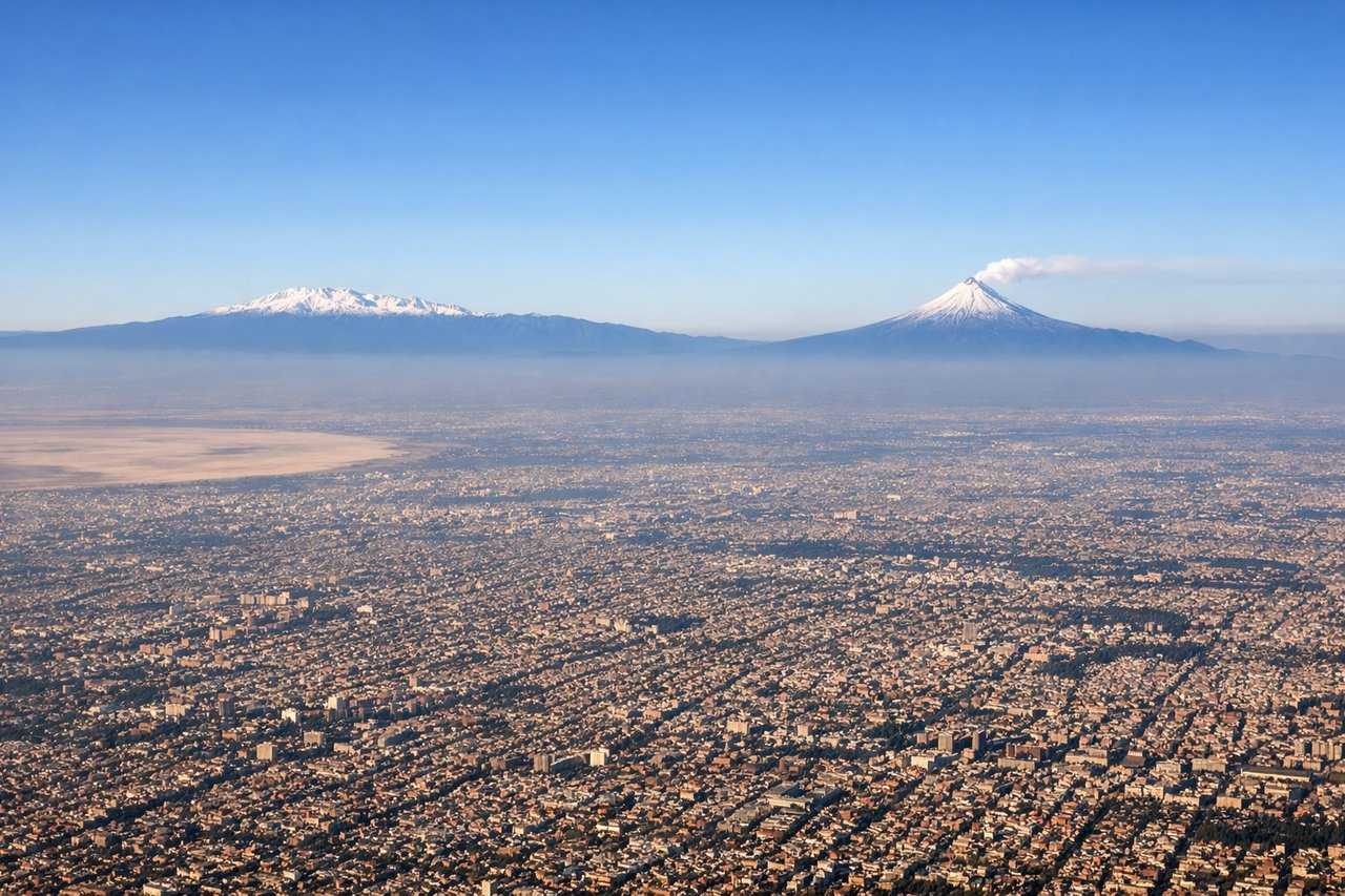
LEFTLeft-side seats offer views of the Sierra Madre Oriental mountain range and the Valley of Mexico as the aircraft climbs northwestward out of Mexico City. The terrain rises dramatically to the east and north, creating strong visual relief.
Landing at NRT
RIGHTRight-side seats provide views of Tokyo Bay, the Kanto Plain, and Mount Fuji during the approach from the northwest. The aircraft descends over the bay and coastal areas, offering clear sightlines to Japan's most iconic geography.
Will your flight be in sunlight?
Pick a date and time in the Sun Map to watch the sun move across your whole flight.
About This Route
Which side of the plane should I sit on flying from Licenciado Benito Juarez International (MEX) to New Tokyo International (NRT)?
Sit on the Right side of the plane for the best views on flights from Mexico City to Tokyo. The right side captures superior scenery on both legs: Mexico City's eastern mountains during departure and Tokyo Bay plus Mount Fuji during arrival. The landing views alone justify the right-side choice for this transpacific route.
What can I see during takeoff from Licenciado Benito Juarez International in Mexico City?
During takeoff from Licenciado Benito Juarez International (MEX), sit on the Left side for the best views. Left-side seats offer views of the Sierra Madre Oriental mountain range and the Valley of Mexico as the aircraft climbs northwestward out of Mexico City. The terrain rises dramatically to the east and north, creating strong visual relief. Notable sights include: Sierra Madre Oriental (eastern escarpment), Lake Texcoco (remnants visible in valley floor), Mexico City urban sprawl (south and southwest), Popocatépetl volcano (distant southeastern horizon on clear days).
What can I see when landing at New Tokyo International in Tokyo?
When landing at New Tokyo International (NRT), sit on the Right side for the best views. Right-side seats provide views of Tokyo Bay, the Kanto Plain, and Mount Fuji during the approach from the northwest. The aircraft descends over the bay and coastal areas, offering clear sightlines to Japan's most iconic geography. Notable sights include: Tokyo Bay (Edo Bay, with visible harbor infrastructure), Mount Fuji (visible on clear days to the southwest, 60+ miles distant), Kanto Plain (flat agricultural and urban terrain), Narita International Airport area and surrounding Chiba Prefecture.
How long is the flight from Mexico City to Tokyo?
The flight from Licenciado Benito Juarez International (MEX) to New Tokyo International (NRT) takes about 13 hours 30 minutes. The shortest flight path between them is 6,993 miles (11,253 km); winds and air traffic control usually add a few percent.
What does the Mexico City to Tokyo flight path pass over?
The flight path crosses the Pacific Ocean at high altitude (typically 35,000-43,000 feet). Notable midpoint geography includes the Aleutian Islands (far north, usually not visible on standard routing), the North Pacific basin (open ocean, no landmarks), and approach to Japan via the Pacific coast. The aircraft typically enters Japanese airspace over the Pacific east of Tokyo, descending over the Kanto region. No significant landmarks are visible during the 10+ hours of open-ocean flight; the midpoint offers only cloud formations and occasional island chains at extreme distance if routing permits.