While takeoff offers good mountain views on the left, the landing approach into Portland on the right side provides the dramatic payoff—Mount Hood and the Cascade Range are iconic and unmissable. Right-side seats capture the most memorable scenery of this route.
Flown MEX to PDX? Did we get it right?
Flight Path
Mexico City to Portland is 2,250 miles (3,621 km), a flight of about 4 hours 15 minutes.
The flight path crosses the Sierra Madre Occidental (western range) in northern Mexico, then transitions over the Chihuahuan Desert plateau. Over the US, you'll pass over west Texas and New Mexico's high desert terrain, then enter Arizona and southern Nevada. The Colorado Plateau's edge becomes visible, followed by the transition into California and Nevada's basin-and-range topography. Near the Oregon border, the terrain begins rising toward the Cascade Range. The entire route follows a northwest trajectory with consistent views of progressively higher terrain as you approach the Pacific Northwest.
Great circle distance and headings ›


Phase by phase
Takeoff from MEX
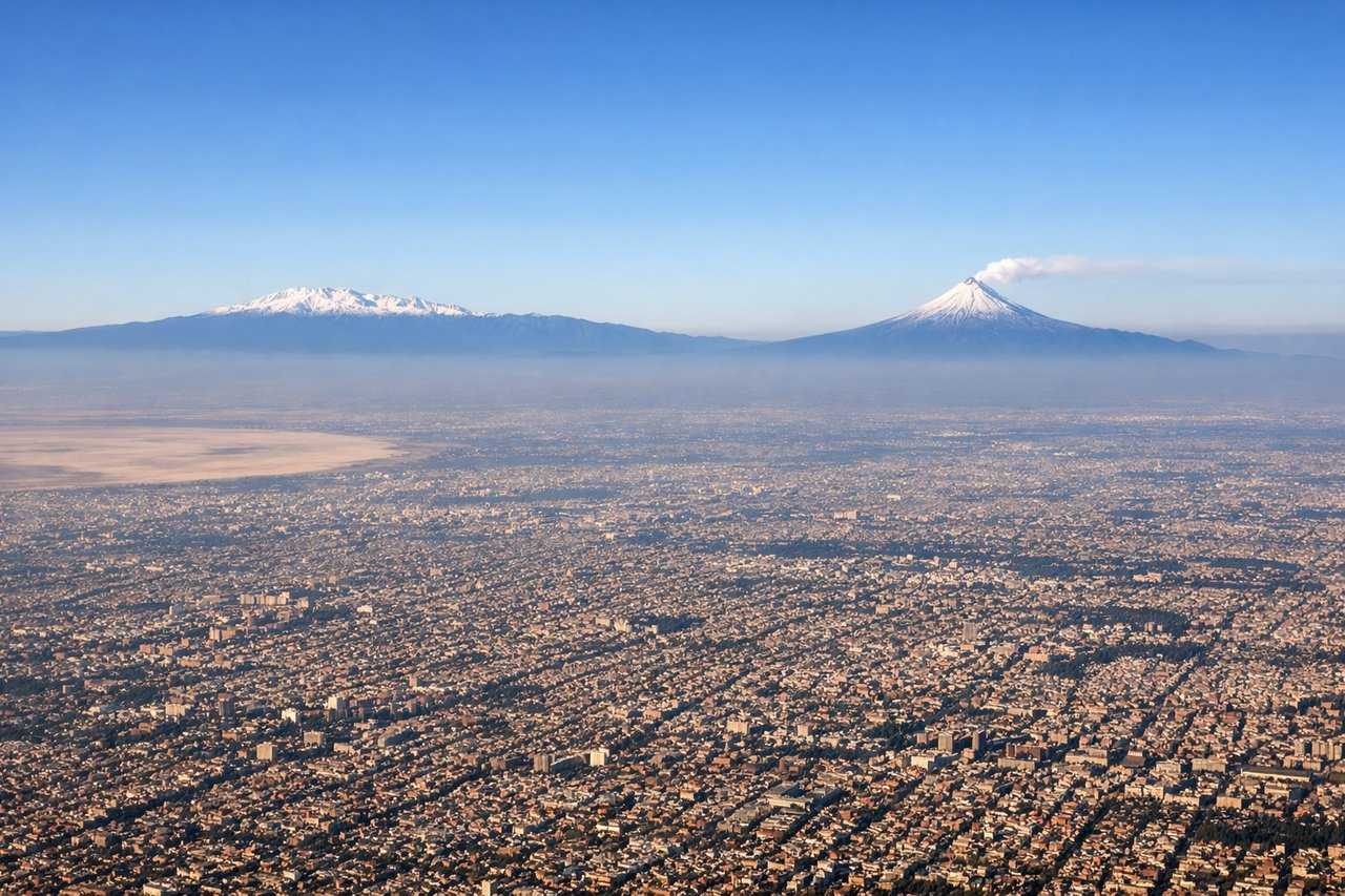
LEFTLeft-side seats offer views of the Sierra Madre Oriental and the Valley of Mexico's eastern rim during northbound climb-out. The terrain rises dramatically to the left as you depart, creating immediate visual interest.
Landing at PDX
RIGHTRight-side seats provide excellent views of the Cascade Range and Mount Hood during the descent into Portland. The volcanic peaks dominate the eastern approach, and right-side passengers get the direct view as the aircraft descends from the southeast.
Will your flight be in sunlight?
Pick a date and time in the Sun Map to watch the sun move across your whole flight.
About This Route
Which side of the plane should I sit on flying from Licenciado Benito Juarez International (MEX) to Portland International (PDX)?
Sit on the Right side of the plane for the best views on flights from Mexico City to Portland. While takeoff offers good mountain views on the left, the landing approach into Portland on the right side provides the dramatic payoff—Mount Hood and the Cascade Range are iconic and unmissable. Right-side seats capture the most memorable scenery of this route.
What can I see during takeoff from Licenciado Benito Juarez International in Mexico City?
During takeoff from Licenciado Benito Juarez International (MEX), sit on the Left side for the best views. Left-side seats offer views of the Sierra Madre Oriental and the Valley of Mexico's eastern rim during northbound climb-out. The terrain rises dramatically to the left as you depart, creating immediate visual interest. Notable sights include: Sierra Madre Oriental (eastern range), Lake Texcoco remnants (visible as water bodies and wetlands in the valley floor), Mexico City urban sprawl (receding southward), Popocatépetl volcano (visible on clear days to the southeast, but left seats get better angle during initial climb).
What can I see when landing at Portland International in Portland?
When landing at Portland International (PDX), sit on the Right side for the best views. Right-side seats provide excellent views of the Cascade Range and Mount Hood during the descent into Portland. The volcanic peaks dominate the eastern approach, and right-side passengers get the direct view as the aircraft descends from the southeast. Notable sights include: Mount Hood (11,240 ft, prominent volcanic cone on the horizon), Cascade Range foothills (forested ridgelines), Willamette Valley (broad agricultural plain with field patterns visible), Columbia River (visible as a meandering feature cutting through the landscape).
How long is the flight from Mexico City to Portland?
The flight from Licenciado Benito Juarez International (MEX) to Portland International (PDX) takes about 4 hours 15 minutes. The shortest flight path between them is 2,250 miles (3,621 km); winds and air traffic control usually add a few percent.
What does the Mexico City to Portland flight path pass over?
The flight path crosses the Sierra Madre Occidental (western range) in northern Mexico, then transitions over the Chihuahuan Desert plateau. Over the US, you'll pass over west Texas and New Mexico's high desert terrain, then enter Arizona and southern Nevada. The Colorado Plateau's edge becomes visible, followed by the transition into California and Nevada's basin-and-range topography. Near the Oregon border, the terrain begins rising toward the Cascade Range. The entire route follows a northwest trajectory with consistent views of progressively higher terrain as you approach the Pacific Northwest.