Montpelier to San Francisco is 2,600 miles (4,184 km), a flight of about 5 hours 15 minutes.
While the takeoff offers good Green Mountain views on the left, the landing approach on the right provides superior scenery: the dramatic Sierra Nevada, the Central Valley's scale, and the iconic San Francisco Bay with the Golden Gate. The landing views are more visually distinctive and memorable.
Flight Path
Adirondack Mountains (New York), Great Lakes region (Lake Ontario and Erie visible to the north), Appalachian plateau, Ohio River valley, Mississippi River valley, Great Plains, Rocky Mountains (Colorado and Wyoming ranges), Great Basin and Sierra Nevada range
Great circle distance and headings ›.jpeg?width=600)


.jpg?width=600)


Phase by phase
Takeoff from MPV
LEFTLeft side captures the Green Mountains running north-south through Vermont immediately after departure. You'll see the spine of the range and the valleys between peaks as you climb out over central Vermont.
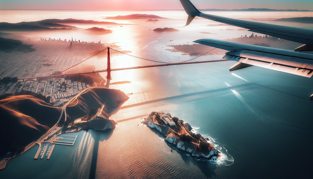
Landing at SFO
RIGHTRight side provides the best views during descent into San Francisco. You'll see the Sierra Nevada range to the east, then the Central Valley, and finally the San Francisco Bay with the Golden Gate Strait and Pacific coastline as you approach from the east.
Landmarks on this routeAll landmarks →
Will your flight be in sunlight?
Pick a date and time in the Sun Map to watch the sun move across your whole flight.
About This Route
Which side of the plane should I sit on flying from Edward F Knapp State (MPV) to San Francisco International (SFO)?
Sit on the Right side of the plane for the best views on flights from Montpelier to San Francisco. While the takeoff offers good Green Mountain views on the left, the landing approach on the right provides superior scenery: the dramatic Sierra Nevada, the Central Valley's scale, and the iconic San Francisco Bay with the Golden Gate. The landing views are more visually distinctive and memorable.
What can I see during takeoff from Edward F Knapp State in Montpelier?
During takeoff from Edward F Knapp State (MPV), sit on the Left side for the best views. Left side captures the Green Mountains running north-south through Vermont immediately after departure. You'll see the spine of the range and the valleys between peaks as you climb out over central Vermont. Notable sights include: Green Mountains, Connecticut River valley to the east, Lake Champlain (western horizon), Camel's Hump peak.
What can I see when landing at San Francisco International in San Francisco?
When landing at San Francisco International (SFO), sit on the Right side for the best views. Right side provides the best views during descent into San Francisco. You'll see the Sierra Nevada range to the east, then the Central Valley, and finally the San Francisco Bay with the Golden Gate Strait and Pacific coastline as you approach from the east. Notable sights include: Sierra Nevada mountains, San Francisco Bay, Golden Gate Strait, Pacific Ocean coastline.
How long is the flight from Montpelier to San Francisco?
The flight from Edward F Knapp State (MPV) to San Francisco International (SFO) takes about 5 hours 15 minutes. The shortest flight path between them is 2,600 miles (4,184 km); winds and air traffic control usually add a few percent.
What does the Montpelier to San Francisco flight path pass over?
Adirondack Mountains (New York), Great Lakes region (Lake Ontario and Erie visible to the north), Appalachian plateau, Ohio River valley, Mississippi River valley, Great Plains, Rocky Mountains (Colorado and Wyoming ranges), Great Basin and Sierra Nevada range