Stockholm to London is 848 miles (1,365 km), a flight of about 2 hours 20 minutes.
Left side wins both ends of the flight. During the cruise over the North Sea and Denmark, the left side also picks up the Danish coastline and the Jutland peninsula as the route tracks southwest, making it the stronger choice throughout.
Flight Path
The route crosses southern Sweden's agricultural lowlands, then the Øresund strait between Sweden and Denmark (with the Øresund Bridge faintly visible on clear days), over the Danish islands of Zealand and Funen, across the Danish-German border region of Jutland, then out over the North Sea. The North Sea crossing is largely featureless open water at cruise altitude, though offshore wind farm arrays are sometimes visible in the southern North Sea near the Dutch and UK coasts. The route descends over East Anglia before tracking into the London TMA.
Great circle distance and headings ›Phase by phase
Takeoff from NYO
LEFTSkavsta's primary runway 08/26 means westbound departures head roughly west, putting Lake Vättern — Sweden's second-largest lake, about 100km long — on the left (south) side during the initial climb and turn. The lake is unmistakable from altitude, a long narrow blue slash through the forested Swedish lowlands.
Landing at LHR
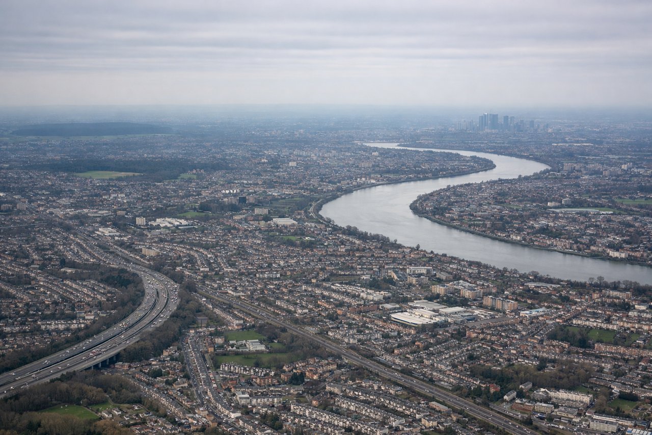
LEFTHeathrow's dominant runway orientation is 09/27 (east-west). On westerly approaches — the most common, landing on runway 27L/27R — aircraft track in from the east over London. The left side gives views over central London: the Thames, the City, Canary Wharf, and the West End as you descend through 3,000-5,000 feet on final approach.
Landmarks on this routeAll landmarks →
Will your flight be in sunlight?
Pick a date and time in the Sun Map to watch the sun move across your whole flight.
About This Route
Which side of the plane should I sit on flying from Skavsta (NYO) to Heathrow (LHR)?
Sit on the Left side of the plane for the best views on flights from Stockholm to London. Left side wins both ends of the flight. During the cruise over the North Sea and Denmark, the left side also picks up the Danish coastline and the Jutland peninsula as the route tracks southwest, making it the stronger choice throughout.
What can I see during takeoff from Skavsta in Stockholm?
During takeoff from Skavsta (NYO), sit on the Left side for the best views. Skavsta's primary runway 08/26 means westbound departures head roughly west, putting Lake Vättern — Sweden's second-largest lake, about 100km long — on the left (south) side during the initial climb and turn. The lake is unmistakable from altitude, a long narrow blue slash through the forested Swedish lowlands. Notable sights include: Lake Vättern (long narrow lake to the south), Lake Roxen near Linköping, the agricultural patchwork of Östergötland, Nyköping town and its river estuary directly below on departure.
What can I see when landing at Heathrow in London?
When landing at Heathrow (LHR), sit on the Left side for the best views. Heathrow's dominant runway orientation is 09/27 (east-west). On westerly approaches — the most common, landing on runway 27L/27R — aircraft track in from the east over London. The left side gives views over central London: the Thames, the City, Canary Wharf, and the West End as you descend through 3,000-5,000 feet on final approach. Notable sights include: River Thames snaking through central London, Canary Wharf tower cluster to the east, Windsor Castle and Windsor Great Park just west of the airport, the M25 motorway ring.
How long is the flight from Stockholm to London?
The flight from Skavsta (NYO) to Heathrow (LHR) takes about 2 hours 20 minutes. The shortest flight path between them is 848 miles (1,365 km); winds and air traffic control usually add a few percent.
What does the Stockholm to London flight path pass over?
The route crosses southern Sweden's agricultural lowlands, then the Øresund strait between Sweden and Denmark (with the Øresund Bridge faintly visible on clear days), over the Danish islands of Zealand and Funen, across the Danish-German border region of Jutland, then out over the North Sea. The North Sea crossing is largely featureless open water at cruise altitude, though offshore wind farm arrays are sometimes visible in the southern North Sea near the Dutch and UK coasts. The route descends over East Anglia before tracking into the London TMA.