Omaha to Houston is 770 miles (1,239 km), a flight of about 2 hours 25 minutes.
Left side wins both ends of the flight. During the southbound cruise at altitude over Kansas and Oklahoma, the left side also faces slightly east, giving occasional views of river systems like the Arkansas River and the Red River as they cross the flight path. Right side is largely featureless flat terrain throughout.
Flight Path
The flight tracks roughly south-southeast over eastern Kansas, crossing the Kansas River and Flint Hills region, then over Oklahoma passing near Wichita and Oklahoma City metro areas visible as urban grids, crossing the Red River into Texas, then over the East Texas Piney Woods before descending into the Houston coastal plain. The terrain is consistently flat with river systems — the Arkansas, Canadian, and Red Rivers — providing the main visual interest at cruise altitude.
Great circle distance and headings ›Phase by phase
Takeoff from OFF
LEFTOffutt's primary runway 30 departure heads northwest, then aircraft typically turn south toward Houston. A left-side seat gives you a clear view of the Missouri River corridor, downtown Omaha's skyline, and the broad floodplain farmland stretching east into Iowa. The river's meandering path is a strong visual anchor during climb-out.
Landing at IAH
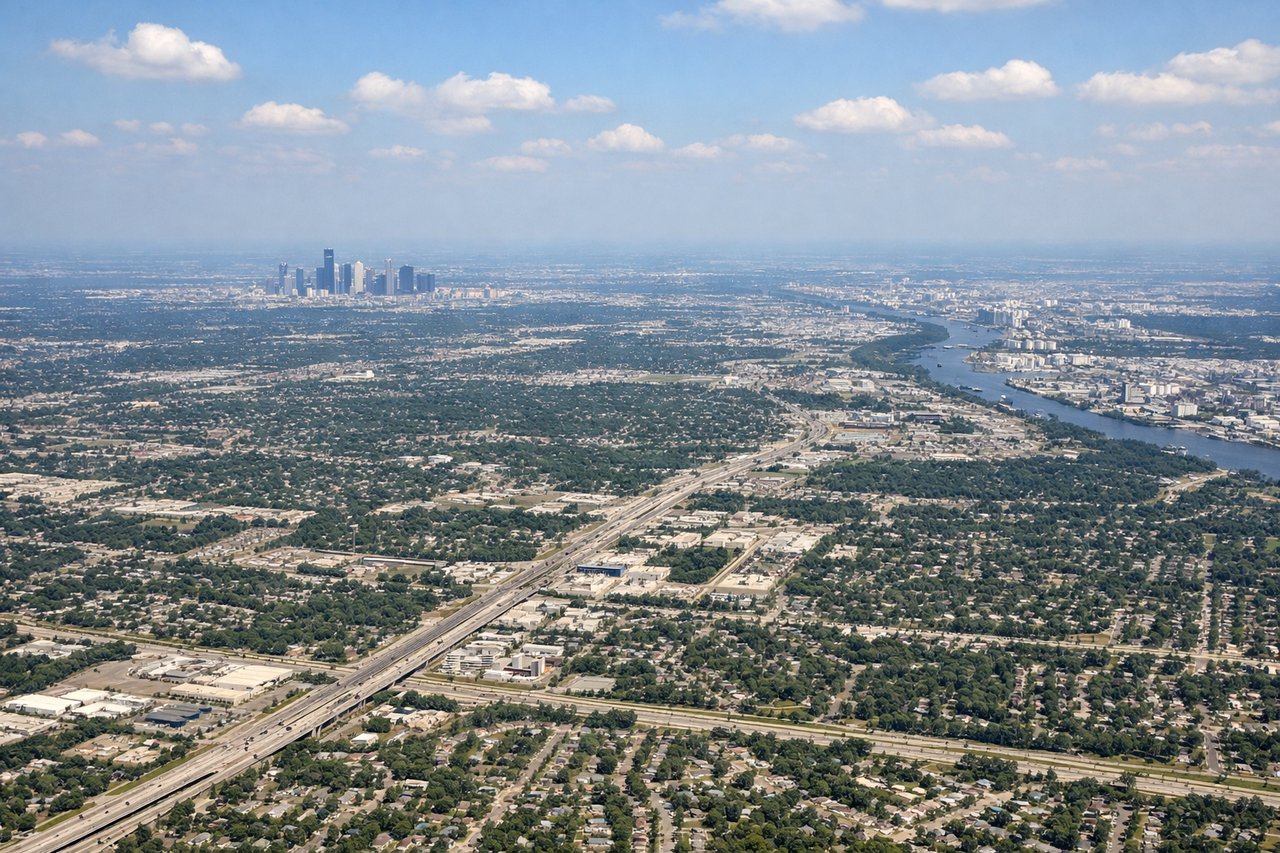
LEFTIAH's primary south-flow arrivals on runways 26L/26R or 27 approach from the north-northeast, meaning a left-side seat faces south and southeast toward downtown Houston's skyline as you descend. You get a prolonged view of the Houston metro sprawl, the Ship Channel industrial corridor, and on clear days the glint of Galveston Bay in the distance.
Will your flight be in sunlight?
Pick a date and time in the Sun Map to watch the sun move across your whole flight.
About This Route
Which side of the plane should I sit on flying from Offutt Afb (OFF) to George Bush Intcntl Houston (IAH)?
Sit on the Left side of the plane for the best views on flights from Omaha to Houston. Left side wins both ends of the flight. During the southbound cruise at altitude over Kansas and Oklahoma, the left side also faces slightly east, giving occasional views of river systems like the Arkansas River and the Red River as they cross the flight path. Right side is largely featureless flat terrain throughout.
What can I see during takeoff from Offutt Afb in Omaha?
During takeoff from Offutt Afb (OFF), sit on the Left side for the best views. Offutt's primary runway 30 departure heads northwest, then aircraft typically turn south toward Houston. A left-side seat gives you a clear view of the Missouri River corridor, downtown Omaha's skyline, and the broad floodplain farmland stretching east into Iowa. The river's meandering path is a strong visual anchor during climb-out. Notable sights include: Missouri River floodplain, downtown Omaha skyline, Eppley Airfield across the river, Council Bluffs Iowa grid farmland.
What can I see when landing at George Bush Intcntl Houston in Houston?
When landing at George Bush Intcntl Houston (IAH), sit on the Left side for the best views. IAH's primary south-flow arrivals on runways 26L/26R or 27 approach from the north-northeast, meaning a left-side seat faces south and southeast toward downtown Houston's skyline as you descend. You get a prolonged view of the Houston metro sprawl, the Ship Channel industrial corridor, and on clear days the glint of Galveston Bay in the distance. Notable sights include: Downtown Houston skyline, Houston Ship Channel and refineries, Lake Houston to the east, Galveston Bay on the horizon.
How long is the flight from Omaha to Houston?
The flight from Offutt Afb (OFF) to George Bush Intcntl Houston (IAH) takes about 2 hours 25 minutes. The shortest flight path between them is 770 miles (1,239 km); winds and air traffic control usually add a few percent.
What does the Omaha to Houston flight path pass over?
The flight tracks roughly south-southeast over eastern Kansas, crossing the Kansas River and Flint Hills region, then over Oklahoma passing near Wichita and Oklahoma City metro areas visible as urban grids, crossing the Red River into Texas, then over the East Texas Piney Woods before descending into the Houston coastal plain. The terrain is consistently flat with river systems — the Arkansas, Canadian, and Red Rivers — providing the main visual interest at cruise altitude.