Omaha to Seattle is 1,369 miles (2,204 km), a flight of about 3 hours 15 minutes.
While takeoff offers river views, the landing approach into Seattle delivers far more dramatic scenery—the Cascade Range and Puget Sound are visually striking and iconic. Left seats capture this better during descent.
Flight Path
You'll cross the Blue Mountains of eastern Oregon and Washington, then the Columbia River plateau. The Snake River canyon becomes visible in central Washington. The Wallowa Mountains appear to the south around the midpoint. As you approach the Cascades, the terrain transitions from high desert to forested slopes, with Mount Hood visible far to the south on clear days.
Great circle distance and headings ›.jpg?width=600)

Phase by phase
Takeoff from OFF
RIGHTRight-side seats offer views of the Missouri River and Omaha's urban sprawl as you climb northwest. The river curves distinctly below, and you'll see the grid of the city receding beneath you.
Landing at SEA
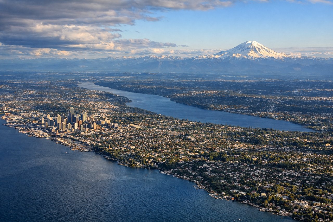
LEFTLeft seats provide excellent views of the Cascade Range and Puget Sound as you descend into Seattle. The mountains rise dramatically to the east, and the sound's complex waterways and islands become visible in the final approach.
Landmarks on this routeAll landmarks →
Will your flight be in sunlight?
Pick a date and time in the Sun Map to watch the sun move across your whole flight.
About This Route
Which side of the plane should I sit on flying from Offutt Afb (OFF) to Seattle Tacoma International (SEA)?
Sit on the Left side of the plane for the best views on flights from Omaha to Seattle. While takeoff offers river views, the landing approach into Seattle delivers far more dramatic scenery—the Cascade Range and Puget Sound are visually striking and iconic. Left seats capture this better during descent.
What can I see during takeoff from Offutt Afb in Omaha?
During takeoff from Offutt Afb (OFF), sit on the Right side for the best views. Right-side seats offer views of the Missouri River and Omaha's urban sprawl as you climb northwest. The river curves distinctly below, and you'll see the grid of the city receding beneath you. Notable sights include: Missouri River, Omaha metropolitan area, Platte River confluence (south), farmland grid patterns extending west.
What can I see when landing at Seattle Tacoma International in Seattle?
When landing at Seattle Tacoma International (SEA), sit on the Left side for the best views. Left seats provide excellent views of the Cascade Range and Puget Sound as you descend into Seattle. The mountains rise dramatically to the east, and the sound's complex waterways and islands become visible in the final approach. Notable sights include: Cascade Range (Mount Rainier visible on clear days), Puget Sound, Lake Washington, Seattle's downtown waterfront.
How long is the flight from Omaha to Seattle?
The flight from Offutt Afb (OFF) to Seattle Tacoma International (SEA) takes about 3 hours 15 minutes. The shortest flight path between them is 1,369 miles (2,204 km); winds and air traffic control usually add a few percent.
What does the Omaha to Seattle flight path pass over?
You'll cross the Blue Mountains of eastern Oregon and Washington, then the Columbia River plateau. The Snake River canyon becomes visible in central Washington. The Wallowa Mountains appear to the south around the midpoint. As you approach the Cascades, the terrain transitions from high desert to forested slopes, with Mount Hood visible far to the south on clear days.