Nome to Anchorage is 537 miles (864 km), a flight of about 1 hour 10 minutes.
While takeoff offers tundra and coastal views, the landing approach into Anchorage provides more dramatic and visually distinctive geography. The Chugach Mountains and Turnagain Arm create a more compelling window view than Nome's relatively flat departure landscape.
Flight Path
The flight path crosses the Bering Sea coast near Golovin, then follows the Alaska coastline south. Notable midpoint features include the Nulato Hills (inland to the east), the Yukon River delta region (visible to the southeast), and the transition from tundra to forested terrain as you approach the Alaska Range foothills. The Iditarod Trail corridor passes below. As you descend toward Anchorage, the Matanuska-Susitna Valley appears to the north, and the Talkeetna Mountains become visible to the northeast before the final approach over Turnagain Arm.
Great circle distance and headings ›Phase by phase
Takeoff from OME
RIGHTNome typically departs runway 03 (northeast) or 21 (southwest). Right-side seats offer views of the Bering Sea coastline and the tundra landscape spreading inland. The Seward Peninsula's terrain is more visually distinctive on the right as you climb out.
Landing at ANC
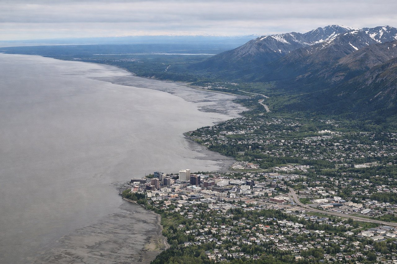
LEFTAnchorage typically lands on runway 01L/01R (northbound) or 19L/19R (southbound). Left-side seats during approach offer views of the Chugach Mountains' dramatic peaks and the Turnagain Arm inlet. These features provide striking visual contrast to the coastal approach.
Landmarks on this routeAll landmarks →
Will your flight be in sunlight?
Pick a date and time in the Sun Map to watch the sun move across your whole flight.
About This Route
Which side of the plane should I sit on flying from Nome (OME) to Ted Stevens Anchorage International (ANC)?
Sit on the Left side of the plane for the best views on flights from Nome to Anchorage. While takeoff offers tundra and coastal views, the landing approach into Anchorage provides more dramatic and visually distinctive geography. The Chugach Mountains and Turnagain Arm create a more compelling window view than Nome's relatively flat departure landscape.
What can I see during takeoff from Nome in Nome?
During takeoff from Nome (OME), sit on the Right side for the best views. Nome typically departs runway 03 (northeast) or 21 (southwest). Right-side seats offer views of the Bering Sea coastline and the tundra landscape spreading inland. The Seward Peninsula's terrain is more visually distinctive on the right as you climb out. Notable sights include: Bering Sea (immediate coastline), Seward Peninsula tundra, Snake River valley to the southeast, Kigluaik Mountains (distant, inland).
What can I see when landing at Ted Stevens Anchorage International in Anchorage?
When landing at Ted Stevens Anchorage International (ANC), sit on the Left side for the best views. Anchorage typically lands on runway 01L/01R (northbound) or 19L/19R (southbound). Left-side seats during approach offer views of the Chugach Mountains' dramatic peaks and the Turnagain Arm inlet. These features provide striking visual contrast to the coastal approach. Notable sights include: Chugach Mountains (prominent ridgeline), Turnagain Arm (water inlet), Anchorage coastal plain, Knik Arm to the west.
How long is the flight from Nome to Anchorage?
The flight from Nome (OME) to Ted Stevens Anchorage International (ANC) takes about 1 hour 10 minutes. The shortest flight path between them is 537 miles (864 km); winds and air traffic control usually add a few percent.
What does the Nome to Anchorage flight path pass over?
The flight path crosses the Bering Sea coast near Golovin, then follows the Alaska coastline south. Notable midpoint features include the Nulato Hills (inland to the east), the Yukon River delta region (visible to the southeast), and the transition from tundra to forested terrain as you approach the Alaska Range foothills. The Iditarod Trail corridor passes below. As you descend toward Anchorage, the Matanuska-Susitna Valley appears to the north, and the Talkeetna Mountains become visible to the northeast before the final approach over Turnagain Arm.