Anchorage to Nome is 537 miles (864 km), a flight of about 1 hour 10 minutes.
Left seats capture the dramatic Chugach Mountains and Cook Inlet on departure, then offer views of the Alaska Range and Bering Strait region during cruise. The westbound routing provides more visually distinctive terrain on the left side of the aircraft throughout the flight.
Flight Path
The flight path crosses the Alaska Range foothills and transitions to the Seward Peninsula tundra. Notable features include the Iditarod Trail corridor (visible as a linear feature across tundra), scattered mountain passes in the Alaska Range (visible as gaps in ridgelines), and numerous glacial lakes and river valleys. The Bering Strait becomes visible on the horizon during the final 20 minutes of flight, with the Diomede Islands occasionally visible in clear conditions. The landscape transitions from forested valleys and glaciated peaks to open tundra with minimal vegetation.
Great circle distance and headings ›Phase by phase
Takeoff from ANC
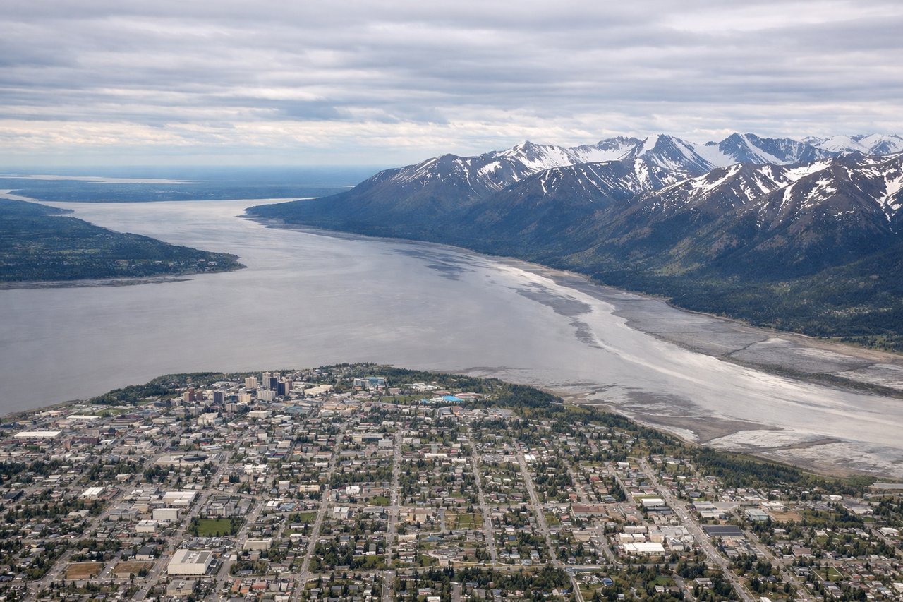
LEFTANC typically departs north on Runway 1L/1R. Left seats face west toward the Chugach Mountains and Cook Inlet, offering dramatic glaciated peaks and water views immediately after rotation. Right seats see inland terrain and the Matanuska Valley.
Landing at OME
RIGHTOME typically lands on Runway 3 (northeast heading). Right seats face southeast toward the Bering Sea coast and the approach path over tundra and coastal features. Left seats see inland tundra with fewer distinctive landmarks during descent.
Landmarks on this routeAll landmarks →
Will your flight be in sunlight?
Pick a date and time in the Sun Map to watch the sun move across your whole flight.
About This Route
Which side of the plane should I sit on flying from Ted Stevens Anchorage International (ANC) to Nome (OME)?
Sit on the Left side of the plane for the best views on flights from Anchorage to Nome. Left seats capture the dramatic Chugach Mountains and Cook Inlet on departure, then offer views of the Alaska Range and Bering Strait region during cruise. The westbound routing provides more visually distinctive terrain on the left side of the aircraft throughout the flight.
What can I see during takeoff from Ted Stevens Anchorage International in Anchorage?
During takeoff from Ted Stevens Anchorage International (ANC), sit on the Left side for the best views. ANC typically departs north on Runway 1L/1R. Left seats face west toward the Chugach Mountains and Cook Inlet, offering dramatic glaciated peaks and water views immediately after rotation. Right seats see inland terrain and the Matanuska Valley. Notable sights include: Chugach Mountains (snow-covered ridges 15-20 miles west), Cook Inlet (water body immediately west), Turnagain Arm (southeastern water feature), Matanuska Glacier (visible as white expanse 40+ miles northeast on clear days).
What can I see when landing at Nome in Nome?
When landing at Nome (OME), sit on the Right side for the best views. OME typically lands on Runway 3 (northeast heading). Right seats face southeast toward the Bering Sea coast and the approach path over tundra and coastal features. Left seats see inland tundra with fewer distinctive landmarks during descent. Notable sights include: Bering Sea (water body to the east and south), Nome city and harbor (small settlement visible on approach), Seward Peninsula (tundra landscape with scattered lakes), coastal lagoons and barrier islands (visible as linear water features).
How long is the flight from Anchorage to Nome?
The flight from Ted Stevens Anchorage International (ANC) to Nome (OME) takes about 1 hour 10 minutes. The shortest flight path between them is 537 miles (864 km); winds and air traffic control usually add a few percent.
What does the Anchorage to Nome flight path pass over?
The flight path crosses the Alaska Range foothills and transitions to the Seward Peninsula tundra. Notable features include the Iditarod Trail corridor (visible as a linear feature across tundra), scattered mountain passes in the Alaska Range (visible as gaps in ridgelines), and numerous glacial lakes and river valleys. The Bering Strait becomes visible on the horizon during the final 20 minutes of flight, with the Diomede Islands occasionally visible in clear conditions. The landscape transitions from forested valleys and glaciated peaks to open tundra with minimal vegetation.