The takeoff side offers a rare chance at a Denali sighting alongside the Chugach and Talkeetna ranges, a dramatic and highly memorable start to the flight that outweighs the pleasant but modest Atlanta skyline view on landing.
Flown ANC to ATL? Did we get it right?
Flight Path
Anchorage to Atlanta is 3,410 miles (5,488 km), a flight of about 6 hours 30 minutes.
Canadian Rockies foothills over British Columbia and Alberta, the northern Great Plains across Montana and the Dakotas, and the Missouri and Mississippi River valleys before descending into the Appalachian foothills of Tennessee and Georgia
Great circle distance and headings ›


Phase by phase
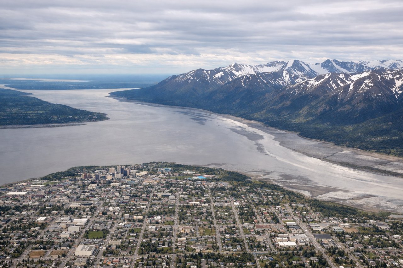
Takeoff from ANC
LEFTDeparting ANC eastbound on the 07 runways, the climb out passes north of the Chugach Range with the Talkeetna Mountains and, on clear days, Denali and the Alaska Range visible in the distance to the north. The right side mainly shows Turnagain Arm and Cook Inlet mudflats, which are pleasant but less dramatic than a Denali sighting.
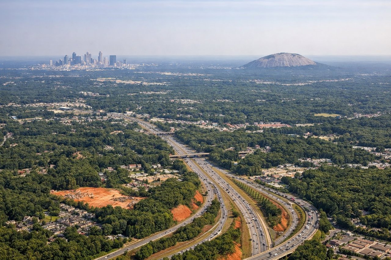
Landing at ATL
RIGHTOn approach to ATL from the north/northwest, the final turn toward the west-facing runways puts downtown Atlanta's skyline and the Chattahoochee River on the right side of the aircraft. The left side mostly shows flat suburban sprawl and pine forest with fewer distinct features.
Will your flight be in sunlight?
Pick a date and time in the Sun Map to watch the sun move across your whole flight.
About This Route
Which side of the plane should I sit on flying from Ted Stevens Anchorage International (ANC) to The William B Hartsfield Atlanta International (ATL)?
Sit on the Left side of the plane for the best views on flights from Anchorage to Atlanta. The takeoff side offers a rare chance at a Denali sighting alongside the Chugach and Talkeetna ranges, a dramatic and highly memorable start to the flight that outweighs the pleasant but modest Atlanta skyline view on landing.
What can I see during takeoff from Ted Stevens Anchorage International in Anchorage?
During takeoff from Ted Stevens Anchorage International (ANC), sit on the Left side for the best views. Departing ANC eastbound on the 07 runways, the climb out passes north of the Chugach Range with the Talkeetna Mountains and, on clear days, Denali and the Alaska Range visible in the distance to the north. The right side mainly shows Turnagain Arm and Cook Inlet mudflats, which are pleasant but less dramatic than a Denali sighting. Notable sights include: Chugach Mountains, Talkeetna Mountains, Denali (Alaska Range) in the distance, Matanuska Valley.
What can I see when landing at The William B Hartsfield Atlanta International in Atlanta?
When landing at The William B Hartsfield Atlanta International (ATL), sit on the Right side for the best views. On approach to ATL from the north/northwest, the final turn toward the west-facing runways puts downtown Atlanta's skyline and the Chattahoochee River on the right side of the aircraft. The left side mostly shows flat suburban sprawl and pine forest with fewer distinct features. Notable sights include: Downtown Atlanta skyline, Chattahoochee River, Hartsfield-Jackson terminal complex.
How long is the flight from Anchorage to Atlanta?
The flight from Ted Stevens Anchorage International (ANC) to The William B Hartsfield Atlanta International (ATL) takes about 6 hours 30 minutes. The shortest flight path between them is 3,410 miles (5,488 km); winds and air traffic control usually add a few percent.
What does the Anchorage to Atlanta flight path pass over?
Canadian Rockies foothills over British Columbia and Alberta, the northern Great Plains across Montana and the Dakotas, and the Missouri and Mississippi River valleys before descending into the Appalachian foothills of Tennessee and Georgia