Anchorage to San Francisco is 2,016 miles (3,244 km), a flight of about 3 hours 30 minutes.
While takeoff favors the right side for Chugach Mountain views, the left side wins overall due to the extended scenic run down the British Columbia and Pacific Northwest coastline—including glaciated coastal ranges, fjords, and islands—plus the spectacular San Francisco Bay approach at the end.
Flight Path
The route passes over the British Columbia coast ranges and Inside Passage islands, then continues over Vancouver Island, the Olympic Mountains and Puget Sound in Washington, and the Oregon and Northern California coastline before reaching the Bay Area.
Great circle distance and headings ›

Phase by phase
Takeoff from ANC
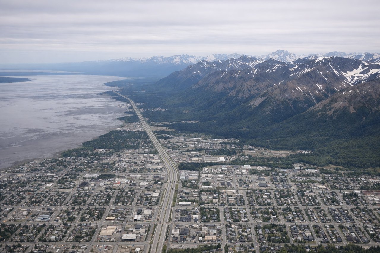
RIGHTDeparting ANC to the south/southeast, the right side gives good views of the Chugach Mountains and Turnagain Arm as the aircraft climbs and banks toward its southeast heading. Cook Inlet and the Kenai Mountains can also appear briefly on this side during the turn.
Landing at SFO
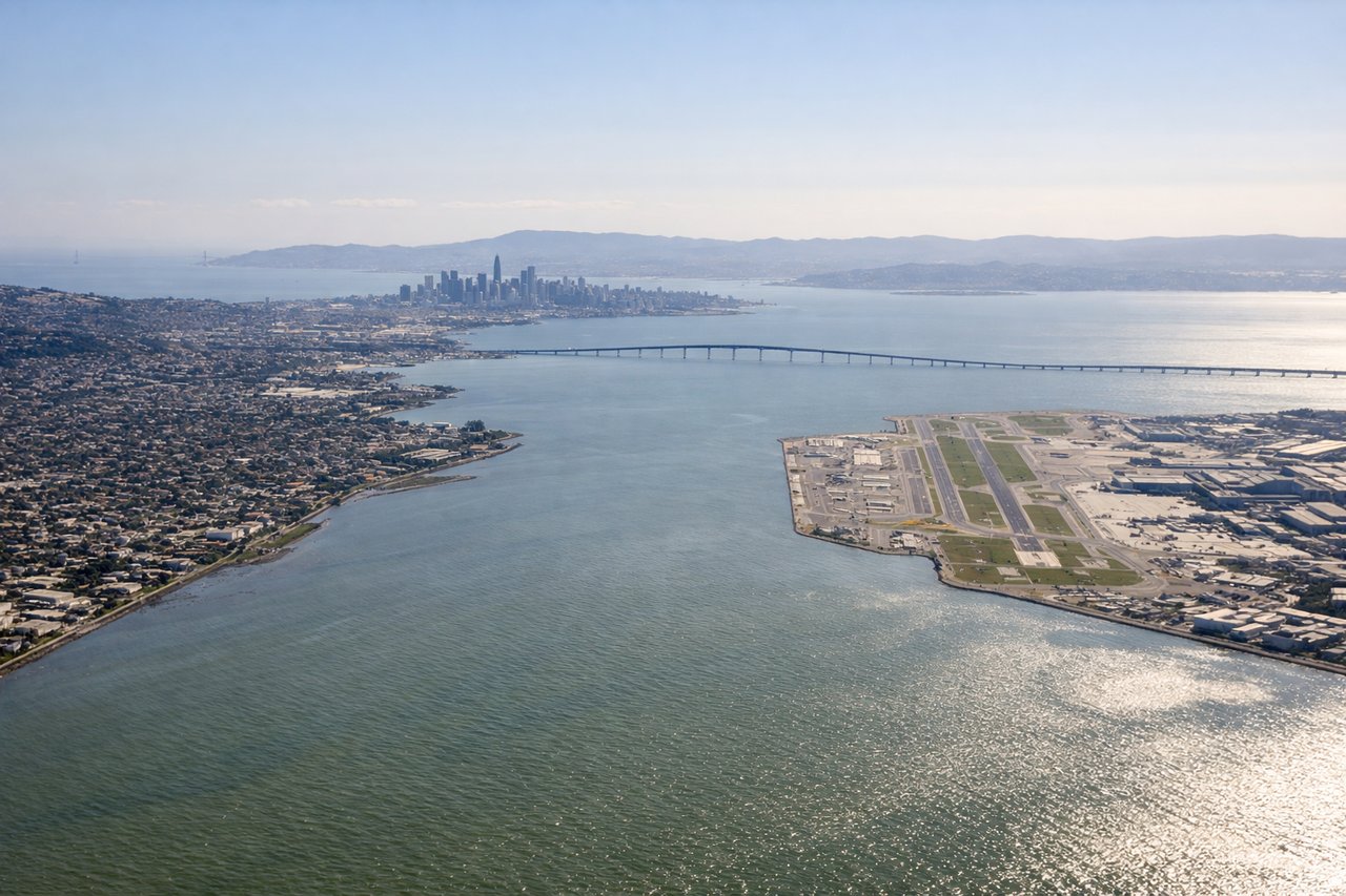
LEFTOn approach into SFO from the north, the left side offers views of the Marin Headlands, the Golden Gate Bridge, and the San Francisco skyline before the final turn over the bay. This is one of the most recognizable urban approach sequences in the US.
Landmarks on this routeAll landmarks →
Will your flight be in sunlight?
Pick a date and time in the Sun Map to watch the sun move across your whole flight.
About This Route
Which side of the plane should I sit on flying from Ted Stevens Anchorage International (ANC) to San Francisco International (SFO)?
Sit on the Left side of the plane for the best views on flights from Anchorage to San Francisco. While takeoff favors the right side for Chugach Mountain views, the left side wins overall due to the extended scenic run down the British Columbia and Pacific Northwest coastline—including glaciated coastal ranges, fjords, and islands—plus the spectacular San Francisco Bay approach at the end.
What can I see during takeoff from Ted Stevens Anchorage International in Anchorage?
During takeoff from Ted Stevens Anchorage International (ANC), sit on the Right side for the best views. Departing ANC to the south/southeast, the right side gives good views of the Chugach Mountains and Turnagain Arm as the aircraft climbs and banks toward its southeast heading. Cook Inlet and the Kenai Mountains can also appear briefly on this side during the turn. Notable sights include: Chugach Mountains, Turnagain Arm, Cook Inlet, Kenai Mountains.
What can I see when landing at San Francisco International in San Francisco?
When landing at San Francisco International (SFO), sit on the Left side for the best views. On approach into SFO from the north, the left side offers views of the Marin Headlands, the Golden Gate Bridge, and the San Francisco skyline before the final turn over the bay. This is one of the most recognizable urban approach sequences in the US. Notable sights include: Golden Gate Bridge, San Francisco skyline, Marin Headlands, San Francisco Bay.
How long is the flight from Anchorage to San Francisco?
The flight from Ted Stevens Anchorage International (ANC) to San Francisco International (SFO) takes about 3 hours 30 minutes. The shortest flight path between them is 2,016 miles (3,244 km); winds and air traffic control usually add a few percent.
What does the Anchorage to San Francisco flight path pass over?
The route passes over the British Columbia coast ranges and Inside Passage islands, then continues over Vancouver Island, the Olympic Mountains and Puget Sound in Washington, and the Oregon and Northern California coastline before reaching the Bay Area.