Paramaribo to Amsterdam is 4,655 miles (7,492 km), a flight of about 11 hours.
While the takeoff offers interesting tropical coastal views, the landing approach into Amsterdam provides more visually distinctive and varied scenery—the Wadden Islands, North Sea, and the unique geometric polder landscape are more dramatic and memorable than the mangrove-dominated Surinamese coast.
Flight Path
The flight path crosses the Atlantic Ocean for roughly 8 hours with minimal visual landmarks. The aircraft will pass over or near the Azores (Portugal) at high altitude if the route tracks southeast, though these islands are often below cloud cover. Over the Atlantic, passengers may see occasional cloud formations and, if flying at dawn or dusk, the curvature of the Earth. As the aircraft approaches European airspace, the Irish coast (County Clare, Galway Bay area) becomes visible on the left during descent, followed by the Welsh coast and English Channel. The North Sea crossing offers views of the British Isles' western and northern coastlines before the final approach into the Netherlands.
Great circle distance and headings ›
.jpeg?width=600)


Phase by phase
Takeoff from ORG
RIGHTRight-side seats offer views of the Corantijn River estuary and the Atlantic coastline as the aircraft climbs northward from Paramaribo. The river forms the border between Suriname and Guyana, creating a distinctive linear feature visible during initial climb.
Landing at AMS
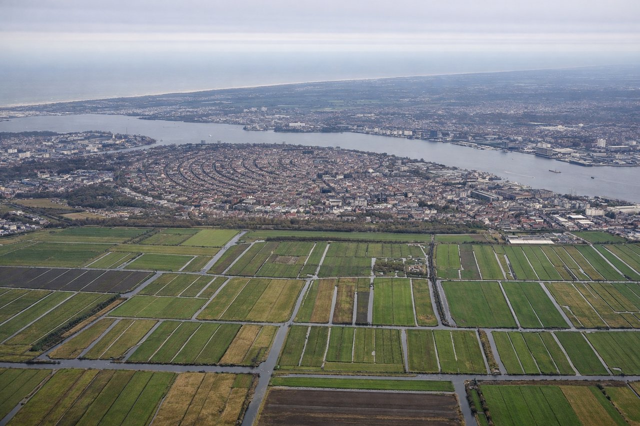
LEFTLeft-side seats provide excellent views of the North Sea coast, the Wadden Islands, and the Dutch inland waterways during descent into Amsterdam. The approach typically brings the aircraft over the northern Netherlands, where the flat landscape, dikes, and polder systems are visually distinctive.
Landmarks on this routeAll landmarks →
Will your flight be in sunlight?
Pick a date and time in the Sun Map to watch the sun move across your whole flight.
About This Route
Which side of the plane should I sit on flying from Zorg En Hoop (ORG) to Schiphol (AMS)?
Sit on the Left side of the plane for the best views on flights from Paramaribo to Amsterdam. While the takeoff offers interesting tropical coastal views, the landing approach into Amsterdam provides more visually distinctive and varied scenery—the Wadden Islands, North Sea, and the unique geometric polder landscape are more dramatic and memorable than the mangrove-dominated Surinamese coast.
What can I see during takeoff from Zorg En Hoop in Paramaribo?
During takeoff from Zorg En Hoop (ORG), sit on the Right side for the best views. Right-side seats offer views of the Corantijn River estuary and the Atlantic coastline as the aircraft climbs northward from Paramaribo. The river forms the border between Suriname and Guyana, creating a distinctive linear feature visible during initial climb. Notable sights include: Corantijn River estuary, Atlantic Ocean coastline, Paramaribo city grid (receding), mangrove wetlands along the coast.
What can I see when landing at Schiphol in Amsterdam?
When landing at Schiphol (AMS), sit on the Left side for the best views. Left-side seats provide excellent views of the North Sea coast, the Wadden Islands, and the Dutch inland waterways during descent into Amsterdam. The approach typically brings the aircraft over the northern Netherlands, where the flat landscape, dikes, and polder systems are visually distinctive. Notable sights include: North Sea coastline, Wadden Islands (Texel, Vlieland, Terschelling), IJsselmeer lake, Dutch polder grid with canals and dikes.
How long is the flight from Paramaribo to Amsterdam?
The flight from Zorg En Hoop (ORG) to Schiphol (AMS) takes about 11 hours. The shortest flight path between them is 4,655 miles (7,492 km); winds and air traffic control usually add a few percent.
What does the Paramaribo to Amsterdam flight path pass over?
The flight path crosses the Atlantic Ocean for roughly 8 hours with minimal visual landmarks. The aircraft will pass over or near the Azores (Portugal) at high altitude if the route tracks southeast, though these islands are often below cloud cover. Over the Atlantic, passengers may see occasional cloud formations and, if flying at dawn or dusk, the curvature of the Earth. As the aircraft approaches European airspace, the Irish coast (County Clare, Galway Bay area) becomes visible on the left during descent, followed by the Welsh coast and English Channel. The North Sea crossing offers views of the British Isles' western and northern coastlines before the final approach into the Netherlands.