Amsterdam to Paramaribo is 4,655 miles (7,492 km), a flight of about 9 hours 30 minutes.
The takeoff view from the right side over Amsterdam's canal ring and harbor is the most visually distinctive moment of the flight. The landing approach offers good river and city views on the left, but the departure over one of Europe's most recognizable urban landscapes edges it out overall.
Flight Path
The route tracks southwest over the English Channel and Bay of Biscay, then crosses the Canary Islands latitude over the open Atlantic. The flight passes over or near the Cape Verde Islands roughly midway. The final third crosses the Atlantic toward the northeast coast of South America, making landfall near the Guiana coast with its vast unbroken rainforest and river delta systems including the Orinoco and Amazon drainage regions visible as brown sediment plumes in the ocean near the coast.
Great circle distance and headings ›

.jpeg?width=600)

Phase by phase
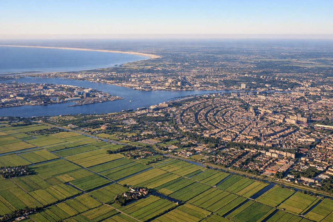
Takeoff from AMS
RIGHTSchiphol typically departs southwest or northwest on runways 18R/36L or 06/24. A southwesterly departure on 18R puts the right side facing east over Amsterdam city center and the IJ waterway. You get a clear view of the Amsterdam canal ring, the harbor, and the flat polder landscape stretching toward Utrecht.
Landing at ORG
LEFTZorg en Hoop airport serves Paramaribo with runway orientations roughly northeast-southwest. On approach from the north or northwest, the left side faces west toward the Suriname River and Paramaribo's waterfront. You get a clear view of the river, the colonial city center along its bank, and the transition from dense jungle to urban settlement.
Landmarks on this routeAll landmarks →
Will your flight be in sunlight?
Pick a date and time in the Sun Map to watch the sun move across your whole flight.
About This Route
Which side of the plane should I sit on flying from Schiphol (AMS) to Zorg En Hoop (ORG)?
Sit on the Right side of the plane for the best views on flights from Amsterdam to Paramaribo. The takeoff view from the right side over Amsterdam's canal ring and harbor is the most visually distinctive moment of the flight. The landing approach offers good river and city views on the left, but the departure over one of Europe's most recognizable urban landscapes edges it out overall.
What can I see during takeoff from Schiphol in Amsterdam?
During takeoff from Schiphol (AMS), sit on the Right side for the best views. Schiphol typically departs southwest or northwest on runways 18R/36L or 06/24. A southwesterly departure on 18R puts the right side facing east over Amsterdam city center and the IJ waterway. You get a clear view of the Amsterdam canal ring, the harbor, and the flat polder landscape stretching toward Utrecht. Notable sights include: Amsterdam canal ring and historic center, IJ harbor and waterway, Amstel River corridor, flat polder farmland east of Schiphol.
What can I see when landing at Zorg En Hoop in Paramaribo?
When landing at Zorg En Hoop (ORG), sit on the Left side for the best views. Zorg en Hoop airport serves Paramaribo with runway orientations roughly northeast-southwest. On approach from the north or northwest, the left side faces west toward the Suriname River and Paramaribo's waterfront. You get a clear view of the river, the colonial city center along its bank, and the transition from dense jungle to urban settlement. Notable sights include: Suriname River and its wide brown mouth, Paramaribo colonial waterfront district, dense Amazonian rainforest canopy north of the city, Fort Zeelandia area along the riverbank.
How long is the flight from Amsterdam to Paramaribo?
The flight from Schiphol (AMS) to Zorg En Hoop (ORG) takes about 9 hours 30 minutes. The shortest flight path between them is 4,655 miles (7,492 km); winds and air traffic control usually add a few percent.
What does the Amsterdam to Paramaribo flight path pass over?
The route tracks southwest over the English Channel and Bay of Biscay, then crosses the Canary Islands latitude over the open Atlantic. The flight passes over or near the Cape Verde Islands roughly midway. The final third crosses the Atlantic toward the northeast coast of South America, making landfall near the Guiana coast with its vast unbroken rainforest and river delta systems including the Orinoco and Amazon drainage regions visible as brown sediment plumes in the ocean near the coast.