The right (east) side delivers a nearly continuous mountain show: Cascade volcanoes at departure, the Coast Mountains and glaciated peaks of British Columbia and Southeast Alaska during cruise, and the Chugach Range framing the final descent into Anchorage. The left side is dominated by open Pacific and Gulf of Alaska water for much of the flight, offering far less variety.
Flight Path
British Columbia's Coast Mountains, the fjords and islands of the Inside Passage, glaciers of the Stikine and Juneau icefields, and the open water of the Gulf of Alaska near Yakutat before the route curves toward Prince William Sound and Anchorage.
Great circle distance and headings ›Phase by phase

Takeoff from PDX
RIGHTAfter departing PDX and turning north toward Anchorage, the Cascade volcanoes line up along the east side of the aircraft. Mt. Hood, Mt. St. Helens, Mt. Adams and eventually Mt. Rainier are all visible in sequence as the plane climbs and settles onto its northbound track.
Landing at ANC
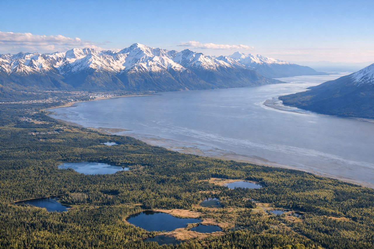
RIGHTOn approach to ANC's runway 07, the flight path tracks northeast over Turnagain Arm and Cook Inlet, putting the steep, glacier-carved Chugach Mountains directly on the right side of the cabin. This is widely considered one of the most dramatic approaches in the US, with mountains rising almost to wingtip height just before landing.
Landmarks on this routeAll landmarks →
Will your flight be in sunlight?
See exactly which side of the plane gets sun and shade at your departure time.
About This Route
Which side of the plane should I sit on flying from Portland International (PDX) to Ted Stevens Anchorage International (ANC)?
Sit on the Right side of the plane for the best views on flights from Portland to Anchorage. The right (east) side delivers a nearly continuous mountain show: Cascade volcanoes at departure, the Coast Mountains and glaciated peaks of British Columbia and Southeast Alaska during cruise, and the Chugach Range framing the final descent into Anchorage. The left side is dominated by open Pacific and Gulf of Alaska water for much of the flight, offering far less variety.
What can I see during takeoff from Portland International in Portland?
During takeoff from Portland International (PDX), sit on the Right side for the best views. After departing PDX and turning north toward Anchorage, the Cascade volcanoes line up along the east side of the aircraft. Mt. Hood, Mt. St. Helens, Mt. Adams and eventually Mt. Rainier are all visible in sequence as the plane climbs and settles onto its northbound track. Notable sights include: Mt. Hood, Mt. St. Helens, Mt. Adams, Willamette River/Portland skyline.
What can I see when landing at Ted Stevens Anchorage International in Anchorage?
When landing at Ted Stevens Anchorage International (ANC), sit on the Right side for the best views. On approach to ANC's runway 07, the flight path tracks northeast over Turnagain Arm and Cook Inlet, putting the steep, glacier-carved Chugach Mountains directly on the right side of the cabin. This is widely considered one of the most dramatic approaches in the US, with mountains rising almost to wingtip height just before landing. Notable sights include: Chugach Mountains, Turnagain Arm, Cook Inlet mudflats, Anchorage skyline.
How long is the flight from Portland to Anchorage?
The flight from Portland International (PDX) to Ted Stevens Anchorage International (ANC) takes 3h 20m.
What does the Portland to Anchorage flight path pass over?
British Columbia's Coast Mountains, the fjords and islands of the Inside Passage, glaciers of the Stikine and Juneau icefields, and the open water of the Gulf of Alaska near Yakutat before the route curves toward Prince William Sound and Anchorage.