The left side delivers a nearly continuous chain of Cascade volcanoes — Mount Hood at departure, then Mount Jefferson, the Three Sisters, and Mount Shasta further south — giving the flight sustained, dramatic terrain variety. The right side's ocean and coastal views are real but only prominent during the final descent into LAX.
Flight Path
Around the Oregon-California border, the flight path passes near Mount Shasta and the upper Sacramento Valley, where the volcanic Cascade peaks give way to California's Central Valley farmland.
Great circle distance and headings ›


.jpg?width=600)
Phase by phase
Takeoff from PDX
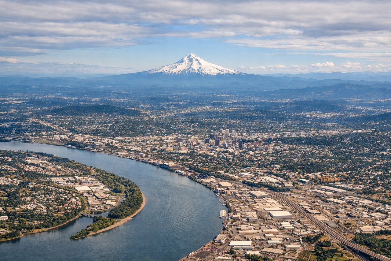
LEFTPDX departures on 28 typically bank south shortly after liftoff, and that turn puts Mount Hood's snow-capped cone right in view on the left side, with the Cascade foothills rolling out behind it. The right side mostly shows Portland's West Hills and the flatter Tualatin Valley, which is comparatively unremarkable.

Landing at LAX
RIGHTIn LAX's typical west-flow arrival, aircraft coming from the north swing out toward the coast before turning onto final approach, putting the Pacific shoreline, Santa Monica Bay, and the Palos Verdes Peninsula on the right side during the descent. The left side mostly shows the San Gabriel Mountains and inland basin haze, less compelling than the coastal approach.
Landmarks on this routeAll landmarks →
Will your flight be in sunlight?
See exactly which side of the plane gets sun and shade at your departure time.
About This Route
Which side of the plane should I sit on flying from Portland International (PDX) to Los Angeles International (LAX)?
Sit on the Left side of the plane for the best views on flights from Portland to Los Angeles. The left side delivers a nearly continuous chain of Cascade volcanoes — Mount Hood at departure, then Mount Jefferson, the Three Sisters, and Mount Shasta further south — giving the flight sustained, dramatic terrain variety. The right side's ocean and coastal views are real but only prominent during the final descent into LAX.
What can I see during takeoff from Portland International in Portland?
During takeoff from Portland International (PDX), sit on the Left side for the best views. PDX departures on 28 typically bank south shortly after liftoff, and that turn puts Mount Hood's snow-capped cone right in view on the left side, with the Cascade foothills rolling out behind it. The right side mostly shows Portland's West Hills and the flatter Tualatin Valley, which is comparatively unremarkable. Notable sights include: Mount Hood, Willamette River, Portland's West Hills, Cascade foothills.
What can I see when landing at Los Angeles International in Los Angeles?
When landing at Los Angeles International (LAX), sit on the Right side for the best views. In LAX's typical west-flow arrival, aircraft coming from the north swing out toward the coast before turning onto final approach, putting the Pacific shoreline, Santa Monica Bay, and the Palos Verdes Peninsula on the right side during the descent. The left side mostly shows the San Gabriel Mountains and inland basin haze, less compelling than the coastal approach. Notable sights include: Santa Monica Bay, Palos Verdes Peninsula, Marina del Rey, Pacific coastline.
How long is the flight from Portland to Los Angeles?
The flight from Portland International (PDX) to Los Angeles International (LAX) takes 2h 10m.
What does the Portland to Los Angeles flight path pass over?
Around the Oregon-California border, the flight path passes near Mount Shasta and the upper Sacramento Valley, where the volcanic Cascade peaks give way to California's Central Valley farmland.