The takeoff view of Mount Hood and the Cascade Range from the left side is more visually distinctive and geographically significant than the landing approach. While the landing offers the Cumberland River and Nashville skyline, the volcanic landscape of the Pacific Northwest is more dramatic and memorable.
Flown PDX to BNA? Did we get it right?
Flight Path
Portland to Nashville is 1,968 miles (3,168 km), a flight of about 4 hours 15 minutes.
The flight path crosses the Blue Mountains (Oregon), then the Snake River Plain (Idaho/Oregon border), then transitions into the Great Plains. Notable geographic features include the Columbia River Gorge (visible during initial climb), the Wallowa Mountains (northeast Oregon), the Owyhee Plateau, the Great Salt Lake region (distant southern view), and the Rocky Mountain front in Wyoming/Montana. The flight crosses from the Pacific Northwest climate zone into the Great Plains, with dramatic terrain changes visible from cruising altitude. The Wasatch Range near Salt Lake City and the Uinta Mountains are visible to the south on the horizon during mid-flight. As the flight approaches Tennessee, the landscape transitions to rolling Appalachian foothills.
Great circle distance and headings ›


Phase by phase
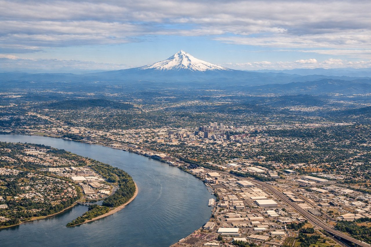
Takeoff from PDX
LEFTPDX typically departs runways 28L/28R (westbound) or 10L/10R (eastbound). Westbound departures offer the best views. Left seats face north during climb-out, revealing the Cascade Range and Mount Hood's snow-covered peak rising distinctly above the surrounding ridgeline. Right seats see only the Willamette Valley floor and distant western hills.

Landing at BNA
RIGHTBNA typically lands runways 20L/20R (southbound) or 02L/02R (northbound). Southbound approaches (more common) descend from the north. Right seats face west during final approach, offering views of the Cumberland River's distinctive meander and Nashville's downtown skyline. Left seats see only the eastern suburbs and approach corridor.
Will your flight be in sunlight?
Pick a date and time in the Sun Map to watch the sun move across your whole flight.
About This Route
Which side of the plane should I sit on flying from Portland International (PDX) to Nashville International (BNA)?
Sit on the Left side of the plane for the best views on flights from Portland to Nashville. The takeoff view of Mount Hood and the Cascade Range from the left side is more visually distinctive and geographically significant than the landing approach. While the landing offers the Cumberland River and Nashville skyline, the volcanic landscape of the Pacific Northwest is more dramatic and memorable.
What can I see during takeoff from Portland International in Portland?
During takeoff from Portland International (PDX), sit on the Left side for the best views. PDX typically departs runways 28L/28R (westbound) or 10L/10R (eastbound). Westbound departures offer the best views. Left seats face north during climb-out, revealing the Cascade Range and Mount Hood's snow-covered peak rising distinctly above the surrounding ridgeline. Right seats see only the Willamette Valley floor and distant western hills. Notable sights include: Mount Hood (11,240 ft, ~50 miles east-northeast), Cascade Range spine, Willamette River valley floor, Portland urban grid receding below.
What can I see when landing at Nashville International in Nashville?
When landing at Nashville International (BNA), sit on the Right side for the best views. BNA typically lands runways 20L/20R (southbound) or 02L/02R (northbound). Southbound approaches (more common) descend from the north. Right seats face west during final approach, offering views of the Cumberland River's distinctive meander and Nashville's downtown skyline. Left seats see only the eastern suburbs and approach corridor. Notable sights include: Cumberland River with characteristic S-bend through Nashville, downtown Nashville skyline (Broadway corridor), Percy Priest Lake (north of airport), Tennessee rolling terrain.
How long is the flight from Portland to Nashville?
The flight from Portland International (PDX) to Nashville International (BNA) takes about 4 hours 15 minutes. The shortest flight path between them is 1,968 miles (3,168 km); winds and air traffic control usually add a few percent.
What does the Portland to Nashville flight path pass over?
The flight path crosses the Blue Mountains (Oregon), then the Snake River Plain (Idaho/Oregon border), then transitions into the Great Plains. Notable geographic features include the Columbia River Gorge (visible during initial climb), the Wallowa Mountains (northeast Oregon), the Owyhee Plateau, the Great Salt Lake region (distant southern view), and the Rocky Mountain front in Wyoming/Montana. The flight crosses from the Pacific Northwest climate zone into the Great Plains, with dramatic terrain changes visible from cruising altitude. The Wasatch Range near Salt Lake City and the Uinta Mountains are visible to the south on the horizon during mid-flight. As the flight approaches Tennessee, the landscape transitions to rolling Appalachian foothills.