The right side wins on both ends of the flight: dramatic Cascade volcano views during departure and a Reykjavik/Faxafloi Bay panorama on arrival, plus a likely pass near Greenland's ice-capped east coast during cruise. The left side mostly offers Puget Sound haze on departure and open ocean toward Reykjanes on arrival.
Flown PDX to KEF? Did we get it right?
Flight Path
Portland to Keflavik is 3,727 miles (5,997 km), a flight of about 7 hours 45 minutes.
Route crosses the Canadian Rockies foothills in Alberta, the vast tundra and lakes around Hudson Bay, the Labrador coast, and typically passes near the southern Greenland ice cap and its fjord-cut east coast before making landfall in Iceland.
Great circle distance and headings ›


Phase by phase

Takeoff from PDX
RIGHTPDX departures typically launch west off 28 before turning north toward Canada, and that turn puts the Cascade volcano chain squarely on the right side. Passengers get a rare lineup of Mount Hood, Mount St. Helens, and Mount Rainier as the climb continues northward along the I-5 corridor.
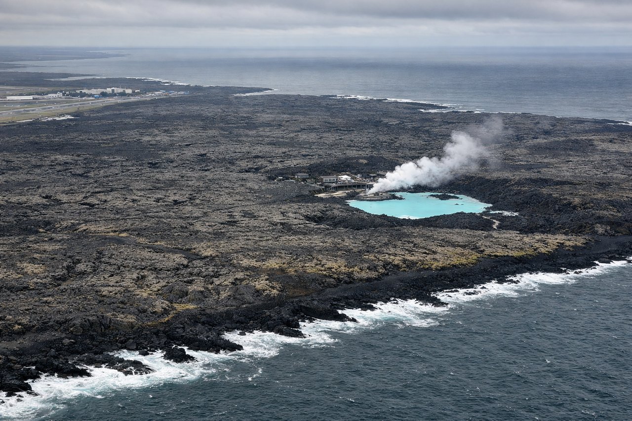
Landing at KEF
RIGHTKEF arrivals landing on runway 28 approach from the east on a westerly heading, which places Reykjavik and Faxafloi Bay on the right side of the cabin. Passengers see the city's skyline across the water backed by Mount Esja, plus the stark black lava fields of the Reykjanes Peninsula just before touchdown.
Will your flight be in sunlight?
Pick a date and time in the Sun Map to watch the sun move across your whole flight.
About This Route
Which side of the plane should I sit on flying from Portland International (PDX) to Keflavik Nas (KEF)?
Sit on the Right side of the plane for the best views on flights from Portland to Keflavik. The right side wins on both ends of the flight: dramatic Cascade volcano views during departure and a Reykjavik/Faxafloi Bay panorama on arrival, plus a likely pass near Greenland's ice-capped east coast during cruise. The left side mostly offers Puget Sound haze on departure and open ocean toward Reykjanes on arrival.
What can I see during takeoff from Portland International in Portland?
During takeoff from Portland International (PDX), sit on the Right side for the best views. PDX departures typically launch west off 28 before turning north toward Canada, and that turn puts the Cascade volcano chain squarely on the right side. Passengers get a rare lineup of Mount Hood, Mount St. Helens, and Mount Rainier as the climb continues northward along the I-5 corridor. Notable sights include: Mount Hood, Mount St. Helens, Mount Rainier, Columbia River.
What can I see when landing at Keflavik Nas in Keflavik?
When landing at Keflavik Nas (KEF), sit on the Right side for the best views. KEF arrivals landing on runway 28 approach from the east on a westerly heading, which places Reykjavik and Faxafloi Bay on the right side of the cabin. Passengers see the city's skyline across the water backed by Mount Esja, plus the stark black lava fields of the Reykjanes Peninsula just before touchdown. Notable sights include: Reykjavik skyline, Mount Esja, Faxafloi Bay, Reykjanes lava fields.
How long is the flight from Portland to Keflavik?
The flight from Portland International (PDX) to Keflavik Nas (KEF) takes about 7 hours 45 minutes. The shortest flight path between them is 3,727 miles (5,997 km); winds and air traffic control usually add a few percent.
What does the Portland to Keflavik flight path pass over?
Route crosses the Canadian Rockies foothills in Alberta, the vast tundra and lakes around Hudson Bay, the Labrador coast, and typically passes near the southern Greenland ice cap and its fjord-cut east coast before making landfall in Iceland.