Beijing to Jakarta is 3,261 miles (5,248 km), a flight of about 5 hours 15 minutes.
While takeoff offers interesting mountain views, the landing approach provides superior geographic drama with two major volcanic peaks and the Sunda Strait—more visually distinctive than Beijing's suburban sprawl and distant mountains.
Flight Path
The flight path crosses the North China Plain, then transitions over Henan and Anhui provinces. The Yangtze River becomes visible around the midpoint (near 30°N), appearing as a major waterway with visible meanders and tributaries. Further south, the flight crosses into tropical regions with increasing cloud cover. The South China Sea approaches show scattered islands and shipping traffic. Hainan Island may be visible to the east depending on exact routing. The final descent into Jakarta crosses the Java Sea with increasingly visible volcanic peaks of western Java.
Great circle distance and headings ›

Phase by phase
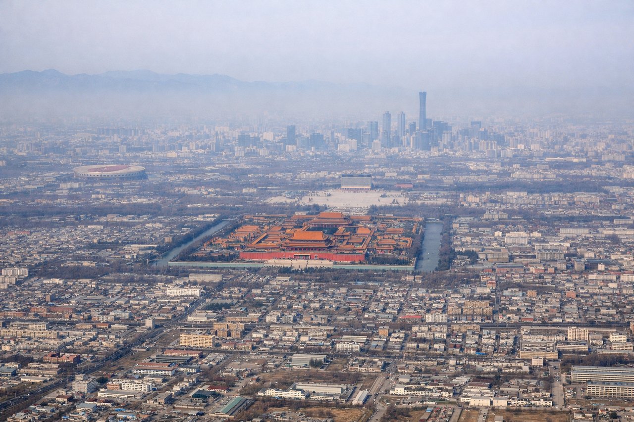
Takeoff from PEK
RIGHTPEK typically departs eastbound (Runways 01L/01R). Right-side seats face north toward the Great Wall's eastern sections and the Yanshan Mountains, which are genuinely visible during climb-out. Left side shows urban sprawl with minimal geographic interest.
Landing at HLP
LEFTHLP uses Runways 25L/25R (westbound approaches). Left-side seats face south toward the Sunda Strait and Java's volcanic peaks, including Mount Salak and Mount Pangrango. Right side shows only Jakarta's northern coastal sprawl and industrial areas.
Landmarks on this routeAll landmarks →
Will your flight be in sunlight?
Pick a date and time in the Sun Map to watch the sun move across your whole flight.
About This Route
Which side of the plane should I sit on flying from Capital (PEK) to Halim Perdanakusuma International Airport (HLP)?
Sit on the Left side of the plane for the best views on flights from Beijing to Jakarta. While takeoff offers interesting mountain views, the landing approach provides superior geographic drama with two major volcanic peaks and the Sunda Strait—more visually distinctive than Beijing's suburban sprawl and distant mountains.
What can I see during takeoff from Capital in Beijing?
During takeoff from Capital (PEK), sit on the Right side for the best views. PEK typically departs eastbound (Runways 01L/01R). Right-side seats face north toward the Great Wall's eastern sections and the Yanshan Mountains, which are genuinely visible during climb-out. Left side shows urban sprawl with minimal geographic interest. Notable sights include: Yanshan Mountains (north, appearing as a distant ridge), Great Wall segments (northeast, visible as linear features on ridgelines), Miyun Reservoir (northeast, large water body reflecting sunlight), Beijing urban grid (directly below, gradually receding).
What can I see when landing at Halim Perdanakusuma International Airport in Jakarta?
When landing at Halim Perdanakusuma International Airport (HLP), sit on the Left side for the best views. HLP uses Runways 25L/25R (westbound approaches). Left-side seats face south toward the Sunda Strait and Java's volcanic peaks, including Mount Salak and Mount Pangrango. Right side shows only Jakarta's northern coastal sprawl and industrial areas. Notable sights include: Mount Salak (south-southwest, prominent volcanic cone), Mount Pangrango (south, distant peak), Sunda Strait (southwest, body of water separating Java from Sumatra), Jakarta's northern coastal zone (below, urban and industrial).
How long is the flight from Beijing to Jakarta?
The flight from Capital (PEK) to Halim Perdanakusuma International Airport (HLP) takes about 5 hours 15 minutes. The shortest flight path between them is 3,261 miles (5,248 km); winds and air traffic control usually add a few percent.
What does the Beijing to Jakarta flight path pass over?
The flight path crosses the North China Plain, then transitions over Henan and Anhui provinces. The Yangtze River becomes visible around the midpoint (near 30°N), appearing as a major waterway with visible meanders and tributaries. Further south, the flight crosses into tropical regions with increasing cloud cover. The South China Sea approaches show scattered islands and shipping traffic. Hainan Island may be visible to the east depending on exact routing. The final descent into Jakarta crosses the Java Sea with increasingly visible volcanic peaks of western Java.