Pensacola to Denver is 1,178 miles (1,896 km), a flight of about 3 hours 15 minutes.
Left side wins both ends of the flight decisively. At departure you get the Gulf Coast barrier islands and Pensacola Bay; at arrival you get the entire Rocky Mountain Front Range and Denver skyline. The mid-flight view over the Mississippi River valley and the Texas panhandle is relatively flat on both sides, so the left advantage at the scenic bookends makes it the clear choice.
Flight Path
The flight tracks northwest over southern Alabama and Mississippi, crossing the Mississippi River near Vicksburg or Natchez, then over northern Louisiana and Arkansas. The route continues over Oklahoma and the Texas panhandle — flat Great Plains the entire way — before crossing into eastern Colorado where the terrain begins to rise subtly toward the Rockies. The Mississippi River crossing is the most visually distinctive mid-flight feature on either side.
Great circle distance and headings ›
.jpg?width=600)
Phase by phase
Takeoff from PNS
LEFTPensacola typically departs northwest on runway 17/35 or northeast on runway 7/25. Departing westbound or northbound, the left side gives you Pensacola Bay, the broad Santa Rosa Sound, and the white quartz sand barrier islands of Santa Rosa Island and Perdido Key stretching along the Gulf coast. The right side gets inland pine forest.
Landing at DEN
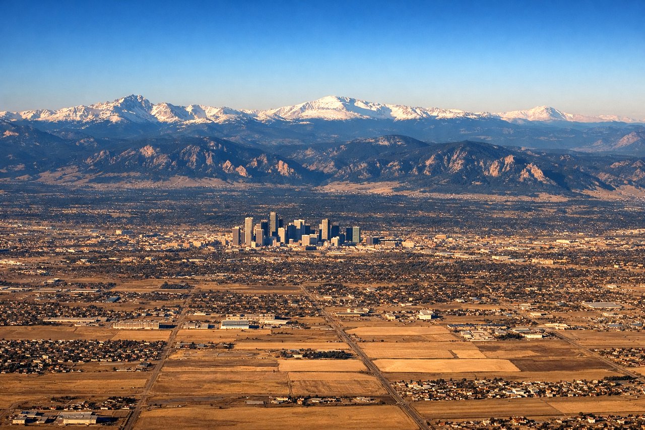
LEFTDenver International sits east of the city, and aircraft typically approach from the east or southeast on runways oriented roughly north-south. On approach from the southeast, the left side faces west toward downtown Denver and the full front range of the Rocky Mountains — the entire wall of peaks from Pikes Peak in the south to Longs Peak in the north is visible. The right side looks east over the flat, featureless eastern plains.
Landmarks on this routeAll landmarks →
Will your flight be in sunlight?
Pick a date and time in the Sun Map to watch the sun move across your whole flight.
About This Route
Which side of the plane should I sit on flying from Pensacola Rgnl (PNS) to Denver International (DEN)?
Sit on the Left side of the plane for the best views on flights from Pensacola to Denver. Left side wins both ends of the flight decisively. At departure you get the Gulf Coast barrier islands and Pensacola Bay; at arrival you get the entire Rocky Mountain Front Range and Denver skyline. The mid-flight view over the Mississippi River valley and the Texas panhandle is relatively flat on both sides, so the left advantage at the scenic bookends makes it the clear choice.
What can I see during takeoff from Pensacola Rgnl in Pensacola?
During takeoff from Pensacola Rgnl (PNS), sit on the Left side for the best views. Pensacola typically departs northwest on runway 17/35 or northeast on runway 7/25. Departing westbound or northbound, the left side gives you Pensacola Bay, the broad Santa Rosa Sound, and the white quartz sand barrier islands of Santa Rosa Island and Perdido Key stretching along the Gulf coast. The right side gets inland pine forest. Notable sights include: Pensacola Bay, Santa Rosa Island barrier island, Perdido Key, Pensacola Beach causeway bridges.
What can I see when landing at Denver International in Denver?
When landing at Denver International (DEN), sit on the Left side for the best views. Denver International sits east of the city, and aircraft typically approach from the east or southeast on runways oriented roughly north-south. On approach from the southeast, the left side faces west toward downtown Denver and the full front range of the Rocky Mountains — the entire wall of peaks from Pikes Peak in the south to Longs Peak in the north is visible. The right side looks east over the flat, featureless eastern plains. Notable sights include: Front Range of the Rocky Mountains, downtown Denver skyline, Pikes Peak, Longs Peak.
How long is the flight from Pensacola to Denver?
The flight from Pensacola Rgnl (PNS) to Denver International (DEN) takes about 3 hours 15 minutes. The shortest flight path between them is 1,178 miles (1,896 km); winds and air traffic control usually add a few percent.
What does the Pensacola to Denver flight path pass over?
The flight tracks northwest over southern Alabama and Mississippi, crossing the Mississippi River near Vicksburg or Natchez, then over northern Louisiana and Arkansas. The route continues over Oklahoma and the Texas panhandle — flat Great Plains the entire way — before crossing into eastern Colorado where the terrain begins to rise subtly toward the Rockies. The Mississippi River crossing is the most visually distinctive mid-flight feature on either side.