Pensacola to Washington is 816 miles (1,313 km), a flight of about 2 hours 20 minutes.
Right side captures the most dramatic scenery: Pensacola Bay and Gulf Coast on departure, then the Appalachian foothills and river valleys through the Carolinas and Virginia during cruise, and finally the Potomac River and National Mall on approach.
Flight Path
The flight path crosses the Appalachian Mountains (visible as ridgelines and valleys in eastern Tennessee and western North Carolina), the Tennessee River valley, and the Blue Ridge Mountains in Virginia. The Roanoke area marks a notable geographic transition point. The Shenandoah Valley runs north-south on the right side during the final descent phase into Washington airspace.
Great circle distance and headings ›Phase by phase
Takeoff from PNS
RIGHTRight side offers immediate views of Pensacola Bay and the Gulf of Mexico coastline as you climb out. The bay's distinctive shape and barrier islands are striking from low altitude during the initial climb.
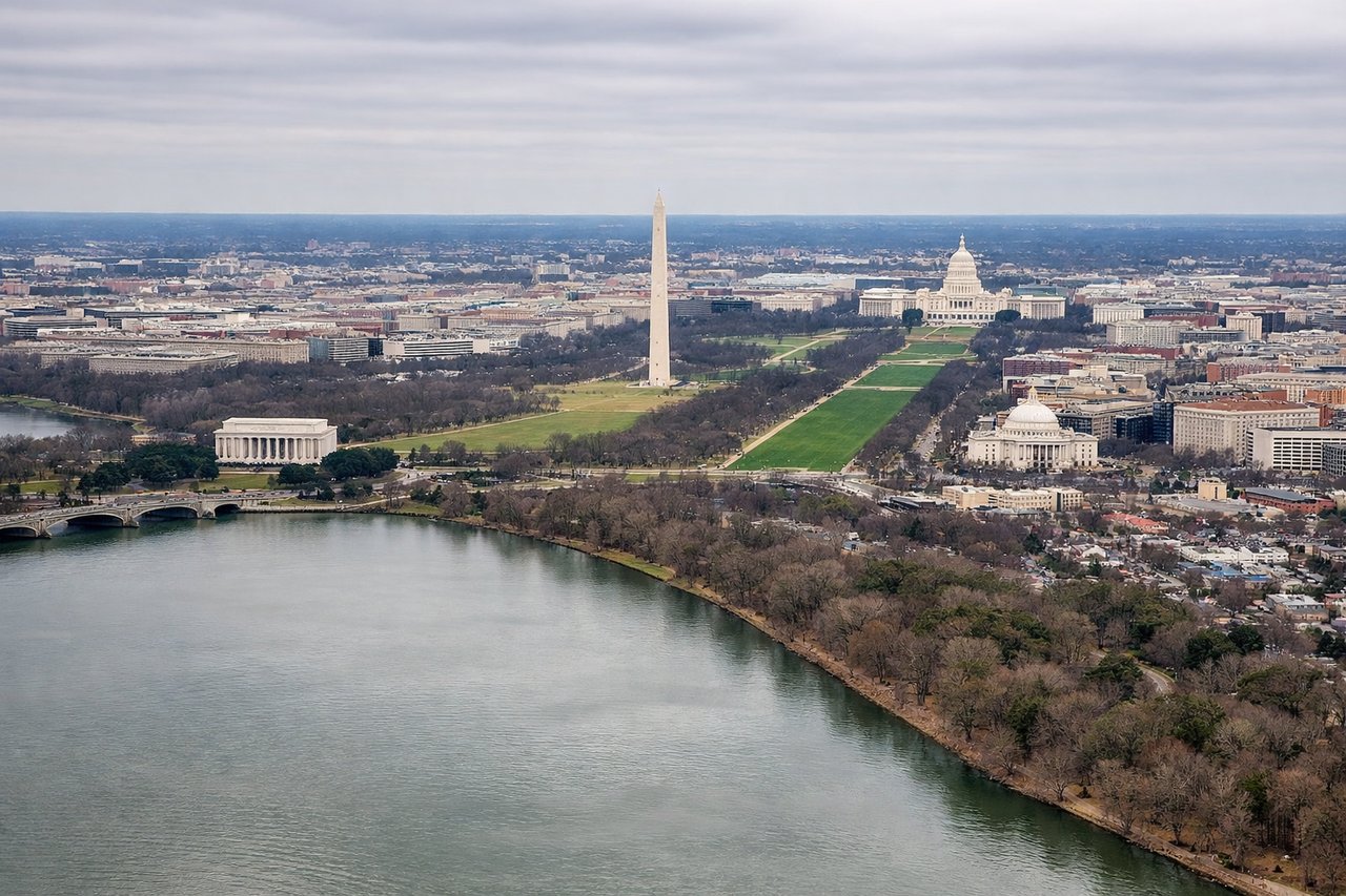
Landing at DCA
LEFTLeft side provides excellent views during descent into DCA. You'll see the Potomac River's distinctive curves, the National Mall with major monuments, and Arlington's urban grid as you approach from the west.
Landmarks on this routeAll landmarks →
Will your flight be in sunlight?
Pick a date and time in the Sun Map to watch the sun move across your whole flight.
About This Route
Which side of the plane should I sit on flying from Pensacola Rgnl (PNS) to Ronald Reagan Washington National (DCA)?
Sit on the Right side of the plane for the best views on flights from Pensacola to Washington. Right side captures the most dramatic scenery: Pensacola Bay and Gulf Coast on departure, then the Appalachian foothills and river valleys through the Carolinas and Virginia during cruise, and finally the Potomac River and National Mall on approach.
What can I see during takeoff from Pensacola Rgnl in Pensacola?
During takeoff from Pensacola Rgnl (PNS), sit on the Right side for the best views. Right side offers immediate views of Pensacola Bay and the Gulf of Mexico coastline as you climb out. The bay's distinctive shape and barrier islands are striking from low altitude during the initial climb. Notable sights include: Pensacola Bay, Santa Rosa Island (barrier island), Gulf of Mexico, Escambia Bay.
What can I see when landing at Ronald Reagan Washington National in Washington?
When landing at Ronald Reagan Washington National (DCA), sit on the Left side for the best views. Left side provides excellent views during descent into DCA. You'll see the Potomac River's distinctive curves, the National Mall with major monuments, and Arlington's urban grid as you approach from the west. Notable sights include: Potomac River, National Mall and monuments, Arlington Virginia, Anacostia River.
How long is the flight from Pensacola to Washington?
The flight from Pensacola Rgnl (PNS) to Ronald Reagan Washington National (DCA) takes about 2 hours 20 minutes. The shortest flight path between them is 816 miles (1,313 km); winds and air traffic control usually add a few percent.
What does the Pensacola to Washington flight path pass over?
The flight path crosses the Appalachian Mountains (visible as ridgelines and valleys in eastern Tennessee and western North Carolina), the Tennessee River valley, and the Blue Ridge Mountains in Virginia. The Roanoke area marks a notable geographic transition point. The Shenandoah Valley runs north-south on the right side during the final descent phase into Washington airspace.