Washington to Pensacola is 816 miles (1,313 km), a flight of about 2 hours 15 minutes.
While takeoff favors the right, the landing view from the left is significantly more dramatic and geographically distinctive. Pensacola Bay and Santa Rosa Island provide clear, recognizable landmarks during descent, making the left side the better overall choice for this route.
Flight Path
The flight path crosses the Appalachian foothills (visible as rolling terrain with ridge lines running northeast-southwest around 1 hour into flight), then transitions to the coastal plain. The Chattahoochee River valley and Alabama-Georgia border region appear as a linear feature. By midpoint, the terrain flattens significantly as you approach the Gulf Coastal Plain. The flight passes east of Birmingham, Alabama (visible as a developed area if conditions permit). The final descent approaches over central Florida Panhandle pine forests and wetland areas before reaching Pensacola Bay.
Great circle distance and headings ›Phase by phase
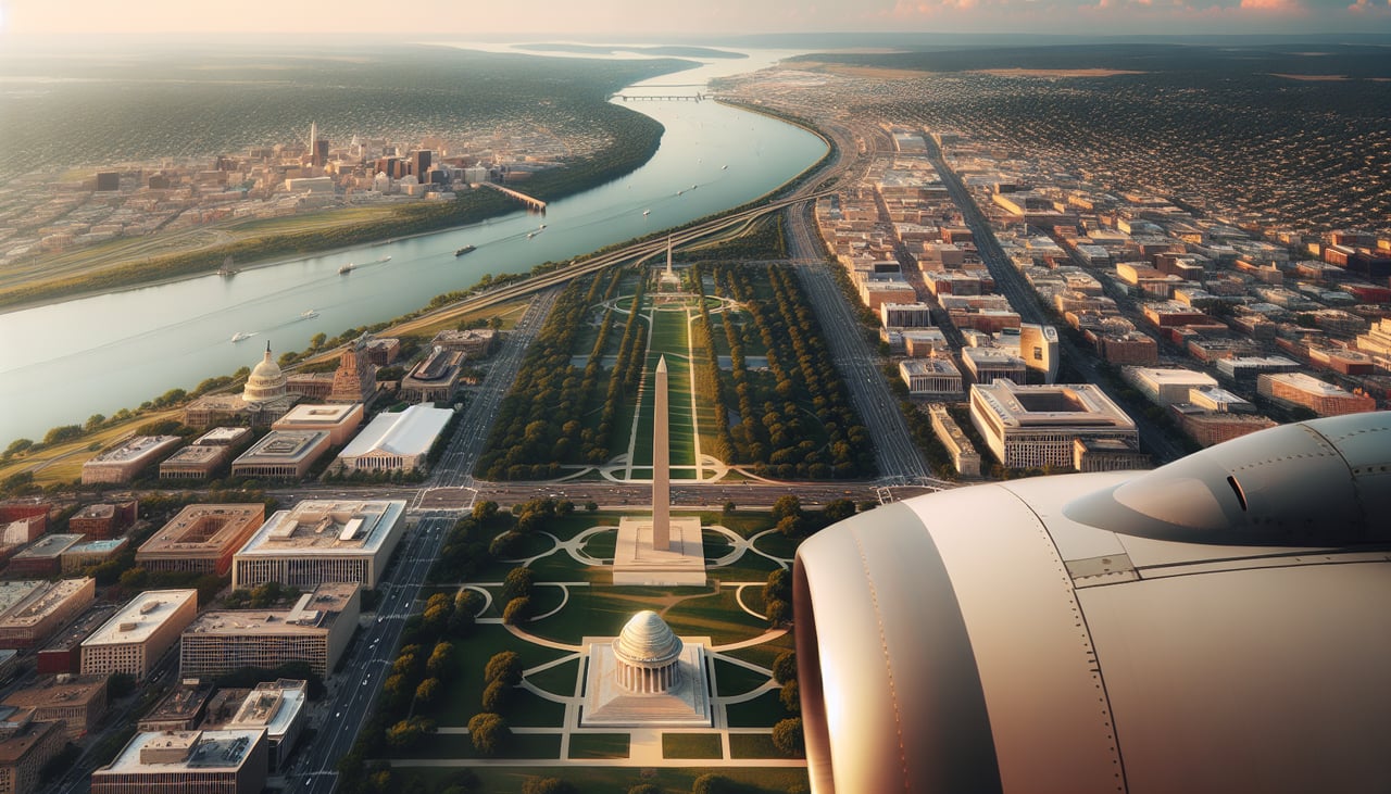
Takeoff from DCA
RIGHTDCA typically departs runway 01 (northbound) or 19 (southbound). Right-side seats on a northbound departure offer immediate views of the Potomac River and central Washington DC landmarks. On southbound departures (runway 19), right seats show the Arlington area and Potomac River bend.
Landing at PNS
LEFTPensacola Regional typically uses runways 07 (eastbound) or 25 (westbound). Left-side seats on approach show Pensacola Bay, the downtown waterfront, and the distinctive geography of the Florida Panhandle coast. The bay's shape and barrier islands are prominent visual references.
Landmarks on this routeAll landmarks →
Will your flight be in sunlight?
Pick a date and time in the Sun Map to watch the sun move across your whole flight.
About This Route
Which side of the plane should I sit on flying from Ronald Reagan Washington National (DCA) to Pensacola Rgnl (PNS)?
Sit on the Left side of the plane for the best views on flights from Washington to Pensacola. While takeoff favors the right, the landing view from the left is significantly more dramatic and geographically distinctive. Pensacola Bay and Santa Rosa Island provide clear, recognizable landmarks during descent, making the left side the better overall choice for this route.
What can I see during takeoff from Ronald Reagan Washington National in Washington?
During takeoff from Ronald Reagan Washington National (DCA), sit on the Right side for the best views. DCA typically departs runway 01 (northbound) or 19 (southbound). Right-side seats on a northbound departure offer immediate views of the Potomac River and central Washington DC landmarks. On southbound departures (runway 19), right seats show the Arlington area and Potomac River bend. Notable sights include: Potomac River (immediate view below), Washington Monument and Lincoln Memorial area (visible in distance to the northwest on northbound), Arlington National Cemetery (visible to the right on southbound), Theodore Roosevelt Island (visible in river below during climb).
What can I see when landing at Pensacola Rgnl in Pensacola?
When landing at Pensacola Rgnl (PNS), sit on the Left side for the best views. Pensacola Regional typically uses runways 07 (eastbound) or 25 (westbound). Left-side seats on approach show Pensacola Bay, the downtown waterfront, and the distinctive geography of the Florida Panhandle coast. The bay's shape and barrier islands are prominent visual references. Notable sights include: Pensacola Bay (large water body with clear shoreline definition), Santa Rosa Island (barrier island to the south), Escambia Bay (to the east), downtown Pensacola waterfront (visible as developed area on bay's north shore).
How long is the flight from Washington to Pensacola?
The flight from Ronald Reagan Washington National (DCA) to Pensacola Rgnl (PNS) takes about 2 hours 15 minutes. The shortest flight path between them is 816 miles (1,313 km); winds and air traffic control usually add a few percent.
What does the Washington to Pensacola flight path pass over?
The flight path crosses the Appalachian foothills (visible as rolling terrain with ridge lines running northeast-southwest around 1 hour into flight), then transitions to the coastal plain. The Chattahoochee River valley and Alabama-Georgia border region appear as a linear feature. By midpoint, the terrain flattens significantly as you approach the Gulf Coastal Plain. The flight passes east of Birmingham, Alabama (visible as a developed area if conditions permit). The final descent approaches over central Florida Panhandle pine forests and wetland areas before reaching Pensacola Bay.