Port of Spain to Panama City is 1,233 miles (1,984 km), a flight of about 2 hours 55 minutes.
Although takeoff favors the right side with Trinidad's mountains and Port of Spain, the left side wins overall because cruise offers glimpses of Colombia's dramatic Sierra Nevada de Santa Marta and the Cartagena coastline, followed by Panama's San Blas Islands, and the approach delivers a striking view of the Panama Canal and Panama City skyline — far more varied and dramatic than the right side's mostly open Caribbean Sea.
Flight Path
Open Caribbean Sea with Colombia's Caribbean coast visible to the south, including the high peaks of the Sierra Nevada de Santa Marta and the Cartagena coastline, followed later by Panama's San Blas Islands (Kuna Yala archipelago) as the route nears the isthmus
Great circle distance and headings ›

Phase by phase
Takeoff from POS
RIGHTDeparting POS westbound, the right side looks north across the Gulf of Paria toward Trinidad's Northern Range mountains and the Port of Spain skyline, a nice burst of terrain and city before the route heads out over open water.
Landing at PTY
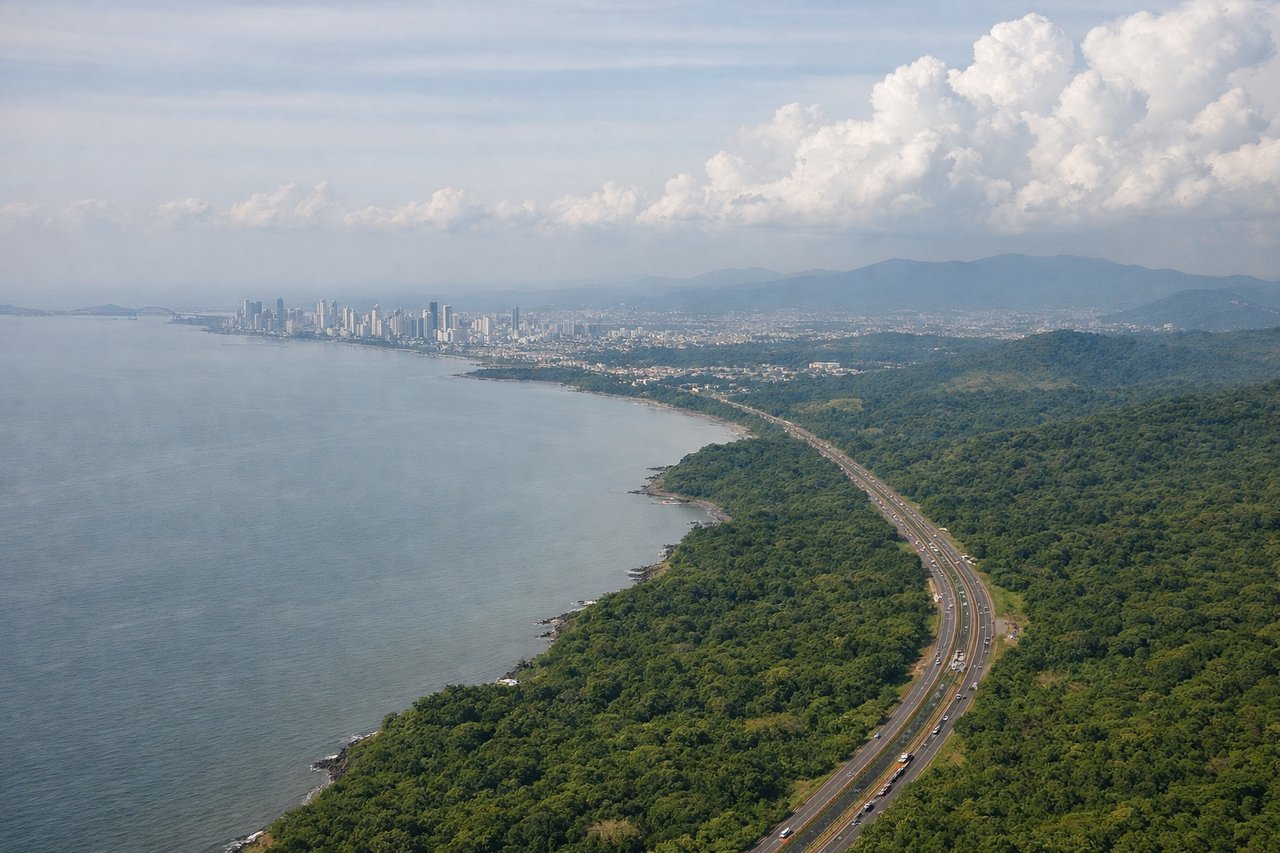
LEFTArrivals into Tocumen frequently swing south over the Gulf of Panama to line up with the northeast-facing runway, giving left-side passengers a sweeping view of Panama City's skyline, the Panama Canal's Pacific entrance, and the Bridge of the Americas just before touchdown.
Landmarks on this routeAll landmarks →
Will your flight be in sunlight?
Pick a date and time in the Sun Map to watch the sun move across your whole flight.
About This Route
Which side of the plane should I sit on flying from Piarco (POS) to Tocumen International (PTY)?
Sit on the Left side of the plane for the best views on flights from Port of Spain to Panama City. Although takeoff favors the right side with Trinidad's mountains and Port of Spain, the left side wins overall because cruise offers glimpses of Colombia's dramatic Sierra Nevada de Santa Marta and the Cartagena coastline, followed by Panama's San Blas Islands, and the approach delivers a striking view of the Panama Canal and Panama City skyline — far more varied and dramatic than the right side's mostly open Caribbean Sea.
What can I see during takeoff from Piarco in Port of Spain?
During takeoff from Piarco (POS), sit on the Right side for the best views. Departing POS westbound, the right side looks north across the Gulf of Paria toward Trinidad's Northern Range mountains and the Port of Spain skyline, a nice burst of terrain and city before the route heads out over open water. Notable sights include: Northern Range mountains, Port of Spain skyline, Gulf of Paria, Paria Peninsula (Venezuela) in the distance.
What can I see when landing at Tocumen International in Panama City?
When landing at Tocumen International (PTY), sit on the Left side for the best views. Arrivals into Tocumen frequently swing south over the Gulf of Panama to line up with the northeast-facing runway, giving left-side passengers a sweeping view of Panama City's skyline, the Panama Canal's Pacific entrance, and the Bridge of the Americas just before touchdown. Notable sights include: Panama City skyline, Bridge of the Americas, Panama Canal Pacific entrance, Amador Causeway.
How long is the flight from Port of Spain to Panama City?
The flight from Piarco (POS) to Tocumen International (PTY) takes about 2 hours 55 minutes. The shortest flight path between them is 1,233 miles (1,984 km); winds and air traffic control usually add a few percent.
What does the Port of Spain to Panama City flight path pass over?
Open Caribbean Sea with Colombia's Caribbean coast visible to the south, including the high peaks of the Sierra Nevada de Santa Marta and the Cartagena coastline, followed later by Panama's San Blas Islands (Kuna Yala archipelago) as the route nears the isthmus