The left side offers solid views during the Coachella Valley departure looking back at the valley and then picks up the best views on landing into Phoenix with the city grid, South Mountain, and Camelback all on the left. The right side wins at takeoff but the left side delivers more consistently across the full flight including the Phoenix arrival.
Flown PSP to PHX? Did we get it right?
Flight Path
Palm Springs to Phoenix is 260 miles (419 km), a flight of about 50 minutes.
The flight crosses the lower Colorado Desert east of the Coachella Valley, passing over the Eagle Mountains and Chuckwalla Mountains, then traverses the broad flat expanse of the Sonoran Desert in western Arizona. The Harquahala Mountains and Hassayampa River plain are visible before the descent into the Phoenix Basin. The terrain is largely flat desert scrub with isolated volcanic mountain ranges rising from the basin floor.
Great circle distance and headings ›Phase by phase
Takeoff from PSP
RIGHTPSP typically departs eastbound on runway 31L/13R or uses runway 31 heading northwest, but the dominant departure for eastbound PHX flights is runway 13 heading southeast then turning east. On a right-side seat departing east, you get a direct view of the Santa Rosa Mountains and the southern end of the Coachella Valley floor stretching away. The San Jacinto massif rises dramatically to the southwest on the right side as the aircraft climbs out over the desert.
Landing at PHX
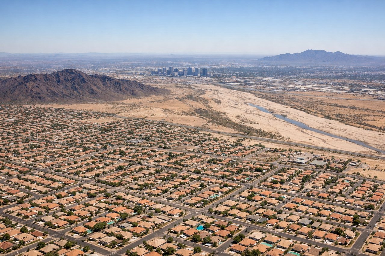
LEFTPHX typically lands westbound on runway 26 or 25L/25R, meaning the aircraft approaches from the east. On the left side, you get a clear view of downtown Phoenix, Tempe, and the distinctive grid of the metro area as the plane descends over the east valley. The South Mountain Park ridgeline is visible to the left and below on final approach.
Will your flight be in sunlight?
Pick a date and time in the Sun Map to watch the sun move across your whole flight.
About This Route
Which side of the plane should I sit on flying from Palm Springs International (PSP) to Phoenix Sky Harbor International (PHX)?
Sit on the Left side of the plane for the best views on flights from Palm Springs to Phoenix. The left side offers solid views during the Coachella Valley departure looking back at the valley and then picks up the best views on landing into Phoenix with the city grid, South Mountain, and Camelback all on the left. The right side wins at takeoff but the left side delivers more consistently across the full flight including the Phoenix arrival.
What can I see during takeoff from Palm Springs International in Palm Springs?
During takeoff from Palm Springs International (PSP), sit on the Right side for the best views. PSP typically departs eastbound on runway 31L/13R or uses runway 31 heading northwest, but the dominant departure for eastbound PHX flights is runway 13 heading southeast then turning east. On a right-side seat departing east, you get a direct view of the Santa Rosa Mountains and the southern end of the Coachella Valley floor stretching away. The San Jacinto massif rises dramatically to the southwest on the right side as the aircraft climbs out over the desert. Notable sights include: San Jacinto Peak (10,834 ft) rising abruptly from the valley floor to the southwest, Santa Rosa Mountains running southeast along the valley edge, Coachella Valley agricultural patchwork below, Salton Sea visible in the distance to the southeast.
What can I see when landing at Phoenix Sky Harbor International in Phoenix?
When landing at Phoenix Sky Harbor International (PHX), sit on the Left side for the best views. PHX typically lands westbound on runway 26 or 25L/25R, meaning the aircraft approaches from the east. On the left side, you get a clear view of downtown Phoenix, Tempe, and the distinctive grid of the metro area as the plane descends over the east valley. The South Mountain Park ridgeline is visible to the left and below on final approach. Notable sights include: Downtown Phoenix skyline to the northwest, South Mountain Park ridgeline to the south, Tempe Town Lake and ASU campus directly below on approach, Camelback Mountain to the north of the flight path.
How long is the flight from Palm Springs to Phoenix?
The flight from Palm Springs International (PSP) to Phoenix Sky Harbor International (PHX) takes about 50 minutes. The shortest flight path between them is 260 miles (419 km); winds and air traffic control usually add a few percent.
What does the Palm Springs to Phoenix flight path pass over?
The flight crosses the lower Colorado Desert east of the Coachella Valley, passing over the Eagle Mountains and Chuckwalla Mountains, then traverses the broad flat expanse of the Sonoran Desert in western Arizona. The Harquahala Mountains and Hassayampa River plain are visible before the descent into the Phoenix Basin. The terrain is largely flat desert scrub with isolated volcanic mountain ranges rising from the basin floor.