The left side wins overall because the cruise phase tracks north over the western Caribbean, past eastern Cuba and the Bahamas, then along the Florida peninsula and Georgia/Carolina coastline before reaching Virginia — a long stretch of genuine coastal and island scenery. The right side spends most of the flight over open Atlantic water with little to see.
Flown PTY to IAD? Did we get it right?
Flight Path
Panama City to Washington is 2,067 miles (3,327 km), a flight of about 4 hours 35 minutes.
Western Caribbean Sea, eastern tip of Cuba, Bahamas island chain, Florida peninsula and Atlantic coastline of Georgia and the Carolinas
Great circle distance and headings ›

Phase by phase
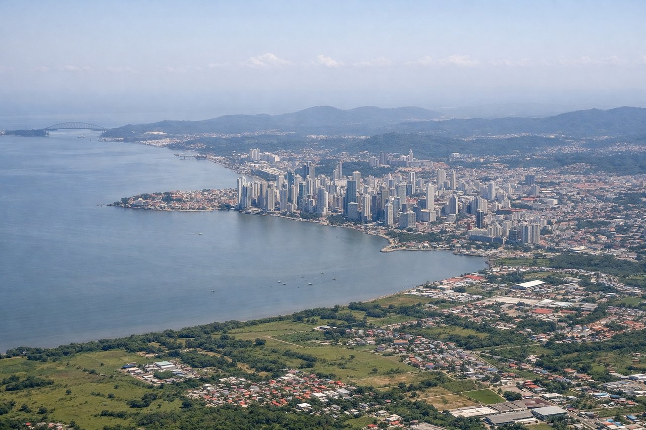
Takeoff from PTY
LEFTDeparting PTY toward the northeast, the initial turn puts Panama City's skyline and the curve of Panama Bay on the left side of the aircraft. Passengers get a brief but clear view of the city's high-rises against the water before the climb-out turns north over the isthmus.
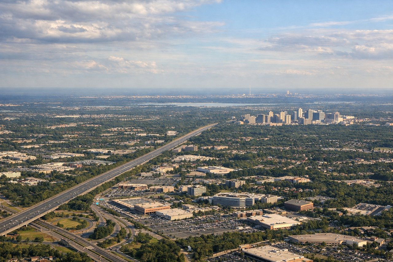
Landing at IAD
RIGHTOn approach to IAD from the south, the final turn onto a northbound runway brings the Washington DC skyline and the Potomac River into view on the right side, offering a last glimpse of the Capitol dome area and the river bends before touchdown in the Virginia countryside.
Will your flight be in sunlight?
Pick a date and time in the Sun Map to watch the sun move across your whole flight.
About This Route
Which side of the plane should I sit on flying from Tocumen International (PTY) to Washington Dulles International (IAD)?
Sit on the Left side of the plane for the best views on flights from Panama City to Washington. The left side wins overall because the cruise phase tracks north over the western Caribbean, past eastern Cuba and the Bahamas, then along the Florida peninsula and Georgia/Carolina coastline before reaching Virginia — a long stretch of genuine coastal and island scenery. The right side spends most of the flight over open Atlantic water with little to see.
What can I see during takeoff from Tocumen International in Panama City?
During takeoff from Tocumen International (PTY), sit on the Left side for the best views. Departing PTY toward the northeast, the initial turn puts Panama City's skyline and the curve of Panama Bay on the left side of the aircraft. Passengers get a brief but clear view of the city's high-rises against the water before the climb-out turns north over the isthmus. Notable sights include: Panama City skyline, Bay of Panama, Panama Canal entrance, Isthmus of Panama coastline.
What can I see when landing at Washington Dulles International in Washington?
When landing at Washington Dulles International (IAD), sit on the Right side for the best views. On approach to IAD from the south, the final turn onto a northbound runway brings the Washington DC skyline and the Potomac River into view on the right side, offering a last glimpse of the Capitol dome area and the river bends before touchdown in the Virginia countryside. Notable sights include: Washington DC skyline, Potomac River, Dulles Greenway corridor, Virginia Piedmont farmland.
How long is the flight from Panama City to Washington?
The flight from Tocumen International (PTY) to Washington Dulles International (IAD) takes about 4 hours 35 minutes. The shortest flight path between them is 2,067 miles (3,327 km); winds and air traffic control usually add a few percent.
What does the Panama City to Washington flight path pass over?
Western Caribbean Sea, eastern tip of Cuba, Bahamas island chain, Florida peninsula and Atlantic coastline of Georgia and the Carolinas