The left side wins overall because the cruise phase tracks near the Andes through Colombia, Ecuador, and Peru, offering long stretches of snow-dusted volcanic peaks and highland terrain, while the right side is dominated by featureless Pacific Ocean for most of the flight.
Flown PTY to LIM? Did we get it right?
Flight Path
Panama City to Lima is 1,466 miles (2,359 km), a flight of about 3 hours 50 minutes.
The route passes over the western Andean ranges of Colombia and Ecuador, including the volcanic highlands near Cotopaxi and Chimborazo, before continuing along the arid coastal desert of northern Peru.
Great circle distance and headings ›


Phase by phase

Takeoff from PTY
RIGHTDeparting PTY on runway 03/21, the climb-out banks over Panama City and the Pacific entrance to the Panama Canal, giving right-side passengers a sweeping view of the skyline, Bay of Panama, and the Bridge of the Americas before the aircraft turns south toward Colombia.
Landing at LIM
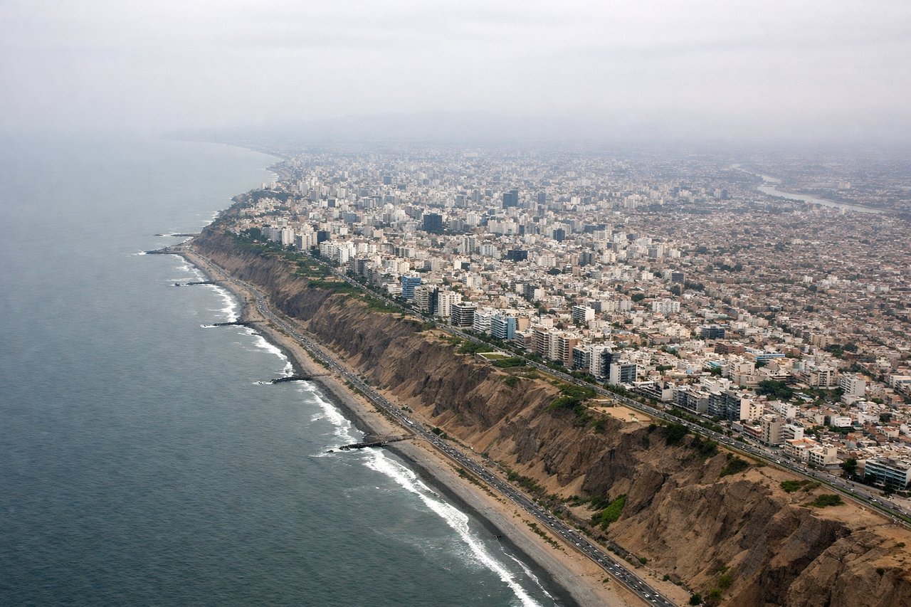
LEFTOn final approach into LIM (runway 16, landing south), the aircraft tracks down the coast with the city of Lima and the dry Andean foothills visible to the left, while the right side faces open ocean. The left side reveals the cliffs of Miraflores, the Rímac valley, and the arid hills rising toward the Andes.
Will your flight be in sunlight?
Pick a date and time in the Sun Map to watch the sun move across your whole flight.
About This Route
Which side of the plane should I sit on flying from Tocumen International (PTY) to Jorge Chávez International Airport (LIM)?
Sit on the Left side of the plane for the best views on flights from Panama City to Lima. The left side wins overall because the cruise phase tracks near the Andes through Colombia, Ecuador, and Peru, offering long stretches of snow-dusted volcanic peaks and highland terrain, while the right side is dominated by featureless Pacific Ocean for most of the flight.
What can I see during takeoff from Tocumen International in Panama City?
During takeoff from Tocumen International (PTY), sit on the Right side for the best views. Departing PTY on runway 03/21, the climb-out banks over Panama City and the Pacific entrance to the Panama Canal, giving right-side passengers a sweeping view of the skyline, Bay of Panama, and the Bridge of the Americas before the aircraft turns south toward Colombia. Notable sights include: Panama City skyline, Bay of Panama, Panama Canal Pacific entrance, Bridge of the Americas.
What can I see when landing at Jorge Chávez International Airport in Lima?
When landing at Jorge Chávez International Airport (LIM), sit on the Left side for the best views. On final approach into LIM (runway 16, landing south), the aircraft tracks down the coast with the city of Lima and the dry Andean foothills visible to the left, while the right side faces open ocean. The left side reveals the cliffs of Miraflores, the Rímac valley, and the arid hills rising toward the Andes. Notable sights include: Miraflores coastal cliffs, Lima cityscape, Rímac River valley, arid Andean foothills.
How long is the flight from Panama City to Lima?
The flight from Tocumen International (PTY) to Jorge Chávez International Airport (LIM) takes about 3 hours 50 minutes. The shortest flight path between them is 1,466 miles (2,359 km); winds and air traffic control usually add a few percent.
What does the Panama City to Lima flight path pass over?
The route passes over the western Andean ranges of Colombia and Ecuador, including the volcanic highlands near Cotopaxi and Chimborazo, before continuing along the arid coastal desert of northern Peru.