While the left side offers good coastal views during departure, the right side provides superior views during the longer cruise phase and landing. The flight path crosses central Texas, and the right side captures the Hill Country terrain, lakes, and the final approach to Austin with the city skyline and Lady Bird Lake clearly visible.
Flown SAN to AUS? Did we get it right?
Flight Path
San Diego to Austin is 1,162 miles (1,871 km), a flight of about 3 hours 15 minutes.
The flight path crosses the Mojave Desert (southeast California), then transitions into Arizona and New Mexico high desert terrain. Notable features include the Colorado River (visible in Arizona), the Sonoran Desert, and eventually the Edwards Plateau and Hill Country of central Texas. The right side of the aircraft provides better views of the Colorado River crossing in Arizona and the transition into Texas hill country. No major mountain ranges directly on the flight path, but the Sierra Nevada recedes to the left (west) during early climb-out, and the Hill Country becomes visible on approach to Austin.
Great circle distance and headings ›Phase by phase
Takeoff from SAN
LEFTSan Diego International typically departs runways 09L/09R (westbound) or 27L/27R (eastbound). Westbound departures favor the left side for views of the Pacific coast, Mission Bay, and the San Diego Bay waterfront. Eastbound departures on the left side show the urban sprawl of central San Diego and the foothills beyond.
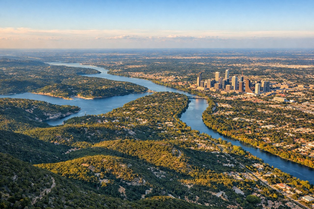
Landing at AUS
RIGHTApproaching Austin Bergstrom on typical landing runways 17L/17R (southbound) or 35L/35R (northbound), the right side captures the Colorado River, Lady Bird Lake (Town Lake), and downtown Austin's skyline. The right window also shows the eastern approach over the Hill Country terrain and the airport's position relative to the city.
Will your flight be in sunlight?
Pick a date and time in the Sun Map to watch the sun move across your whole flight.
About This Route
Which side of the plane should I sit on flying from San Diego International Lindbergh Fld (SAN) to Austin Bergstrom International (AUS)?
Sit on the Right side of the plane for the best views on flights from San Diego to Austin. While the left side offers good coastal views during departure, the right side provides superior views during the longer cruise phase and landing. The flight path crosses central Texas, and the right side captures the Hill Country terrain, lakes, and the final approach to Austin with the city skyline and Lady Bird Lake clearly visible.
What can I see during takeoff from San Diego International Lindbergh Fld in San Diego?
During takeoff from San Diego International Lindbergh Fld (SAN), sit on the Left side for the best views. San Diego International typically departs runways 09L/09R (westbound) or 27L/27R (eastbound). Westbound departures favor the left side for views of the Pacific coast, Mission Bay, and the San Diego Bay waterfront. Eastbound departures on the left side show the urban sprawl of central San Diego and the foothills beyond. Notable sights include: Pacific Ocean (west), Mission Bay (southwest), San Diego Bay with Coronado Island (south), Cabrillo National Monument on Point Loma (southwest).
What can I see when landing at Austin Bergstrom International in Austin?
When landing at Austin Bergstrom International (AUS), sit on the Right side for the best views. Approaching Austin Bergstrom on typical landing runways 17L/17R (southbound) or 35L/35R (northbound), the right side captures the Colorado River, Lady Bird Lake (Town Lake), and downtown Austin's skyline. The right window also shows the eastern approach over the Hill Country terrain and the airport's position relative to the city. Notable sights include: Lady Bird Lake (Town Lake) with downtown Austin skyline (north), Colorado River (east), Mount Bonnell (northwest, distant), Hill Country terrain (south and east).
How long is the flight from San Diego to Austin?
The flight from San Diego International Lindbergh Fld (SAN) to Austin Bergstrom International (AUS) takes about 3 hours 15 minutes. The shortest flight path between them is 1,162 miles (1,871 km); winds and air traffic control usually add a few percent.
What does the San Diego to Austin flight path pass over?
The flight path crosses the Mojave Desert (southeast California), then transitions into Arizona and New Mexico high desert terrain. Notable features include the Colorado River (visible in Arizona), the Sonoran Desert, and eventually the Edwards Plateau and Hill Country of central Texas. The right side of the aircraft provides better views of the Colorado River crossing in Arizona and the transition into Texas hill country. No major mountain ranges directly on the flight path, but the Sierra Nevada recedes to the left (west) during early climb-out, and the Hill Country becomes visible on approach to Austin.