The right side delivers a more consistent scenic arc — San Diego's skyline and harbor at takeoff, then Sierra Nevada peaks and Mount Shasta's volcanic cone during the inland cruise portion of the route — while the left side is dominated by open ocean or flat valley floor for much of the flight, only redeemed by Mount Hood near landing.
Flown SAN to PDX? Did we get it right?
Flight Path
San Diego to Portland is 934 miles (1,503 km), a flight of about 2 hours 15 minutes.
Sierra Nevada range, California's Central Valley, Mount Shasta, Klamath Basin
Great circle distance and headings ›


Phase by phase
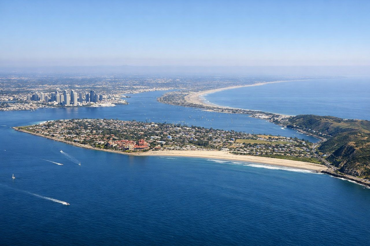
Takeoff from SAN
RIGHTAs the aircraft lifts off Runway 27 and banks north to join the route toward Oregon, the right side captures downtown San Diego's skyline, the harbor, and Coronado Bridge sweeping into view before the coastline falls away. The left side mostly just sees open Pacific water at this stage.
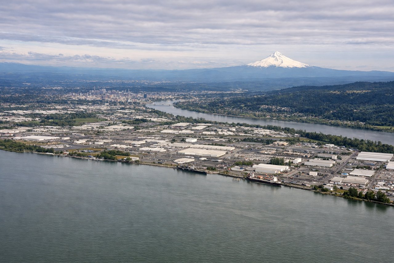
Landing at PDX
LEFTOn the typical westerly approach into PDX, the aircraft descends from the east and turns to land heading west on Runway 28, putting Mount Hood's snow-capped cone off the left side as the Willamette Valley opens up below. The right side mostly shows flatter Columbia River farmland with less drama.
Will your flight be in sunlight?
Pick a date and time in the Sun Map to watch the sun move across your whole flight.
About This Route
Which side of the plane should I sit on flying from San Diego International Lindbergh Fld (SAN) to Portland International (PDX)?
Sit on the Right side of the plane for the best views on flights from San Diego to Portland. The right side delivers a more consistent scenic arc — San Diego's skyline and harbor at takeoff, then Sierra Nevada peaks and Mount Shasta's volcanic cone during the inland cruise portion of the route — while the left side is dominated by open ocean or flat valley floor for much of the flight, only redeemed by Mount Hood near landing.
What can I see during takeoff from San Diego International Lindbergh Fld in San Diego?
During takeoff from San Diego International Lindbergh Fld (SAN), sit on the Right side for the best views. As the aircraft lifts off Runway 27 and banks north to join the route toward Oregon, the right side captures downtown San Diego's skyline, the harbor, and Coronado Bridge sweeping into view before the coastline falls away. The left side mostly just sees open Pacific water at this stage. Notable sights include: Downtown San Diego skyline, San Diego Bay, Coronado Bridge, Balboa Park.
What can I see when landing at Portland International in Portland?
When landing at Portland International (PDX), sit on the Left side for the best views. On the typical westerly approach into PDX, the aircraft descends from the east and turns to land heading west on Runway 28, putting Mount Hood's snow-capped cone off the left side as the Willamette Valley opens up below. The right side mostly shows flatter Columbia River farmland with less drama. Notable sights include: Mount Hood, Willamette River, Portland downtown, Columbia River.
How long is the flight from San Diego to Portland?
The flight from San Diego International Lindbergh Fld (SAN) to Portland International (PDX) takes about 2 hours 15 minutes. The shortest flight path between them is 934 miles (1,503 km); winds and air traffic control usually add a few percent.
What does the San Diego to Portland flight path pass over?
Sierra Nevada range, California's Central Valley, Mount Shasta, Klamath Basin