The right side offers a stronger overall experience: the San Diego bay/harbor departure view, glimpses of Arizona and New Mexico desert terrain and distant mountain ranges during cruise, and the Mississippi River/Gateway Arch approach into St. Louis. The left side mostly faces open sky and less distinctive terrain for the majority of the route.
Flown SAN to STL? Did we get it right?
Flight Path
San Diego to St. Louis is 1,554 miles (2,501 km), a flight of about 3 hours 5 minutes.
Sonoran Desert basins near Phoenix, the Mogollon Rim of Arizona, and the high plains of eastern New Mexico and the Texas Panhandle along the typical southern transcontinental routing.
Great circle distance and headings ›


Phase by phase
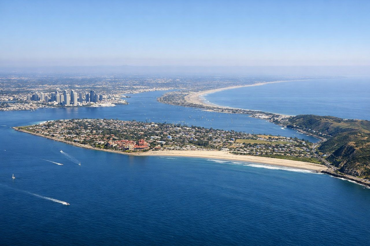
Takeoff from SAN
RIGHTDeparting Runway 27, the aircraft climbs out over San Diego Bay before banking back toward the northeast. Passengers on the right catch a last look at downtown San Diego's skyline, Coronado, and the harbor before the turn inland toward the desert.
Landing at STL
RIGHTOn approach into St. Louis from the west, the flight path passes south of downtown, giving right-side passengers a view of the Mississippi River bends and the Gateway Arch glinting near the riverfront just before touchdown.
Will your flight be in sunlight?
Pick a date and time in the Sun Map to watch the sun move across your whole flight.
About This Route
Which side of the plane should I sit on flying from San Diego International Lindbergh Fld (SAN) to Lambert St Louis International (STL)?
Sit on the Right side of the plane for the best views on flights from San Diego to St. Louis. The right side offers a stronger overall experience: the San Diego bay/harbor departure view, glimpses of Arizona and New Mexico desert terrain and distant mountain ranges during cruise, and the Mississippi River/Gateway Arch approach into St. Louis. The left side mostly faces open sky and less distinctive terrain for the majority of the route.
What can I see during takeoff from San Diego International Lindbergh Fld in San Diego?
During takeoff from San Diego International Lindbergh Fld (SAN), sit on the Right side for the best views. Departing Runway 27, the aircraft climbs out over San Diego Bay before banking back toward the northeast. Passengers on the right catch a last look at downtown San Diego's skyline, Coronado, and the harbor before the turn inland toward the desert. Notable sights include: San Diego Bay, Coronado, downtown San Diego skyline, Balboa Park.
What can I see when landing at Lambert St Louis International in St. Louis?
When landing at Lambert St Louis International (STL), sit on the Right side for the best views. On approach into St. Louis from the west, the flight path passes south of downtown, giving right-side passengers a view of the Mississippi River bends and the Gateway Arch glinting near the riverfront just before touchdown. Notable sights include: Mississippi River, Gateway Arch, downtown St. Louis, Missouri River confluence.
How long is the flight from San Diego to St. Louis?
The flight from San Diego International Lindbergh Fld (SAN) to Lambert St Louis International (STL) takes about 3 hours 5 minutes. The shortest flight path between them is 1,554 miles (2,501 km); winds and air traffic control usually add a few percent.
What does the San Diego to St. Louis flight path pass over?
Sonoran Desert basins near Phoenix, the Mogollon Rim of Arizona, and the high plains of eastern New Mexico and the Texas Panhandle along the typical southern transcontinental routing.