While the takeoff offers decent Hill Country views on the right, the landing approach into Chicago on the left side provides superior scenery—Lake Michigan, the iconic skyline, and the urban grid are all visually compelling and worth the trade-off.
Flown SAT to MDW? Did we get it right?
Flight Path
San Antonio to Chicago is 1,037 miles (1,668 km), a flight of about 3 hours 15 minutes.
The flight path crosses central Texas and Oklahoma, passing over the Brazos River valley, the Red River (Texas-Oklahoma border), and the Arbuckle Mountains in southern Oklahoma. Around the midpoint near the Oklahoma-Kansas border, you may see scattered lakes and prairie terrain. As you approach Illinois, the landscape flattens into agricultural plains with visible field patterns and occasional river valleys. The Illinois River and its tributaries become visible in the final hour before reaching Chicago.
Great circle distance and headings ›

Phase by phase
Takeoff from SAT
RIGHTRight-side seats capture San Antonio's urban sprawl and the surrounding Texas Hill Country terrain as you climb northeastward. You'll see the city grid fade into rolling hills and scattered ranch land.
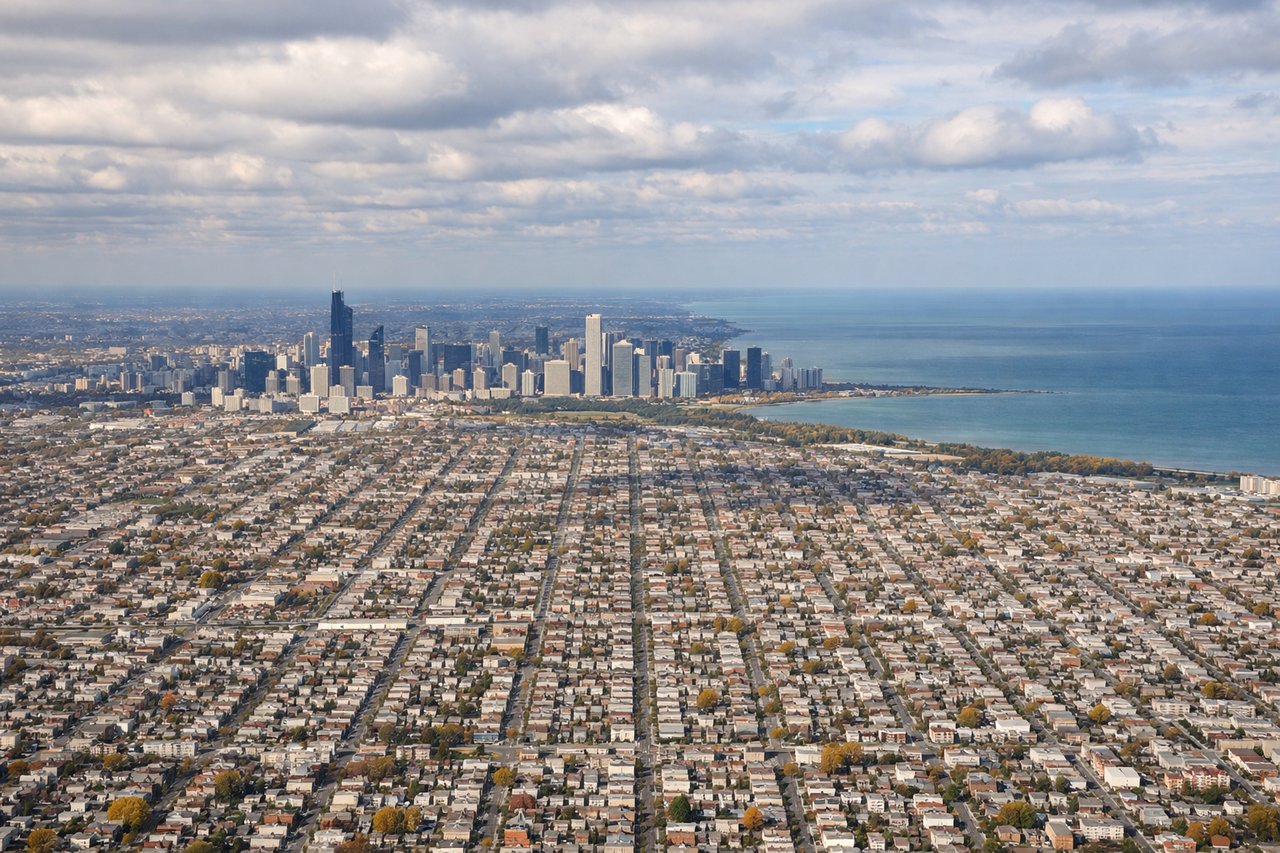
Landing at MDW
LEFTLeft-side seats offer the best views during descent into Chicago. You'll see Lake Michigan's shoreline, the Chicago skyline, and the grid of neighborhoods approaching Midway from the southwest.
Will your flight be in sunlight?
Pick a date and time in the Sun Map to watch the sun move across your whole flight.
About This Route
Which side of the plane should I sit on flying from San Antonio International (SAT) to Chicago Midway International (MDW)?
Sit on the Left side of the plane for the best views on flights from San Antonio to Chicago. While the takeoff offers decent Hill Country views on the right, the landing approach into Chicago on the left side provides superior scenery—Lake Michigan, the iconic skyline, and the urban grid are all visually compelling and worth the trade-off.
What can I see during takeoff from San Antonio International in San Antonio?
During takeoff from San Antonio International (SAT), sit on the Right side for the best views. Right-side seats capture San Antonio's urban sprawl and the surrounding Texas Hill Country terrain as you climb northeastward. You'll see the city grid fade into rolling hills and scattered ranch land. Notable sights include: San Antonio city center and downtown skyline, Texas Hill Country rolling terrain to the north and east, Medina River valley visible as a linear feature through the landscape.
What can I see when landing at Chicago Midway International in Chicago?
When landing at Chicago Midway International (MDW), sit on the Left side for the best views. Left-side seats offer the best views during descent into Chicago. You'll see Lake Michigan's shoreline, the Chicago skyline, and the grid of neighborhoods approaching Midway from the southwest. Notable sights include: Lake Michigan's eastern shoreline and water surface, Chicago downtown skyline and Willis Tower, the grid pattern of Chicago's South Side neighborhoods, Midway International Airport runways and surrounding industrial areas.
How long is the flight from San Antonio to Chicago?
The flight from San Antonio International (SAT) to Chicago Midway International (MDW) takes about 3 hours 15 minutes. The shortest flight path between them is 1,037 miles (1,668 km); winds and air traffic control usually add a few percent.
What does the San Antonio to Chicago flight path pass over?
The flight path crosses central Texas and Oklahoma, passing over the Brazos River valley, the Red River (Texas-Oklahoma border), and the Arbuckle Mountains in southern Oklahoma. Around the midpoint near the Oklahoma-Kansas border, you may see scattered lakes and prairie terrain. As you approach Illinois, the landscape flattens into agricultural plains with visible field patterns and occasional river valleys. The Illinois River and its tributaries become visible in the final hour before reaching Chicago.