Left side wins at both ends of the flight — downtown San Antonio on departure and the Chicago lakefront and Loop skyline on approach. The right side offers flat Texas and Illinois farmland for most of the journey with no comparable highlights.
Flight Path
The flight tracks northeast over the Texas Hill Country briefly after departure, then crosses the flat agricultural plains of central Texas, Oklahoma, and Kansas. The Red River crossing between Texas and Oklahoma is visible as a wide reddish-brown braided river. Crossing into Missouri and Illinois the terrain remains flat with the Missouri and Illinois Rivers visible as broad silvery ribbons cutting through patchwork farmland. No significant mountain ranges or large lakes on this route until Lake Michigan appears on descent.
Great circle distance and headings ›

Phase by phase
Takeoff from SAT
LEFTSAT's primary departures heading northeast use runways 13R/31L and 12R/30L. Departing to the northeast, the left (west/northwest) side gives you a clear view back over downtown San Antonio, the Tower of the Americas, and the sprawling urban grid. The right side faces open suburban sprawl toward the airport's east.
Landing at ORD
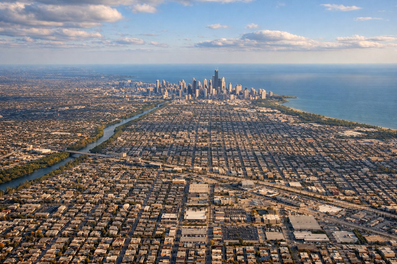
LEFTORD's primary arrival runways from the south typically use 10L/28R or 10C/28C, with aircraft approaching from the south-southwest. The left side on approach gives a clear view of the Chicago lakefront, Lake Michigan, and the downtown Loop skyline. The right side faces the flat western suburbs with little of visual interest.
Landmarks on this routeAll landmarks →
Will your flight be in sunlight?
See exactly which side of the plane gets sun and shade at your departure time.
About This Route
Which side of the plane should I sit on flying from San Antonio International (SAT) to Chicago Ohare International (ORD)?
Sit on the Left side of the plane for the best views on flights from San Antonio to Chicago. Left side wins at both ends of the flight — downtown San Antonio on departure and the Chicago lakefront and Loop skyline on approach. The right side offers flat Texas and Illinois farmland for most of the journey with no comparable highlights.
What can I see during takeoff from San Antonio International in San Antonio?
During takeoff from San Antonio International (SAT), sit on the Left side for the best views. SAT's primary departures heading northeast use runways 13R/31L and 12R/30L. Departing to the northeast, the left (west/northwest) side gives you a clear view back over downtown San Antonio, the Tower of the Americas, and the sprawling urban grid. The right side faces open suburban sprawl toward the airport's east. Notable sights include: Downtown San Antonio skyline, Tower of the Americas, San Antonio River corridor, Loop 410 freeway ring.
What can I see when landing at Chicago Ohare International in Chicago?
When landing at Chicago Ohare International (ORD), sit on the Left side for the best views. ORD's primary arrival runways from the south typically use 10L/28R or 10C/28C, with aircraft approaching from the south-southwest. The left side on approach gives a clear view of the Chicago lakefront, Lake Michigan, and the downtown Loop skyline. The right side faces the flat western suburbs with little of visual interest. Notable sights include: Lake Michigan shoreline, Chicago Loop skyline, Millennium Park and Grant Park greenspace, the distinct grid of Chicago's street layout.
How long is the flight from San Antonio to Chicago?
The flight from San Antonio International (SAT) to Chicago Ohare International (ORD) takes Approximately 2 hours 30 minutes.
What does the San Antonio to Chicago flight path pass over?
The flight tracks northeast over the Texas Hill Country briefly after departure, then crosses the flat agricultural plains of central Texas, Oklahoma, and Kansas. The Red River crossing between Texas and Oklahoma is visible as a wide reddish-brown braided river. Crossing into Missouri and Illinois the terrain remains flat with the Missouri and Illinois Rivers visible as broad silvery ribbons cutting through patchwork farmland. No significant mountain ranges or large lakes on this route until Lake Michigan appears on descent.