Left side wins both ends of the flight. During the cruise over west Texas and New Mexico, the left side also offers occasional glimpses of the Sangre de Cristo Mountains and the Raton Pass area as the route curves northwest toward Colorado, while the right side faces open, featureless high plains.
Flight Path
The flight crosses the Texas Hill Country north of San Antonio, then the Permian Basin and Llano Estacado of west Texas, the high plains of eastern New Mexico near Tucumcari, the Raton Pass area where New Mexico meets Colorado, the Purgatoire River valley, and the Colorado Piedmont before descending toward Denver. The terrain is largely flat to rolling high plains with the Sangre de Cristo Mountains visible as a distant range to the left (west) in the New Mexico and southern Colorado segment.
Great circle distance and headings ›Phase by phase
Takeoff from SAT
LEFTSAT typically departs north on runway 13R/31L or 12R/30L. A northbound departure puts downtown San Antonio and the San Antonio River valley on the left side. You get a clear look at the urban core and the sprawl of the Hill Country beginning to the northwest.
Landing at DEN
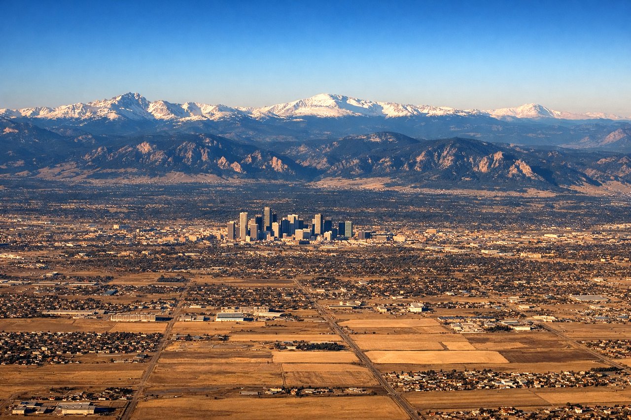
LEFTDenver International sits on the plains east of the city, and aircraft typically approach from the east or southeast on runways oriented north-south. A left window seat on approach gives you the Front Range of the Rocky Mountains — including Pikes Peak to the south and the entire Denver metro spread below — while the right side faces open plains.
Landmarks on this routeAll landmarks →
Will your flight be in sunlight?
See exactly which side of the plane gets sun and shade at your departure time.
About This Route
Which side of the plane should I sit on flying from San Antonio International (SAT) to Denver International (DEN)?
Sit on the Left side of the plane for the best views on flights from San Antonio to Denver. Left side wins both ends of the flight. During the cruise over west Texas and New Mexico, the left side also offers occasional glimpses of the Sangre de Cristo Mountains and the Raton Pass area as the route curves northwest toward Colorado, while the right side faces open, featureless high plains.
What can I see during takeoff from San Antonio International in San Antonio?
During takeoff from San Antonio International (SAT), sit on the Left side for the best views. SAT typically departs north on runway 13R/31L or 12R/30L. A northbound departure puts downtown San Antonio and the San Antonio River valley on the left side. You get a clear look at the urban core and the sprawl of the Hill Country beginning to the northwest. Notable sights include: Downtown San Antonio skyline, San Antonio River corridor, Edwards Plateau escarpment to the northwest, Loop 410 highway grid.
What can I see when landing at Denver International in Denver?
When landing at Denver International (DEN), sit on the Left side for the best views. Denver International sits on the plains east of the city, and aircraft typically approach from the east or southeast on runways oriented north-south. A left window seat on approach gives you the Front Range of the Rocky Mountains — including Pikes Peak to the south and the entire Denver metro spread below — while the right side faces open plains. Notable sights include: Front Range of the Rocky Mountains, Pikes Peak (south), Longs Peak (north), Denver metro skyline.
How long is the flight from San Antonio to Denver?
The flight from San Antonio International (SAT) to Denver International (DEN) takes Approximately 2 hours 15 minutes.
What does the San Antonio to Denver flight path pass over?
The flight crosses the Texas Hill Country north of San Antonio, then the Permian Basin and Llano Estacado of west Texas, the high plains of eastern New Mexico near Tucumcari, the Raton Pass area where New Mexico meets Colorado, the Purgatoire River valley, and the Colorado Piedmont before descending toward Denver. The terrain is largely flat to rolling high plains with the Sangre de Cristo Mountains visible as a distant range to the left (west) in the New Mexico and southern Colorado segment.