The right side wins overall because the long cruise segment—the bulk of this 10-hour flight—tracks along the north Pacific rim past the Alaska Peninsula, Aleutian Islands, and Kamchatka's volcanic chain, offering the route's most dramatic and rare scenery. The left side's Mount Fuji landing view is excellent but can't offset hours of open ocean during cruise.
Flown SEA to HND? Did we get it right?
Flight Path
Seattle to Tokyo is 4,792 miles (7,711 km), a flight of about 10 hours 25 minutes.
Gulf of Alaska, Aleutian Islands chain, Bering Sea, Kamchatka Peninsula volcanoes, Kuril Islands
Great circle distance and headings ›


Phase by phase
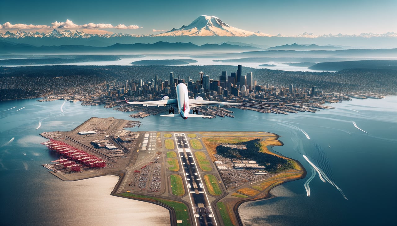
Takeoff from SEA
RIGHTDeparting SEA on runway 34, the initial climb tracks north with a slight left turn onto the oceanic route, putting downtown Seattle, Lake Washington, and the Cascade Range on the right side of the aircraft. Mount Rainier's snow-capped cone is often visible off the right rear as the plane climbs out.
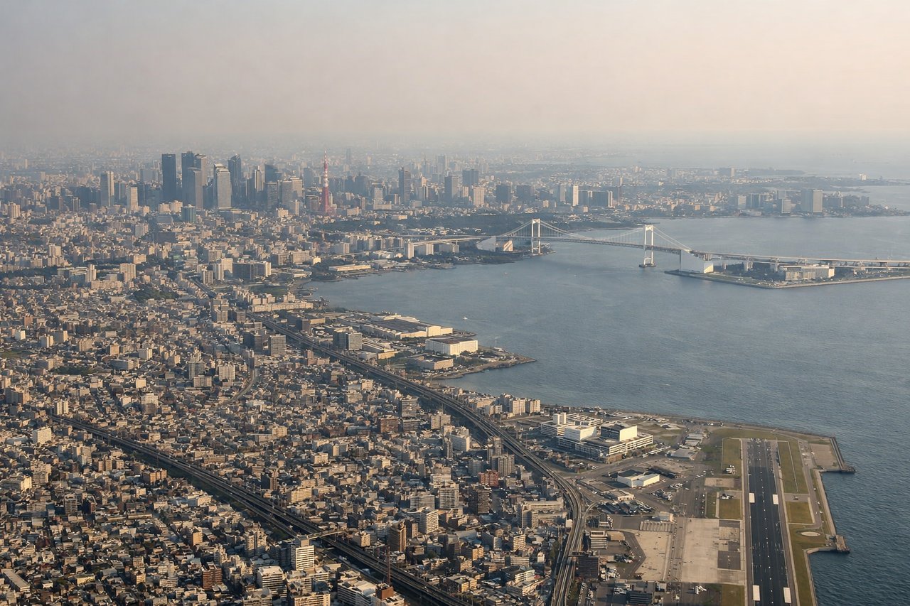
Landing at HND
LEFTOn the typical south-wind arrival into HND, aircraft fly north over Tokyo Bay before landing on 34L/34R, putting the Tokyo cityscape and, on clear days, Mount Fuji's distinctive peak on the left side of the plane. The right side mostly faces the industrial Chiba shoreline and open bay.
Will your flight be in sunlight?
Pick a date and time in the Sun Map to watch the sun move across your whole flight.
About This Route
Which side of the plane should I sit on flying from Seattle Tacoma International (SEA) to Tokyo International (HND)?
Sit on the Right side of the plane for the best views on flights from Seattle to Tokyo. The right side wins overall because the long cruise segment—the bulk of this 10-hour flight—tracks along the north Pacific rim past the Alaska Peninsula, Aleutian Islands, and Kamchatka's volcanic chain, offering the route's most dramatic and rare scenery. The left side's Mount Fuji landing view is excellent but can't offset hours of open ocean during cruise.
What can I see during takeoff from Seattle Tacoma International in Seattle?
During takeoff from Seattle Tacoma International (SEA), sit on the Right side for the best views. Departing SEA on runway 34, the initial climb tracks north with a slight left turn onto the oceanic route, putting downtown Seattle, Lake Washington, and the Cascade Range on the right side of the aircraft. Mount Rainier's snow-capped cone is often visible off the right rear as the plane climbs out. Notable sights include: Downtown Seattle skyline, Lake Washington, Cascade Range, Mount Rainier.
What can I see when landing at Tokyo International in Tokyo?
When landing at Tokyo International (HND), sit on the Left side for the best views. On the typical south-wind arrival into HND, aircraft fly north over Tokyo Bay before landing on 34L/34R, putting the Tokyo cityscape and, on clear days, Mount Fuji's distinctive peak on the left side of the plane. The right side mostly faces the industrial Chiba shoreline and open bay. Notable sights include: Tokyo Bay, Tokyo skyline (Odaiba, Shinagawa), Mount Fuji, Boso Peninsula coastline.
How long is the flight from Seattle to Tokyo?
The flight from Seattle Tacoma International (SEA) to Tokyo International (HND) takes about 10 hours 25 minutes. The shortest flight path between them is 4,792 miles (7,711 km); winds and air traffic control usually add a few percent.
What does the Seattle to Tokyo flight path pass over?
Gulf of Alaska, Aleutian Islands chain, Bering Sea, Kamchatka Peninsula volcanoes, Kuril Islands