The right side wins on both ends of the flight: Mount Rainier dominates the departure view, and the Atlanta skyline plus Chattahoochee River add visual interest on arrival, while the left side mostly offers flat plains and a less distinctive approach.
Flown SEA to ATL? Did we get it right?
Flight Path
Seattle to Atlanta is 2,178 miles (3,505 km), a flight of about 4 hours 20 minutes.
Route crosses the northern Rockies over Idaho and Montana, then the Great Plains of the Dakotas and Nebraska, before crossing the Mississippi River and the rolling terrain of the Tennessee Valley into the Appalachian foothills of north Georgia.
Great circle distance and headings ›


Phase by phase
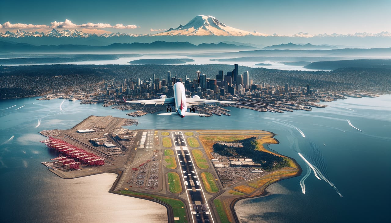
Takeoff from SEA
RIGHTEastbound departures from SEA typically climb out to the south before turning east, putting Mount Rainier directly off the right side of the aircraft. Passengers also get a brief look at Puget Sound and the southern edge of the Seattle skyline before the turn.

Landing at ATL
RIGHTOn the descent into ATL from the northwest, flights commonly swing south of the field before turning onto final approach, which places downtown Atlanta's skyline and the Chattahoochee River off the right side of the cabin. The rolling, tree-covered Piedmont terrain gives Atlanta's approach more visual texture than the flatter final stretch on the opposite side.
Will your flight be in sunlight?
Pick a date and time in the Sun Map to watch the sun move across your whole flight.
About This Route
Which side of the plane should I sit on flying from Seattle Tacoma International (SEA) to The William B Hartsfield Atlanta International (ATL)?
Sit on the Right side of the plane for the best views on flights from Seattle to Atlanta. The right side wins on both ends of the flight: Mount Rainier dominates the departure view, and the Atlanta skyline plus Chattahoochee River add visual interest on arrival, while the left side mostly offers flat plains and a less distinctive approach.
What can I see during takeoff from Seattle Tacoma International in Seattle?
During takeoff from Seattle Tacoma International (SEA), sit on the Right side for the best views. Eastbound departures from SEA typically climb out to the south before turning east, putting Mount Rainier directly off the right side of the aircraft. Passengers also get a brief look at Puget Sound and the southern edge of the Seattle skyline before the turn. Notable sights include: Mount Rainier, Puget Sound, Seattle skyline, Cascade foothills.
What can I see when landing at The William B Hartsfield Atlanta International in Atlanta?
When landing at The William B Hartsfield Atlanta International (ATL), sit on the Right side for the best views. On the descent into ATL from the northwest, flights commonly swing south of the field before turning onto final approach, which places downtown Atlanta's skyline and the Chattahoochee River off the right side of the cabin. The rolling, tree-covered Piedmont terrain gives Atlanta's approach more visual texture than the flatter final stretch on the opposite side. Notable sights include: Atlanta downtown skyline, Chattahoochee River, Piedmont hills, suburban Atlanta sprawl.
How long is the flight from Seattle to Atlanta?
The flight from Seattle Tacoma International (SEA) to The William B Hartsfield Atlanta International (ATL) takes about 4 hours 20 minutes. The shortest flight path between them is 2,178 miles (3,505 km); winds and air traffic control usually add a few percent.
What does the Seattle to Atlanta flight path pass over?
Route crosses the northern Rockies over Idaho and Montana, then the Great Plains of the Dakotas and Nebraska, before crossing the Mississippi River and the rolling terrain of the Tennessee Valley into the Appalachian foothills of north Georgia.