The right side wins on both ends of the flight — Mount Rainier and the Cascades dominate the departure view, and the approach into MSY delivers a scenic pass over Lake Pontchartrain and the New Orleans riverfront, while the left side offers mostly flat plains and open sky for the bulk of the route.
Flown SEA to MSY? Did we get it right?
Flight Path
Seattle to New Orleans is 2,083 miles (3,353 km), a flight of about 4 hours 5 minutes.
Snake River Plain and the Rocky Mountain foothills of Idaho/Utah, followed by the Great Plains of Colorado, Kansas, and Oklahoma before descending toward the Gulf Coast lowlands of Louisiana
Great circle distance and headings ›


Phase by phase
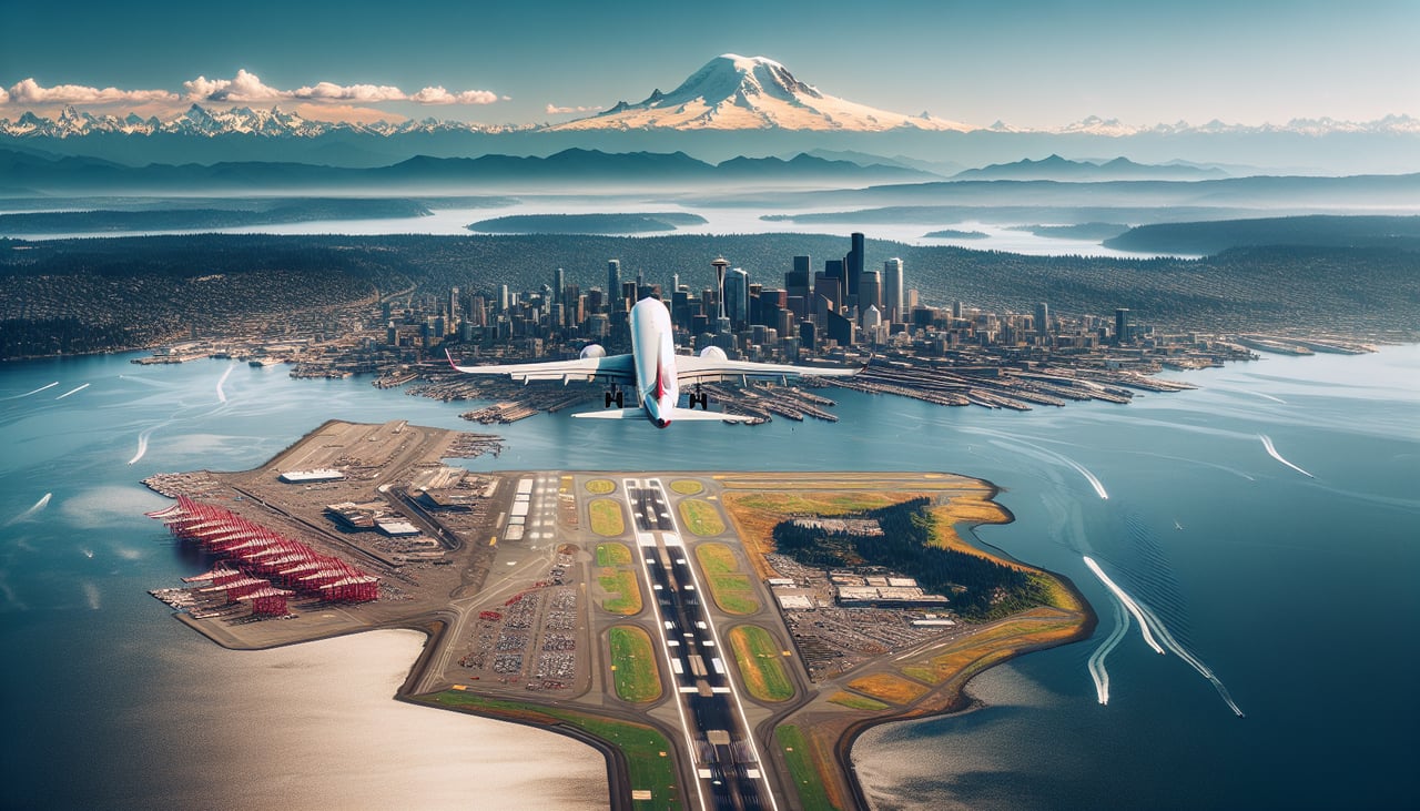
Takeoff from SEA
RIGHTDeparting SEA to the southeast, the right side offers a clear view back toward Mount Rainier and the southern Cascades as the plane climbs, while the left side mostly shows Lake Washington's suburbs fading into haze with no comparable peaks.
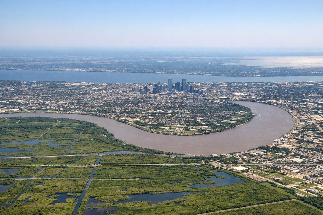
Landing at MSY
RIGHTOn approach into MSY, arrivals from the northwest typically curve over Lake Pontchartrain before turning toward the runway, giving right-side passengers a sweeping view of the lake, the causeway, and the New Orleans skyline along the Mississippi River bend.
Will your flight be in sunlight?
Pick a date and time in the Sun Map to watch the sun move across your whole flight.
About This Route
Which side of the plane should I sit on flying from Seattle Tacoma International (SEA) to Louis Armstrong New Orleans International (MSY)?
Sit on the Right side of the plane for the best views on flights from Seattle to New Orleans. The right side wins on both ends of the flight — Mount Rainier and the Cascades dominate the departure view, and the approach into MSY delivers a scenic pass over Lake Pontchartrain and the New Orleans riverfront, while the left side offers mostly flat plains and open sky for the bulk of the route.
What can I see during takeoff from Seattle Tacoma International in Seattle?
During takeoff from Seattle Tacoma International (SEA), sit on the Right side for the best views. Departing SEA to the southeast, the right side offers a clear view back toward Mount Rainier and the southern Cascades as the plane climbs, while the left side mostly shows Lake Washington's suburbs fading into haze with no comparable peaks. Notable sights include: Mount Rainier, Mount Adams, Cascade foothills, Puget Sound shoreline.
What can I see when landing at Louis Armstrong New Orleans International in New Orleans?
When landing at Louis Armstrong New Orleans International (MSY), sit on the Right side for the best views. On approach into MSY, arrivals from the northwest typically curve over Lake Pontchartrain before turning toward the runway, giving right-side passengers a sweeping view of the lake, the causeway, and the New Orleans skyline along the Mississippi River bend. Notable sights include: Lake Pontchartrain, Lake Pontchartrain Causeway, New Orleans skyline, Mississippi River bends.
How long is the flight from Seattle to New Orleans?
The flight from Seattle Tacoma International (SEA) to Louis Armstrong New Orleans International (MSY) takes about 4 hours 5 minutes. The shortest flight path between them is 2,083 miles (3,353 km); winds and air traffic control usually add a few percent.
What does the Seattle to New Orleans flight path pass over?
Snake River Plain and the Rocky Mountain foothills of Idaho/Utah, followed by the Great Plains of Colorado, Kansas, and Oklahoma before descending toward the Gulf Coast lowlands of Louisiana