Right side wins both ends of the flight. At takeoff you get Mount Rainier and the Seattle skyline; at landing you get Land's End and the Cabo San Lucas coastline. Along the mid-flight corridor over central California and the Baja Peninsula, the right side also faces west toward the Pacific coastline of Baja, which is more scenic than the interior desert views on the left.
Flown SEA to SJD? Did we get it right?
Flight Path
Seattle to San Jose Del Cabo is 1,817 miles (2,924 km), a flight of about 4 hours.
The flight tracks south-southeast over Oregon and northern California, crossing the Sacramento Valley and the Central Valley. Over central California the Sierra Nevada is visible to the left (east). The route then crosses into Baja California, flying the length of the peninsula over the stark Sonoran Desert and the spine of the Sierra de Baja California mountain range. The Sea of Cortez becomes visible to the left and the Pacific to the right as the peninsula narrows toward Los Cabos.
Great circle distance and headings ›


Phase by phase
Takeoff from SEA
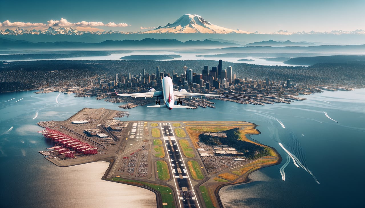
RIGHTSEA typically departs south on runway 16L/16R, then turns southeast. The right side gives you a clear view of Mount Rainier dominating the eastern skyline, plus the full sweep of Puget Sound and the Seattle city skyline receding behind you. The left side faces west toward the Olympic Peninsula, which is less dramatic on departure.
Landing at SJD
RIGHTLos Cabos typically lands on runway 16 heading south, or runway 34 heading north depending on winds. On approach from the north, the right side faces west toward the Pacific Ocean and the dramatic rocky tip of the Baja Peninsula at Land's End, including the iconic El Arco rock arch visible near Cabo San Lucas. The left side sees the Sea of Cortez but misses the more dramatic Pacific coastline and the peninsula tip.
Will your flight be in sunlight?
Pick a date and time in the Sun Map to watch the sun move across your whole flight.
About This Route
Which side of the plane should I sit on flying from Seattle Tacoma International (SEA) to Los Cabos International (SJD)?
Sit on the Right side of the plane for the best views on flights from Seattle to San Jose Del Cabo. Right side wins both ends of the flight. At takeoff you get Mount Rainier and the Seattle skyline; at landing you get Land's End and the Cabo San Lucas coastline. Along the mid-flight corridor over central California and the Baja Peninsula, the right side also faces west toward the Pacific coastline of Baja, which is more scenic than the interior desert views on the left.
What can I see during takeoff from Seattle Tacoma International in Seattle?
During takeoff from Seattle Tacoma International (SEA), sit on the Right side for the best views. SEA typically departs south on runway 16L/16R, then turns southeast. The right side gives you a clear view of Mount Rainier dominating the eastern skyline, plus the full sweep of Puget Sound and the Seattle city skyline receding behind you. The left side faces west toward the Olympic Peninsula, which is less dramatic on departure. Notable sights include: Mount Rainier (14,411 ft, unmistakable snow cone to the southeast), Seattle city skyline and Elliott Bay, Puget Sound waterways and islands, Mount Adams visible further south on the horizon.
What can I see when landing at Los Cabos International in San Jose Del Cabo?
When landing at Los Cabos International (SJD), sit on the Right side for the best views. Los Cabos typically lands on runway 16 heading south, or runway 34 heading north depending on winds. On approach from the north, the right side faces west toward the Pacific Ocean and the dramatic rocky tip of the Baja Peninsula at Land's End, including the iconic El Arco rock arch visible near Cabo San Lucas. The left side sees the Sea of Cortez but misses the more dramatic Pacific coastline and the peninsula tip. Notable sights include: Land's End and El Arco rock formation at Cabo San Lucas, Pacific Ocean coastline along the western Baja shore, Sea of Cortez visible to the east, the arid desert mountains of the Sierra de la Laguna inland.
How long is the flight from Seattle to San Jose Del Cabo?
The flight from Seattle Tacoma International (SEA) to Los Cabos International (SJD) takes about 4 hours. The shortest flight path between them is 1,817 miles (2,924 km); winds and air traffic control usually add a few percent.
What does the Seattle to San Jose Del Cabo flight path pass over?
The flight tracks south-southeast over Oregon and northern California, crossing the Sacramento Valley and the Central Valley. Over central California the Sierra Nevada is visible to the left (east). The route then crosses into Baja California, flying the length of the peninsula over the stark Sonoran Desert and the spine of the Sierra de Baja California mountain range. The Sea of Cortez becomes visible to the left and the Pacific to the right as the peninsula narrows toward Los Cabos.