The right side wins both ends of the flight: Mount Rainier and the Cascades during departure, then Tampa Bay and the Gulf coastline during arrival, while the left side offers comparatively flat, less distinctive terrain at both airports.
Flight Path
The route crosses the Rocky Mountain foothills of Idaho and Wyoming, then the flat expanse of the Great Plains across Nebraska and Kansas, the Mississippi River near the Missouri-Arkansas border, and the Gulf Coastal plain of Alabama and Georgia before descending into Florida.
Great circle distance and headings ›
.jpg?width=600)
.jpg?width=600)

Phase by phase
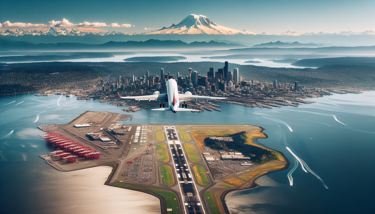
Takeoff from SEA
RIGHTDeparting SEA to the southeast, the right side offers a clear view of Mount Rainier's snow-capped bulk rising over the Cascade foothills as the aircraft climbs and turns onto its easterly heading. Passengers also get a last glimpse of Puget Sound's inlets before the plane settles onto its transcontinental track.
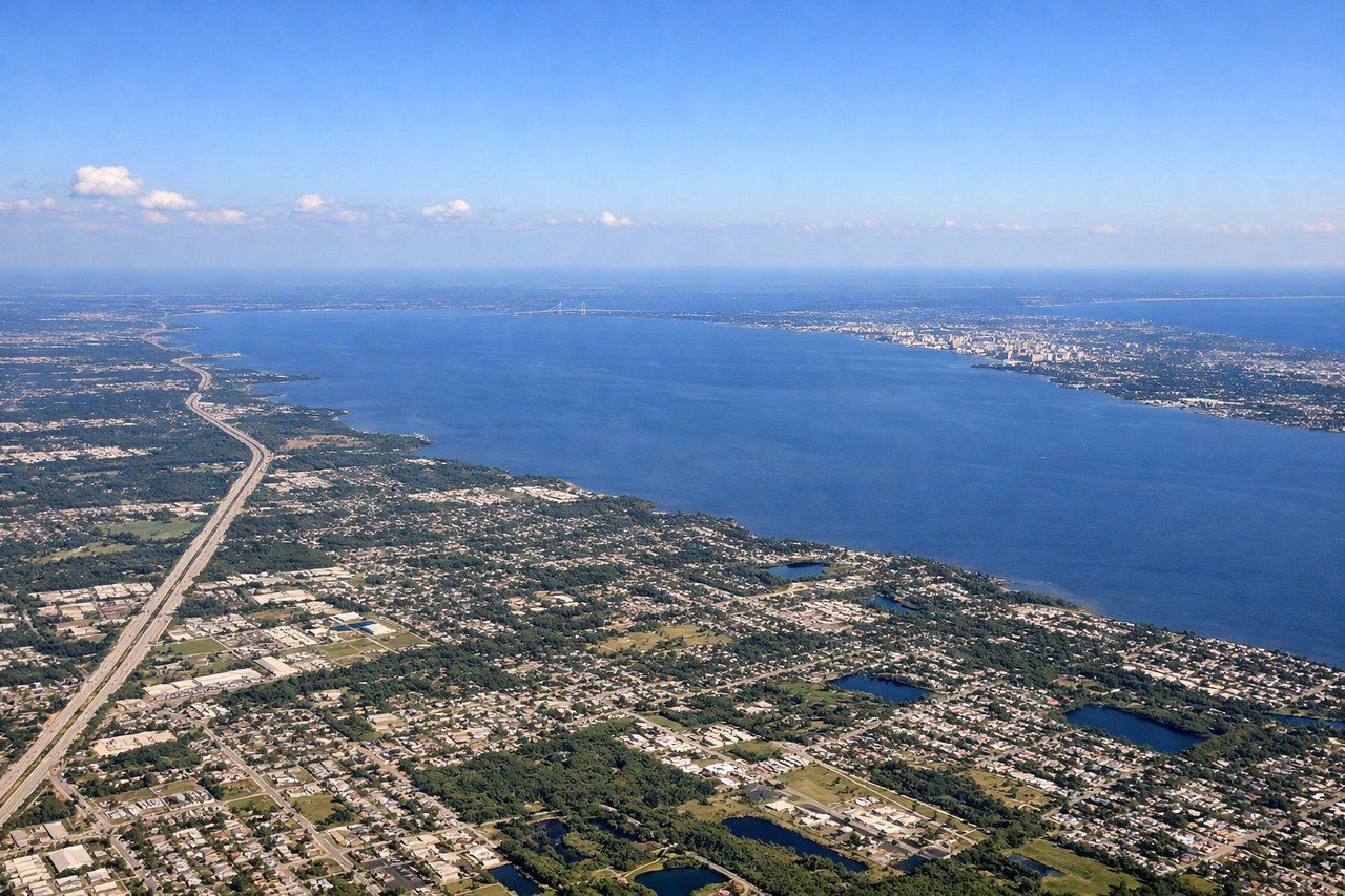
Landing at TPA
RIGHTOn approach into TPA from the north, the right side faces west toward Tampa Bay, giving passengers a sweeping view of the bay's causeways, barrier islands, and the Gulf of Mexico beyond as the plane lines up for landing. The St. Petersburg shoreline and open water contrast with the flat green Florida landscape.
Landmarks on this routeAll landmarks →
Will your flight be in sunlight?
See exactly which side of the plane gets sun and shade at your departure time.
About This Route
Which side of the plane should I sit on flying from Seattle Tacoma International (SEA) to Tampa International (TPA)?
Sit on the Right side of the plane for the best views on flights from Seattle to Tampa. The right side wins both ends of the flight: Mount Rainier and the Cascades during departure, then Tampa Bay and the Gulf coastline during arrival, while the left side offers comparatively flat, less distinctive terrain at both airports.
What can I see during takeoff from Seattle Tacoma International in Seattle?
During takeoff from Seattle Tacoma International (SEA), sit on the Right side for the best views. Departing SEA to the southeast, the right side offers a clear view of Mount Rainier's snow-capped bulk rising over the Cascade foothills as the aircraft climbs and turns onto its easterly heading. Passengers also get a last glimpse of Puget Sound's inlets before the plane settles onto its transcontinental track. Notable sights include: Mount Rainier, Cascade Range foothills, Puget Sound inlets, Green River valley.
What can I see when landing at Tampa International in Tampa?
When landing at Tampa International (TPA), sit on the Right side for the best views. On approach into TPA from the north, the right side faces west toward Tampa Bay, giving passengers a sweeping view of the bay's causeways, barrier islands, and the Gulf of Mexico beyond as the plane lines up for landing. The St. Petersburg shoreline and open water contrast with the flat green Florida landscape. Notable sights include: Tampa Bay, Courtney Campbell Causeway, St. Petersburg skyline, Gulf of Mexico.
How long is the flight from Seattle to Tampa?
The flight from Seattle Tacoma International (SEA) to Tampa International (TPA) takes 4h 55m.
What does the Seattle to Tampa flight path pass over?
The route crosses the Rocky Mountain foothills of Idaho and Wyoming, then the flat expanse of the Great Plains across Nebraska and Kansas, the Mississippi River near the Missouri-Arkansas border, and the Gulf Coastal plain of Alabama and Georgia before descending into Florida.