The left side wins on the strength of the cruise phase near Palawan's mountainous terrain and Sulu Sea islands, plus a landing sequence dominated by Cebu City's skyline and mountains, which together outweigh the brief Singapore coastal view the right side gets at takeoff.
Flight Path
The route crosses the South China Sea near the southern tip of Palawan, transitions into the Sulu Sea, and threads past the Visayan islands of Negros and Panay, with Negros' Mount Kanlaon volcano occasionally visible in the distance before the descent into Cebu.
Great circle distance and headings ›Phase by phase
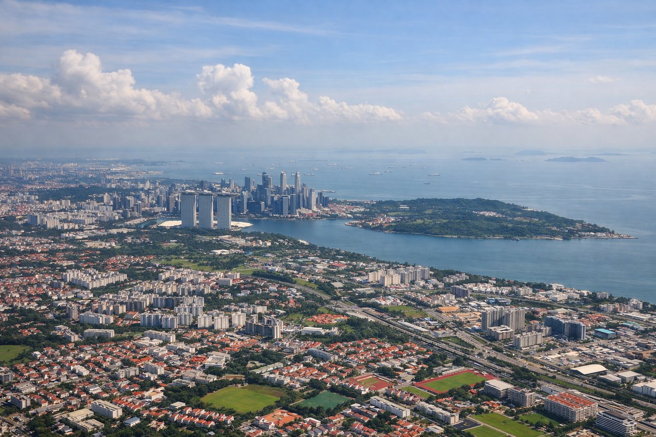
Takeoff from SIN
RIGHTDeparting Changi to the northeast, the right side keeps Singapore's eastern coastline in view a bit longer as the aircraft climbs and banks toward the Philippines, with Changi Point, Pulau Ubin, and the Johor Strait sliding past before the long overwater stretch begins.
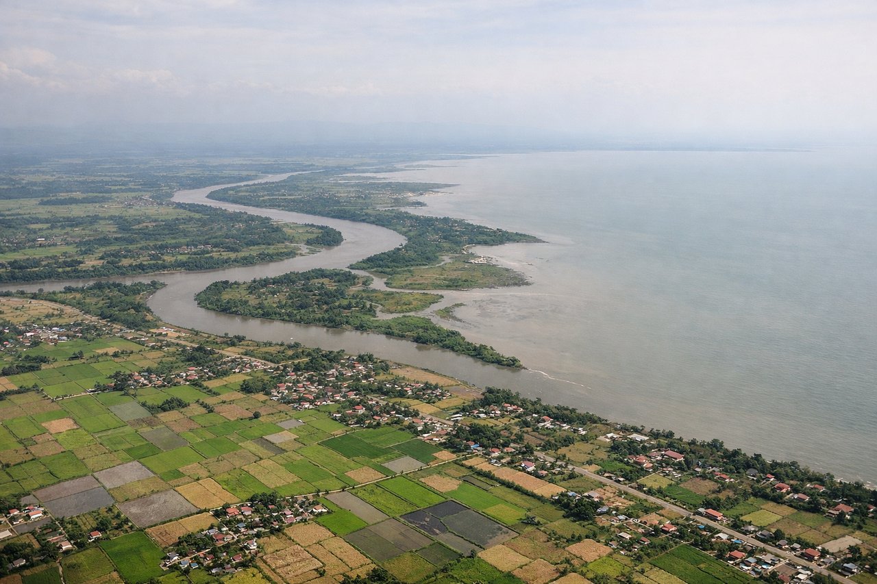
Landing at CEB
LEFTOn the approach into Mactan-Cebu (typically runway 04 during the Nov-Apr Amihan season), the jet swings in from the southwest, putting Cebu City's dense skyline, the twin Cebu-Mactan bridges, and the forested central Cebu mountain ridge on the left, while the right side only shows open water toward Bohol.
Landmarks on this routeAll landmarks →
Will your flight be in sunlight?
See exactly which side of the plane gets sun and shade at your departure time.
About This Route
Which side of the plane should I sit on flying from Singapore Changi (SIN) to Mactan Cebu International Airport (CEB)?
Sit on the Left side of the plane for the best views on flights from Singapore to Cebu. The left side wins on the strength of the cruise phase near Palawan's mountainous terrain and Sulu Sea islands, plus a landing sequence dominated by Cebu City's skyline and mountains, which together outweigh the brief Singapore coastal view the right side gets at takeoff.
What can I see during takeoff from Singapore Changi in Singapore?
During takeoff from Singapore Changi (SIN), sit on the Right side for the best views. Departing Changi to the northeast, the right side keeps Singapore's eastern coastline in view a bit longer as the aircraft climbs and banks toward the Philippines, with Changi Point, Pulau Ubin, and the Johor Strait sliding past before the long overwater stretch begins. Notable sights include: Pulau Ubin, Changi Point/Changi Village, Johor Strait, Singapore's eastern coastline.
What can I see when landing at Mactan Cebu International Airport in Cebu?
When landing at Mactan Cebu International Airport (CEB), sit on the Left side for the best views. On the approach into Mactan-Cebu (typically runway 04 during the Nov-Apr Amihan season), the jet swings in from the southwest, putting Cebu City's dense skyline, the twin Cebu-Mactan bridges, and the forested central Cebu mountain ridge on the left, while the right side only shows open water toward Bohol. Notable sights include: Cebu City skyline, Cebu-Mactan Bridges, Central Cebu mountain range, Mactan Strait.
How long is the flight from Singapore to Cebu?
The flight from Singapore Changi (SIN) to Mactan Cebu International Airport (CEB) takes 3h 40m.
What does the Singapore to Cebu flight path pass over?
The route crosses the South China Sea near the southern tip of Palawan, transitions into the Sulu Sea, and threads past the Visayan islands of Negros and Panay, with Negros' Mount Kanlaon volcano occasionally visible in the distance before the descent into Cebu.