Singapore to Minot is 8,678 miles (13,965 km), a flight of about 18 hours.
The right side captures the most dramatic geography: the departure from Singapore's maritime landscape and straits, followed by views of Southeast Asia's coastlines and river deltas during the long transpacific crossing. The left side offers less visual interest over the Pacific and North American interior.
Flight Path
Over the Pacific Ocean, the flight passes north of Hawaii (not visible on typical routing), then approaches North America over the Aleutian Islands region. The midpoint offers primarily open ocean with occasional cloud formations. As the aircraft approaches North America, the Cascade Range and Rocky Mountains become visible in the distance on the left side during descent into the northern Great Plains. The flight path crosses over British Columbia, Alberta, and Saskatchewan before reaching North Dakota.
Great circle distance and headings ›

Phase by phase
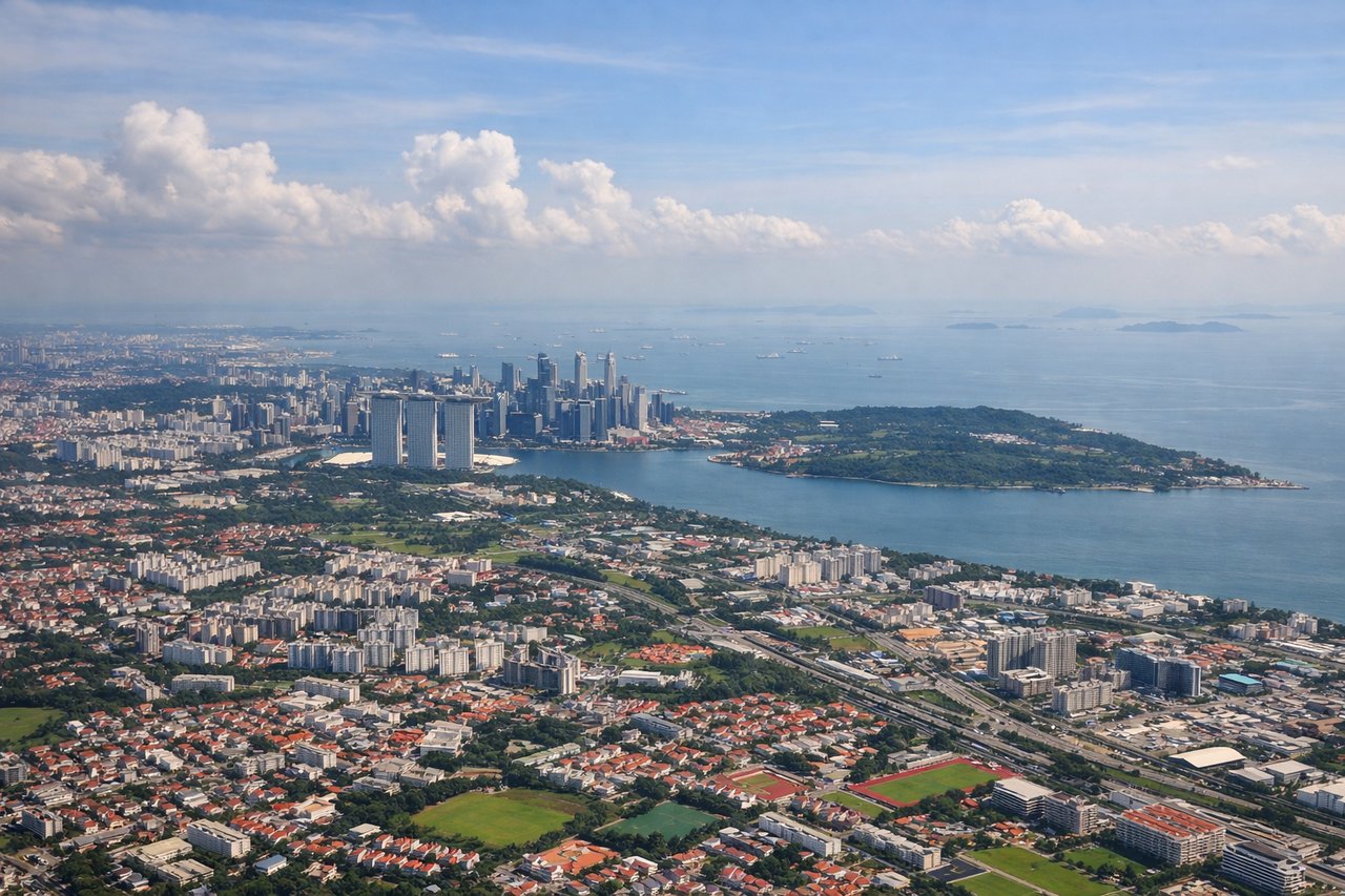
Takeoff from SIN
RIGHTRight side offers views of Singapore Strait and the Malaysian peninsula as the aircraft climbs northwestward. You'll see the busy shipping lanes and coastal geography that define Singapore's maritime setting.
Landing at MIB
LEFTLeft side provides views of the Great Plains and the approach into Minot AFB from the southeast. You'll see the characteristic flat, open prairie landscape with agricultural fields and the Souris River valley as the aircraft descends.
Landmarks on this routeAll landmarks →
Will your flight be in sunlight?
Pick a date and time in the Sun Map to watch the sun move across your whole flight.
About This Route
Which side of the plane should I sit on flying from Singapore Changi (SIN) to Minot Afb (MIB)?
Sit on the Right side of the plane for the best views on flights from Singapore to Minot. The right side captures the most dramatic geography: the departure from Singapore's maritime landscape and straits, followed by views of Southeast Asia's coastlines and river deltas during the long transpacific crossing. The left side offers less visual interest over the Pacific and North American interior.
What can I see during takeoff from Singapore Changi in Singapore?
During takeoff from Singapore Changi (SIN), sit on the Right side for the best views. Right side offers views of Singapore Strait and the Malaysian peninsula as the aircraft climbs northwestward. You'll see the busy shipping lanes and coastal geography that define Singapore's maritime setting. Notable sights include: Singapore Strait, Johor Strait, Malaysian peninsula coastline, Pulau Ubin island.
What can I see when landing at Minot Afb in Minot?
When landing at Minot Afb (MIB), sit on the Left side for the best views. Left side provides views of the Great Plains and the approach into Minot AFB from the southeast. You'll see the characteristic flat, open prairie landscape with agricultural fields and the Souris River valley as the aircraft descends. Notable sights include: Souris River valley, agricultural grid pattern of North Dakota plains, Minot city lights, prairie grassland.
How long is the flight from Singapore to Minot?
The flight from Singapore Changi (SIN) to Minot Afb (MIB) takes about 18 hours. The shortest flight path between them is 8,678 miles (13,965 km); winds and air traffic control usually add a few percent.
What does the Singapore to Minot flight path pass over?
Over the Pacific Ocean, the flight passes north of Hawaii (not visible on typical routing), then approaches North America over the Aleutian Islands region. The midpoint offers primarily open ocean with occasional cloud formations. As the aircraft approaches North America, the Cascade Range and Rocky Mountains become visible in the distance on the left side during descent into the northern Great Plains. The flight path crosses over British Columbia, Alberta, and Saskatchewan before reaching North Dakota.