San Jose Del Cabo to Charlotte is 1,916 miles (3,084 km), a flight of about 4 hours 45 minutes.
While takeoff favors the right with the Sea of Cortez and Los Cabos coastline, the long cruise leg crosses the Sierra Madre Occidental and Chihuahuan Desert on the left, and the Charlotte arrival gives left-side passengers a clear skyline view—making the left side more consistently rewarding across the full flight.
Flight Path
Sierra Madre Occidental foothills, Chihuahuan Desert basins, Gulf of Mexico coastal plain near the Texas-Louisiana border, Mississippi River delta lowlands, and the rolling Piedmont approaching the southern Appalachian foothills near Charlotte
Great circle distance and headings ›
.jpeg?width=600)
Phase by phase
Takeoff from SJD
RIGHTDeparting SJD on runway 34, the aircraft climbs north then banks right toward the northeast routing, swinging the right side toward the turquoise Sea of Cortez and the Los Cabos resort coastline. The left side mainly shows the drier, less distinct foothills of the Sierra de la Laguna receding into haze.
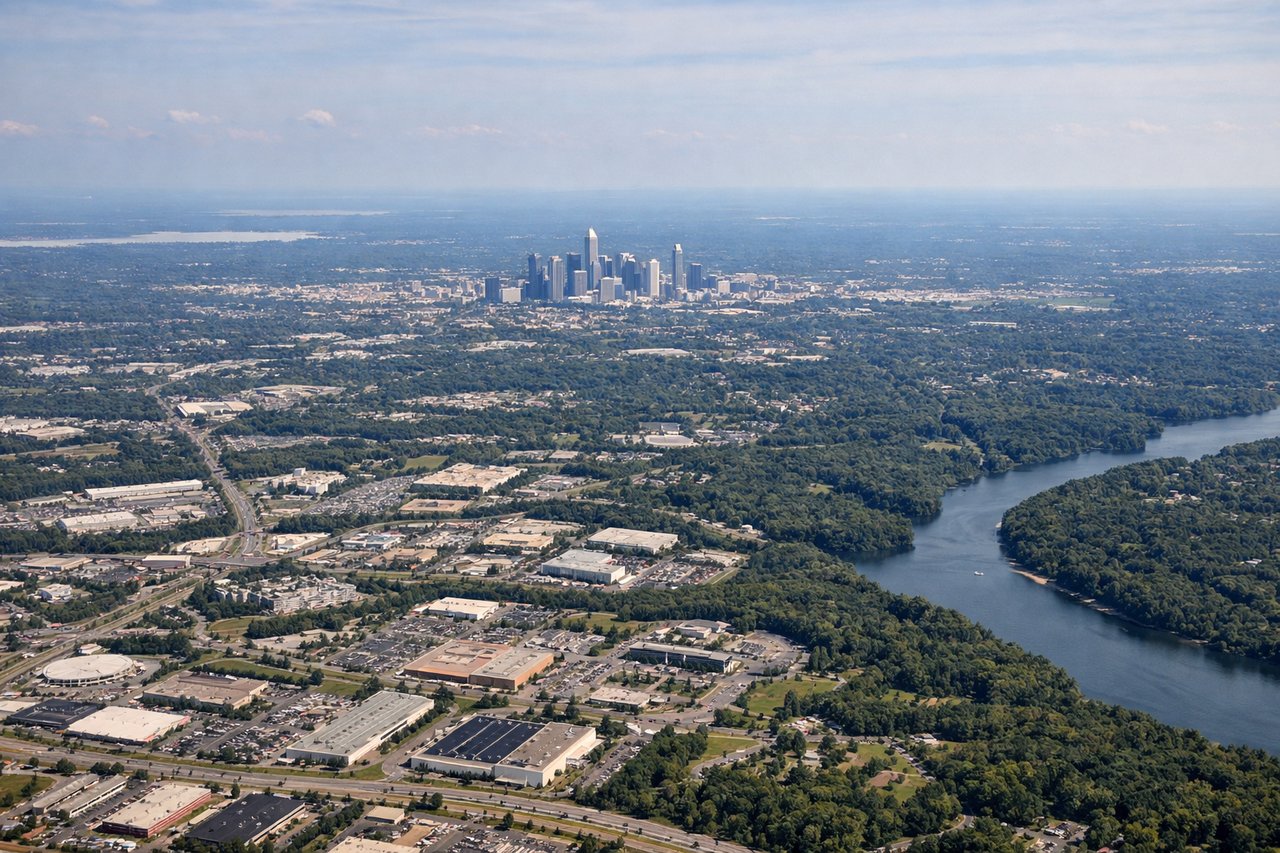
Landing at CLT
LEFTWith Charlotte's typical south-flow arrivals, planes descend from the north on a southbound track, putting uptown Charlotte's skyline and the Catawba River basin off the left side as the jet lines up for the runway. The right side mostly faces flat, undistinguished Piedmont farmland and suburbs.
Landmarks on this routeAll landmarks →
Will your flight be in sunlight?
Pick a date and time in the Sun Map to watch the sun move across your whole flight.
About This Route
Which side of the plane should I sit on flying from Los Cabos International (SJD) to Charlotte Douglas International (CLT)?
Sit on the Left side of the plane for the best views on flights from San Jose Del Cabo to Charlotte. While takeoff favors the right with the Sea of Cortez and Los Cabos coastline, the long cruise leg crosses the Sierra Madre Occidental and Chihuahuan Desert on the left, and the Charlotte arrival gives left-side passengers a clear skyline view—making the left side more consistently rewarding across the full flight.
What can I see during takeoff from Los Cabos International in San Jose Del Cabo?
During takeoff from Los Cabos International (SJD), sit on the Right side for the best views. Departing SJD on runway 34, the aircraft climbs north then banks right toward the northeast routing, swinging the right side toward the turquoise Sea of Cortez and the Los Cabos resort coastline. The left side mainly shows the drier, less distinct foothills of the Sierra de la Laguna receding into haze. Notable sights include: Sea of Cortez, San Jose del Cabo marina and beaches, Baja California Sur coastline, Sierra de la Laguna foothills (distant).
What can I see when landing at Charlotte Douglas International in Charlotte?
When landing at Charlotte Douglas International (CLT), sit on the Left side for the best views. With Charlotte's typical south-flow arrivals, planes descend from the north on a southbound track, putting uptown Charlotte's skyline and the Catawba River basin off the left side as the jet lines up for the runway. The right side mostly faces flat, undistinguished Piedmont farmland and suburbs. Notable sights include: Uptown Charlotte skyline, Catawba River, rolling Piedmont farmland, Lake Norman (distant, if visible).
How long is the flight from San Jose Del Cabo to Charlotte?
The flight from Los Cabos International (SJD) to Charlotte Douglas International (CLT) takes about 4 hours 45 minutes. The shortest flight path between them is 1,916 miles (3,084 km); winds and air traffic control usually add a few percent.
What does the San Jose Del Cabo to Charlotte flight path pass over?
Sierra Madre Occidental foothills, Chihuahuan Desert basins, Gulf of Mexico coastal plain near the Texas-Louisiana border, Mississippi River delta lowlands, and the rolling Piedmont approaching the southern Appalachian foothills near Charlotte