San Jose Del Cabo to Denver is 1,192 miles (1,918 km), a flight of about 3 hours 5 minutes.
While the right side offers a brief scenic burst at takeoff over the Sea of Cortez, the left side delivers a more consistent visual narrative — distant ranges of the Sierra Madre Occidental during the Mexican portion of the flight, followed by a dramatic Rocky Mountain and Denver skyline approach that the right side entirely lacks.
Flight Path
Sonoran Desert lowlands, scattered ranges of the Sierra Madre Occidental foothills to the west, and the arid basins of northern Mexico and southern Arizona along the flight path
Great circle distance and headings ›
.jpg?width=600)
.jpg?width=600)
Phase by phase
Takeoff from SJD
RIGHTSan Jose del Cabo sits on the Sea of Cortez side of the Baja peninsula, and departures on runway 34 climb north with the turquoise Gulf waters and Cabo's rocky shoreline visible on the right. The left side initially shows only the arid Sierra de la Laguna foothills inland.
Landing at DEN
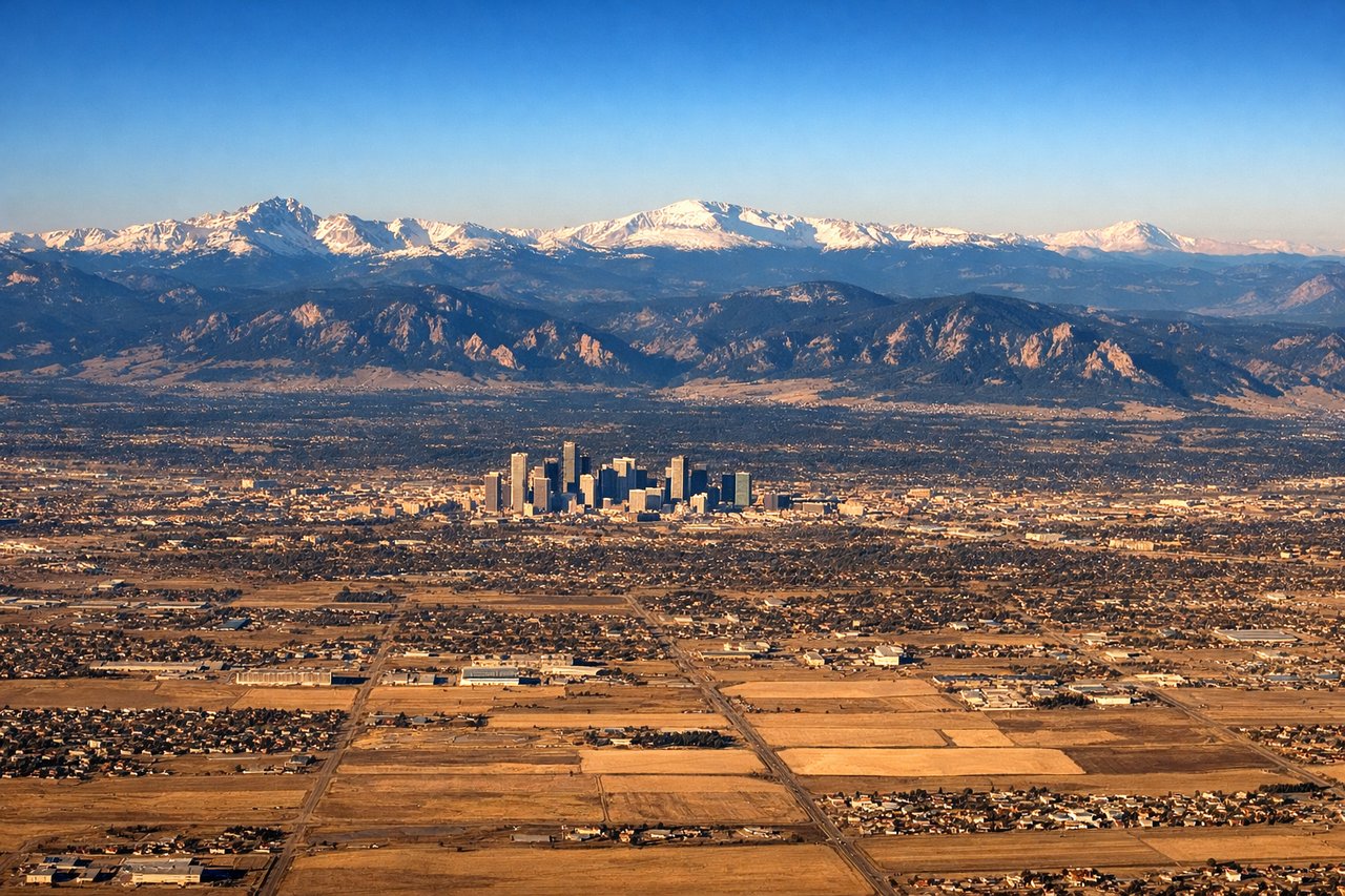
LEFTApproaching Denver from the south, the Front Range of the Rockies rises dramatically to the west along with downtown Denver's skyline, both visible on the left side during descent. The right side faces only the flat eastern plains with no distinguishing features.
Landmarks on this routeAll landmarks →
Will your flight be in sunlight?
Pick a date and time in the Sun Map to watch the sun move across your whole flight.
About This Route
Which side of the plane should I sit on flying from Los Cabos International (SJD) to Denver International (DEN)?
Sit on the Left side of the plane for the best views on flights from San Jose Del Cabo to Denver. While the right side offers a brief scenic burst at takeoff over the Sea of Cortez, the left side delivers a more consistent visual narrative — distant ranges of the Sierra Madre Occidental during the Mexican portion of the flight, followed by a dramatic Rocky Mountain and Denver skyline approach that the right side entirely lacks.
What can I see during takeoff from Los Cabos International in San Jose Del Cabo?
During takeoff from Los Cabos International (SJD), sit on the Right side for the best views. San Jose del Cabo sits on the Sea of Cortez side of the Baja peninsula, and departures on runway 34 climb north with the turquoise Gulf waters and Cabo's rocky shoreline visible on the right. The left side initially shows only the arid Sierra de la Laguna foothills inland. Notable sights include: Sea of Cortez, Cabo San Lucas coastline, Sierra de la Laguna foothills.
What can I see when landing at Denver International in Denver?
When landing at Denver International (DEN), sit on the Left side for the best views. Approaching Denver from the south, the Front Range of the Rockies rises dramatically to the west along with downtown Denver's skyline, both visible on the left side during descent. The right side faces only the flat eastern plains with no distinguishing features. Notable sights include: Front Range of the Rockies, Longs Peak area, Denver downtown skyline, South Platte River valley.
How long is the flight from San Jose Del Cabo to Denver?
The flight from Los Cabos International (SJD) to Denver International (DEN) takes about 3 hours 5 minutes. The shortest flight path between them is 1,192 miles (1,918 km); winds and air traffic control usually add a few percent.
What does the San Jose Del Cabo to Denver flight path pass over?
Sonoran Desert lowlands, scattered ranges of the Sierra Madre Occidental foothills to the west, and the arid basins of northern Mexico and southern Arizona along the flight path