Right-side seats win for the full journey: Sea of Cortez and Baja mountains on departure, then the dramatic transition across the Great Plains, and finally the Minnesota River valley and Twin Cities on arrival. Left side offers less consistent scenery.
Flown SJD to MSP? Did we get it right?
Flight Path
San Jose Del Cabo to Minneapolis is 1,766 miles (2,842 km), a flight of about 4 hours 15 minutes.
Chihuahuan Desert (northern Mexico), Rio Grande valley (Texas-Mexico border), Texas Panhandle plains, Oklahoma grasslands, Kansas wheat fields, Missouri River valley, Iowa agricultural landscape
Great circle distance and headings ›Phase by phase
Takeoff from SJD
RIGHTRight-side seats capture the Sea of Cortez immediately after departure, with the Baja California Peninsula's rugged terrain and coastal cliffs visible as the aircraft climbs northward. The water contrasts sharply against the desert landscape.
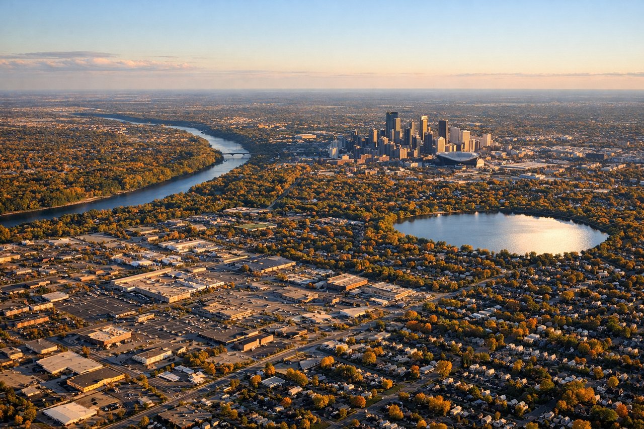
Landing at MSP
RIGHTRight-side seats offer the best view during the final approach into Minneapolis, showing the Minnesota River valley, urban sprawl of the Twin Cities, and the transition from agricultural land to developed areas. The Mississippi River system is also visible from this angle.
Will your flight be in sunlight?
Pick a date and time in the Sun Map to watch the sun move across your whole flight.
About This Route
Which side of the plane should I sit on flying from Los Cabos International (SJD) to Minneapolis St Paul International (MSP)?
Sit on the Right side of the plane for the best views on flights from San Jose Del Cabo to Minneapolis. Right-side seats win for the full journey: Sea of Cortez and Baja mountains on departure, then the dramatic transition across the Great Plains, and finally the Minnesota River valley and Twin Cities on arrival. Left side offers less consistent scenery.
What can I see during takeoff from Los Cabos International in San Jose Del Cabo?
During takeoff from Los Cabos International (SJD), sit on the Right side for the best views. Right-side seats capture the Sea of Cortez immediately after departure, with the Baja California Peninsula's rugged terrain and coastal cliffs visible as the aircraft climbs northward. The water contrasts sharply against the desert landscape. Notable sights include: Sea of Cortez (east), Baja California Peninsula mountains (west), Los Cabos coastal cliffs (south), Sierra de la Laguna range (north-northwest).
What can I see when landing at Minneapolis St Paul International in Minneapolis?
When landing at Minneapolis St Paul International (MSP), sit on the Right side for the best views. Right-side seats offer the best view during the final approach into Minneapolis, showing the Minnesota River valley, urban sprawl of the Twin Cities, and the transition from agricultural land to developed areas. The Mississippi River system is also visible from this angle. Notable sights include: Minnesota River valley (south), Twin Cities urban area (center), Mississippi River (east of airport), agricultural plains (surrounding terrain).
How long is the flight from San Jose Del Cabo to Minneapolis?
The flight from Los Cabos International (SJD) to Minneapolis St Paul International (MSP) takes about 4 hours 15 minutes. The shortest flight path between them is 1,766 miles (2,842 km); winds and air traffic control usually add a few percent.
What does the San Jose Del Cabo to Minneapolis flight path pass over?
Chihuahuan Desert (northern Mexico), Rio Grande valley (Texas-Mexico border), Texas Panhandle plains, Oklahoma grasslands, Kansas wheat fields, Missouri River valley, Iowa agricultural landscape