While takeoff offers excellent Sea of Cortez and Sierra de la Laguna views on the right, the landing approach into PDX on the left provides Mount Hood, the Cascade Range, and the Columbia River gorge—three major, visually striking features that dominate the final 30 minutes of flight. The landing experience outweighs the takeoff advantage.
Flown SJD to PDX? Did we get it right?
Flight Path
San Jose Del Cabo to Portland is 1,710 miles (2,752 km), a flight of about 4 hours 30 minutes.
The flight path crosses the Sonoran Desert (Arizona), with the Colorado River visible near the Arizona-California border. The Sierra Madre Occidental mountains appear to the east (Mexico side). As the flight progresses north into California and Oregon, the Great Basin terrain becomes visible, followed by the volcanic plateau of central Oregon. The Cascade Range becomes prominent roughly 100 miles south of Portland.
Great circle distance and headings ›

Phase by phase
Takeoff from SJD
RIGHTSJD typically departs to the north or northeast. Right-side seats offer views of the Sea of Cortez immediately east of the airport, plus the Sierra de la Laguna mountains rising inland to the northeast. Left side faces the Pacific Ocean and lower terrain with less dramatic relief.
Landing at PDX
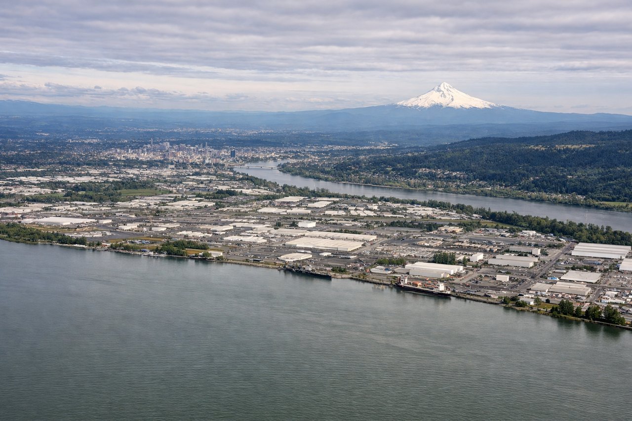
LEFTPDX typically lands from the north on runways 28L/28R or from the south on 10L/10R. On approach from the south (most common), left-side seats face east toward the Cascade Range and Mount Hood. On northbound approaches, left seats see the Columbia River gorge and surrounding terrain. Either way, left offers superior mountain and river geography.
Will your flight be in sunlight?
Pick a date and time in the Sun Map to watch the sun move across your whole flight.
About This Route
Which side of the plane should I sit on flying from Los Cabos International (SJD) to Portland International (PDX)?
Sit on the Left side of the plane for the best views on flights from San Jose Del Cabo to Portland. While takeoff offers excellent Sea of Cortez and Sierra de la Laguna views on the right, the landing approach into PDX on the left provides Mount Hood, the Cascade Range, and the Columbia River gorge—three major, visually striking features that dominate the final 30 minutes of flight. The landing experience outweighs the takeoff advantage.
What can I see during takeoff from Los Cabos International in San Jose Del Cabo?
During takeoff from Los Cabos International (SJD), sit on the Right side for the best views. SJD typically departs to the north or northeast. Right-side seats offer views of the Sea of Cortez immediately east of the airport, plus the Sierra de la Laguna mountains rising inland to the northeast. Left side faces the Pacific Ocean and lower terrain with less dramatic relief. Notable sights include: Sea of Cortez (visible as deep blue water east of runway), Sierra de la Laguna mountain range (northeast, elevation ~7,000 ft), Cabo San Lucas peninsula tip (south, visible as narrow landform), Los Cabos coastal development (immediate ground reference).
What can I see when landing at Portland International in Portland?
When landing at Portland International (PDX), sit on the Left side for the best views. PDX typically lands from the north on runways 28L/28R or from the south on 10L/10R. On approach from the south (most common), left-side seats face east toward the Cascade Range and Mount Hood. On northbound approaches, left seats see the Columbia River gorge and surrounding terrain. Either way, left offers superior mountain and river geography. Notable sights include: Mount Hood (11,240 ft, visible 50+ miles away on clear days as a snow-capped peak), Cascade Range (extending north-south, visible as a ridge line), Columbia River (visible as a meandering ribbon through the landscape on approach), Willamette Valley (broad agricultural plain visible to the south and west).
How long is the flight from San Jose Del Cabo to Portland?
The flight from Los Cabos International (SJD) to Portland International (PDX) takes about 4 hours 30 minutes. The shortest flight path between them is 1,710 miles (2,752 km); winds and air traffic control usually add a few percent.
What does the San Jose Del Cabo to Portland flight path pass over?
The flight path crosses the Sonoran Desert (Arizona), with the Colorado River visible near the Arizona-California border. The Sierra Madre Occidental mountains appear to the east (Mexico side). As the flight progresses north into California and Oregon, the Great Basin terrain becomes visible, followed by the volcanic plateau of central Oregon. The Cascade Range becomes prominent roughly 100 miles south of Portland.