The left side delivers the most dramatic scenery of the flight — the volcanic Cordillera Central on departure is genuinely spectacular and unique. The right side wins at landing but the Atlanta approach is relatively flat suburban terrain. The volcanic highlands of Costa Rica on the left at takeoff outweigh the Atlanta skyline glimpse on the right.
Flown SJO to ATL? Did we get it right?
Flight Path
San Jose to Atlanta is 1,634 miles (2,629 km), a flight of about 4 hours 30 minutes.
The flight tracks north-northwest over Nicaragua's Lake Nicaragua (Lago de Nicaragua, one of the largest lakes in Central America and clearly visible from altitude), then over Honduras and Guatemala's mountainous interior, across the Yucatán Peninsula or Gulf of Honduras depending on routing, over the Gulf of Mexico or Cuba, then across the Florida Straits and up through Florida and Georgia. The Sierra Madre of Guatemala and the volcanic chain of Central America may be visible on the left side during the early portion of the flight.
Great circle distance and headings ›Phase by phase
Takeoff from SJO
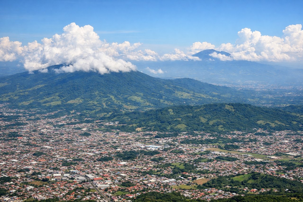
LEFTJuan Santamaría airport sits in the Central Valley and typically departs runway 07 heading northeast, then turns north. The left side gives you the Cordillera Central including Volcán Poás and Volcán Barva as you climb out over the valley. The right side faces south toward the city sprawl and lower terrain.
Landing at ATL
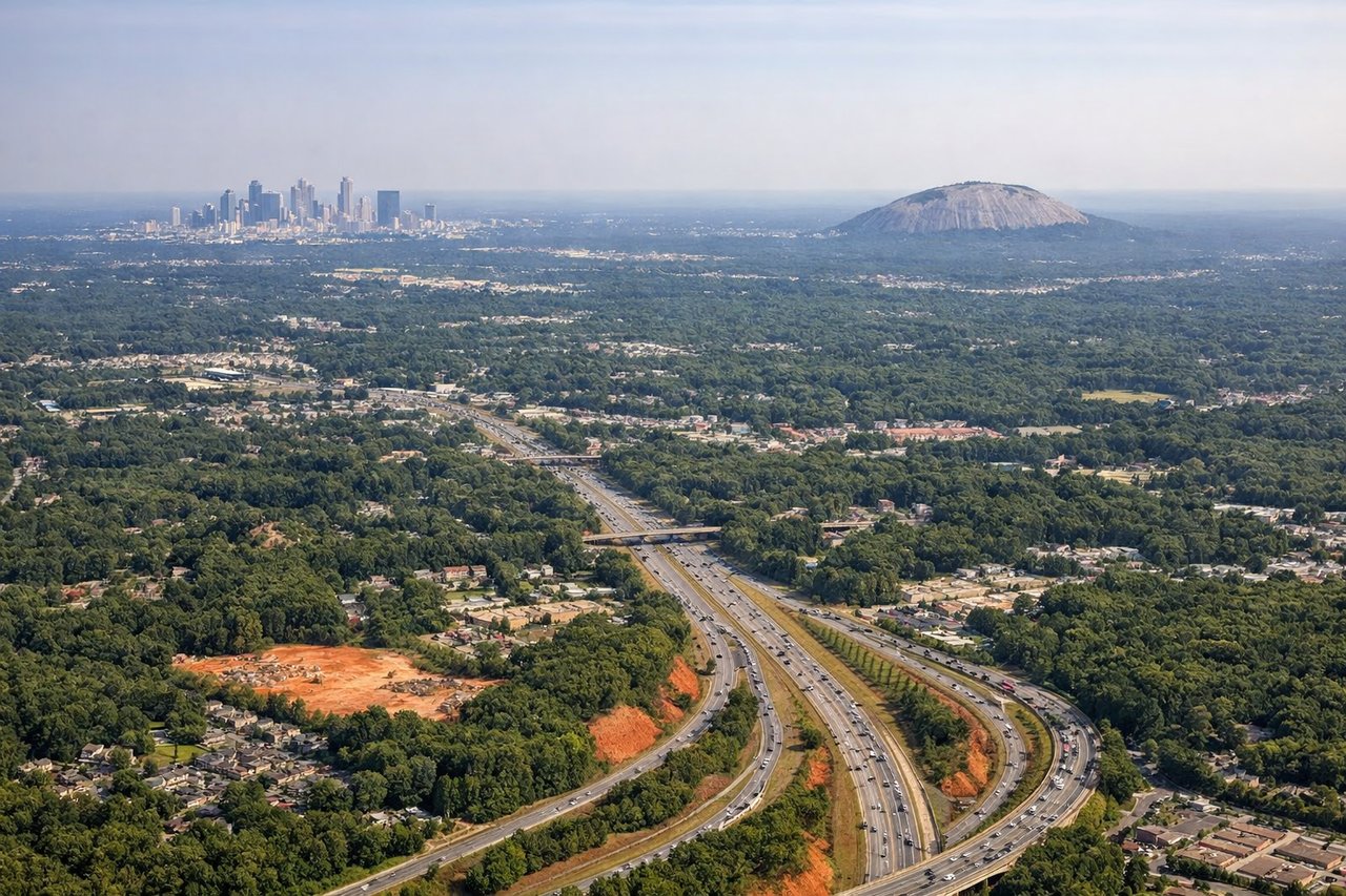
RIGHTHartsfield-Jackson typically lands from the east or northeast on runways oriented roughly 08L/R or 09L/R, meaning the approach comes from the east over the Atlanta suburbs. The right side on final approach gives a clear view of downtown Atlanta's skyline to the north as you descend over the southern suburbs.
Will your flight be in sunlight?
Pick a date and time in the Sun Map to watch the sun move across your whole flight.
About This Route
Which side of the plane should I sit on flying from Juan Santamaria International (SJO) to The William B Hartsfield Atlanta International (ATL)?
Sit on the Left side of the plane for the best views on flights from San Jose to Atlanta. The left side delivers the most dramatic scenery of the flight — the volcanic Cordillera Central on departure is genuinely spectacular and unique. The right side wins at landing but the Atlanta approach is relatively flat suburban terrain. The volcanic highlands of Costa Rica on the left at takeoff outweigh the Atlanta skyline glimpse on the right.
What can I see during takeoff from Juan Santamaria International in San Jose?
During takeoff from Juan Santamaria International (SJO), sit on the Left side for the best views. Juan Santamaría airport sits in the Central Valley and typically departs runway 07 heading northeast, then turns north. The left side gives you the Cordillera Central including Volcán Poás and Volcán Barva as you climb out over the valley. The right side faces south toward the city sprawl and lower terrain. Notable sights include: Volcán Poás (2,708m), Volcán Barva, the Central Valley urban corridor of San José below, and the green ridgelines of the Cordillera Central.
What can I see when landing at The William B Hartsfield Atlanta International in Atlanta?
When landing at The William B Hartsfield Atlanta International (ATL), sit on the Right side for the best views. Hartsfield-Jackson typically lands from the east or northeast on runways oriented roughly 08L/R or 09L/R, meaning the approach comes from the east over the Atlanta suburbs. The right side on final approach gives a clear view of downtown Atlanta's skyline to the north as you descend over the southern suburbs. Notable sights include: Downtown Atlanta skyline (Peachtree Street towers), Stone Mountain visible to the northeast on clear days, the sprawling I-285 perimeter highway interchange network, and the massive Hartsfield terminal complex coming into view on final.
How long is the flight from San Jose to Atlanta?
The flight from Juan Santamaria International (SJO) to The William B Hartsfield Atlanta International (ATL) takes about 4 hours 30 minutes. The shortest flight path between them is 1,634 miles (2,629 km); winds and air traffic control usually add a few percent.
What does the San Jose to Atlanta flight path pass over?
The flight tracks north-northwest over Nicaragua's Lake Nicaragua (Lago de Nicaragua, one of the largest lakes in Central America and clearly visible from altitude), then over Honduras and Guatemala's mountainous interior, across the Yucatán Peninsula or Gulf of Honduras depending on routing, over the Gulf of Mexico or Cuba, then across the Florida Straits and up through Florida and Georgia. The Sierra Madre of Guatemala and the volcanic chain of Central America may be visible on the left side during the early portion of the flight.