Sacramento to Denver is 907 miles (1,460 km), a flight of about 2 hours 15 minutes.
The left side delivers the flight's two most dramatic terrain features — the Sierra Nevada and Lake Tahoe during departure, and the Front Range peaks including Longs Peak during arrival — while the right side stays over comparatively flat valley and plains scenery for most of the route.
Flight Path
Great Basin desert ranges of Nevada, the Bonneville Salt Flats and Great Salt Lake basin in Utah (visible in the distance to the north), and the western Colorado Plateau leading into the Rocky Mountains
Great circle distance and headings ›
.jpg?width=600)
Phase by phase
Takeoff from SMF
LEFTDeparting SMF to the south or north, the climb-out curves the aircraft onto an eastbound track, putting the Sierra Nevada crest and the Lake Tahoe basin on the left as the plane gains altitude over the Sacramento Valley. The right side shows only the flat Central Valley farmland receding southward.
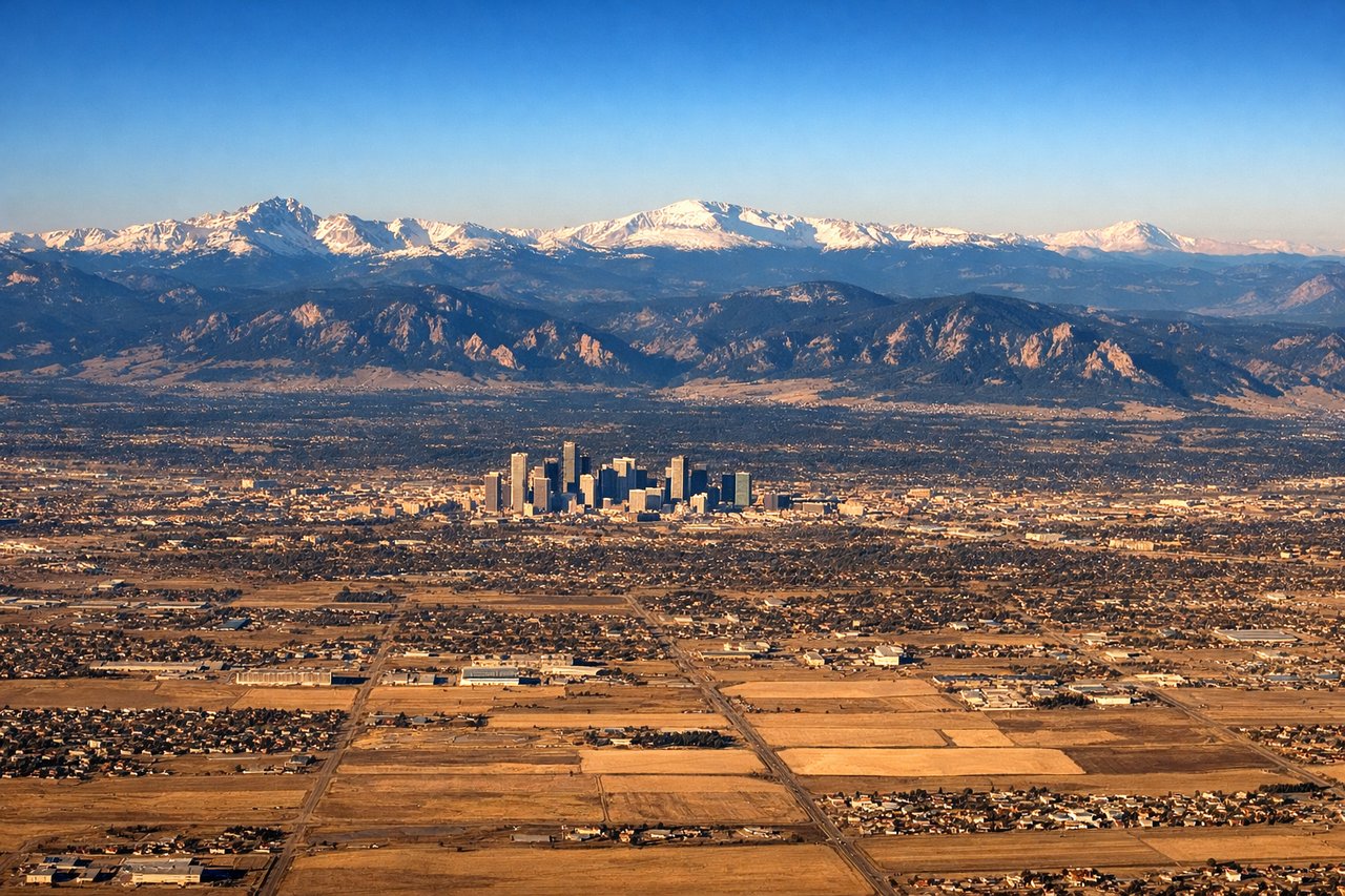
Landing at DEN
LEFTOn approach into DEN from the west, the descent path crosses the Front Range, and the northern side of the aircraft offers views of the jagged peaks near Rocky Mountain National Park, including Longs Peak, before the terrain flattens into the Denver metro grid. The right side mostly shows the drier plains south of the city.
Landmarks on this routeAll landmarks →
Will your flight be in sunlight?
Pick a date and time in the Sun Map to watch the sun move across your whole flight.
About This Route
Which side of the plane should I sit on flying from Sacramento International (SMF) to Denver International (DEN)?
Sit on the Left side of the plane for the best views on flights from Sacramento to Denver. The left side delivers the flight's two most dramatic terrain features — the Sierra Nevada and Lake Tahoe during departure, and the Front Range peaks including Longs Peak during arrival — while the right side stays over comparatively flat valley and plains scenery for most of the route.
What can I see during takeoff from Sacramento International in Sacramento?
During takeoff from Sacramento International (SMF), sit on the Left side for the best views. Departing SMF to the south or north, the climb-out curves the aircraft onto an eastbound track, putting the Sierra Nevada crest and the Lake Tahoe basin on the left as the plane gains altitude over the Sacramento Valley. The right side shows only the flat Central Valley farmland receding southward. Notable sights include: Sacramento River delta, Sierra Nevada foothills, Lake Tahoe basin, Central Valley farmland.
What can I see when landing at Denver International in Denver?
When landing at Denver International (DEN), sit on the Left side for the best views. On approach into DEN from the west, the descent path crosses the Front Range, and the northern side of the aircraft offers views of the jagged peaks near Rocky Mountain National Park, including Longs Peak, before the terrain flattens into the Denver metro grid. The right side mostly shows the drier plains south of the city. Notable sights include: Front Range peaks, Longs Peak, Rocky Mountain foothills, Denver metro grid.
How long is the flight from Sacramento to Denver?
The flight from Sacramento International (SMF) to Denver International (DEN) takes about 2 hours 15 minutes. The shortest flight path between them is 907 miles (1,460 km); winds and air traffic control usually add a few percent.
What does the Sacramento to Denver flight path pass over?
Great Basin desert ranges of Nevada, the Bonneville Salt Flats and Great Salt Lake basin in Utah (visible in the distance to the north), and the western Colorado Plateau leading into the Rocky Mountains