Santa Ana to Salt Lake City is 588 miles (947 km), a flight of about 1 hour 35 minutes.
The right side delivers dramatic mountain scenery on both ends of the flight — the San Gabriel/San Bernardino ranges at departure and the Wasatch Range plus Great Salt Lake at arrival — while the left side is dominated by flat desert and valley terrain with far less visual variety.
Flight Path
Mojave Desert basins, dry lake beds near the California-Nevada border, and the sparse mountain-and-valley terrain of western Utah
Great circle distance and headings ›.jpg?width=600)


Phase by phase
Takeoff from SNA
RIGHTAfter the initial southwest departure over Newport Beach, the aircraft turns northeast toward Utah, putting the San Gabriel and San Bernardino Mountains prominently on the right side as the plane climbs out of the Los Angeles basin. The left side mostly shows the receding Pacific coastline before turning away.
Landing at SLC
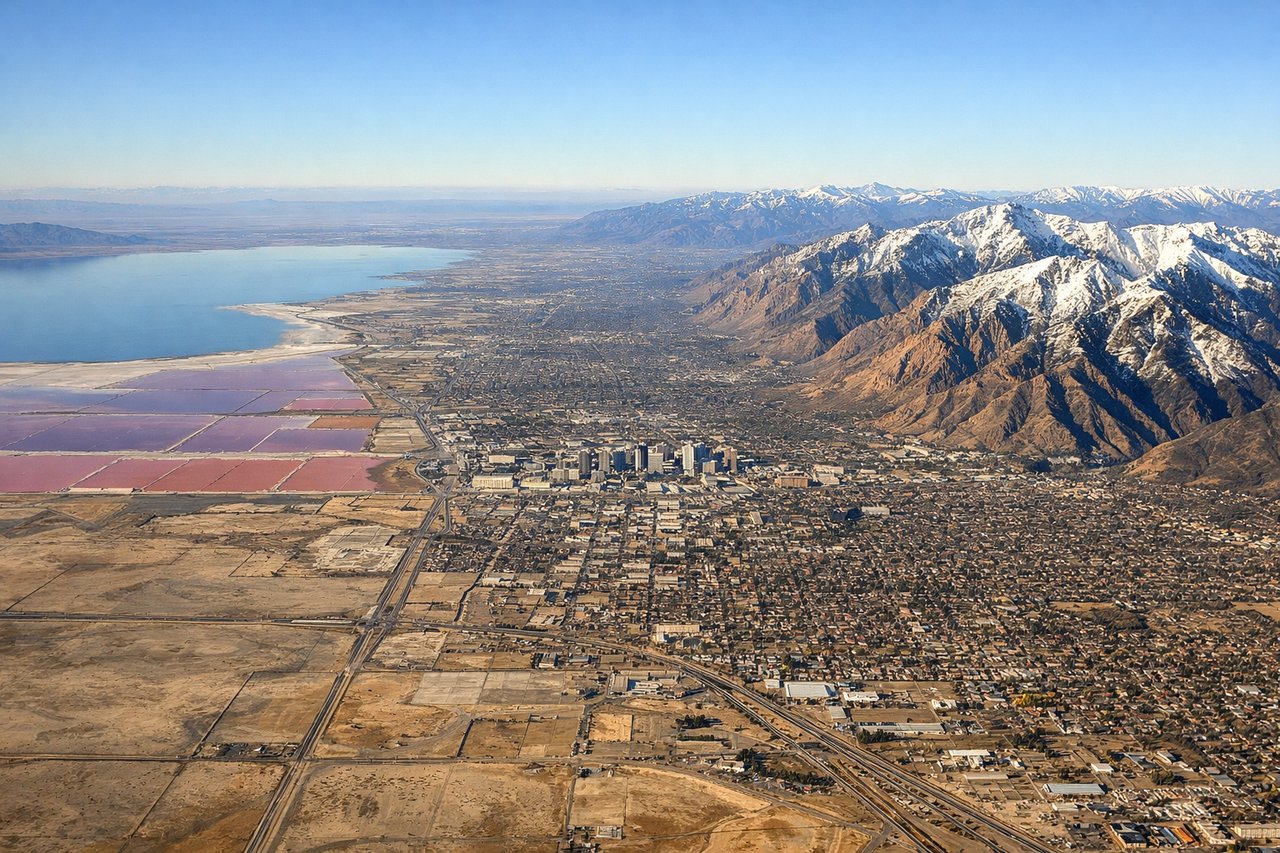
RIGHTOn approach into Salt Lake City, the north-south runway alignment and typical approach path bring the jagged Wasatch Range into view on the right side, along with glimpses of the Great Salt Lake's northern arm before touchdown. The left side offers flatter valley terrain with less visual interest.
Landmarks on this routeAll landmarks →
Will your flight be in sunlight?
Pick a date and time in the Sun Map to watch the sun move across your whole flight.
About This Route
Which side of the plane should I sit on flying from John Wayne Arpt Orange Co (SNA) to Salt Lake City International (SLC)?
Sit on the Right side of the plane for the best views on flights from Santa Ana to Salt Lake City. The right side delivers dramatic mountain scenery on both ends of the flight — the San Gabriel/San Bernardino ranges at departure and the Wasatch Range plus Great Salt Lake at arrival — while the left side is dominated by flat desert and valley terrain with far less visual variety.
What can I see during takeoff from John Wayne Arpt Orange Co in Santa Ana?
During takeoff from John Wayne Arpt Orange Co (SNA), sit on the Right side for the best views. After the initial southwest departure over Newport Beach, the aircraft turns northeast toward Utah, putting the San Gabriel and San Bernardino Mountains prominently on the right side as the plane climbs out of the Los Angeles basin. The left side mostly shows the receding Pacific coastline before turning away. Notable sights include: Newport Beach coastline, Catalina Island (distant), San Gabriel Mountains, San Bernardino Mountains.
What can I see when landing at Salt Lake City International in Salt Lake City?
When landing at Salt Lake City International (SLC), sit on the Right side for the best views. On approach into Salt Lake City, the north-south runway alignment and typical approach path bring the jagged Wasatch Range into view on the right side, along with glimpses of the Great Salt Lake's northern arm before touchdown. The left side offers flatter valley terrain with less visual interest. Notable sights include: Wasatch Range, Great Salt Lake, Salt Lake Valley, Oquirrh Mountains (distant).
How long is the flight from Santa Ana to Salt Lake City?
The flight from John Wayne Arpt Orange Co (SNA) to Salt Lake City International (SLC) takes about 1 hour 35 minutes. The shortest flight path between them is 588 miles (947 km); winds and air traffic control usually add a few percent.
What does the Santa Ana to Salt Lake City flight path pass over?
Mojave Desert basins, dry lake beds near the California-Nevada border, and the sparse mountain-and-valley terrain of western Utah