St. Louis to Los Angeles is 1,589 miles (2,557 km), a flight of about 4 hours.
While the left side wins at takeoff for the Arch and Mississippi River views, the right side delivers more consistently across the full flight — you get the Ozark highlands of Missouri and Arkansas early on, the Texas Panhandle plains in the middle, the New Mexico high desert and Sacramento Mountains, and then the spectacular descent into LA with the Santa Monica Mountains and coastline. The right side's landing view is the single most dramatic moment of the flight.
Flight Path
The flight tracks southwest over the Ozark Plateau of southern Missouri and Arkansas, then crosses the flat agricultural plains of Oklahoma and the Texas Panhandle. Over New Mexico, the terrain rises noticeably with the Sacramento Mountains and Guadalupe Mountains visible to the south. The flight then crosses the Sonoran Desert of Arizona before entering California over the Colorado Desert near the Salton Sea, which is a large, distinctive inland body of water visible from altitude. The San Bernardino and San Gabriel Mountains mark the final approach into the LA Basin.
Great circle distance and headings ›
.jpg?width=600)
.jpg?width=600)
.jpeg?width=600)
.jpg?width=600)
Phase by phase
Takeoff from STL
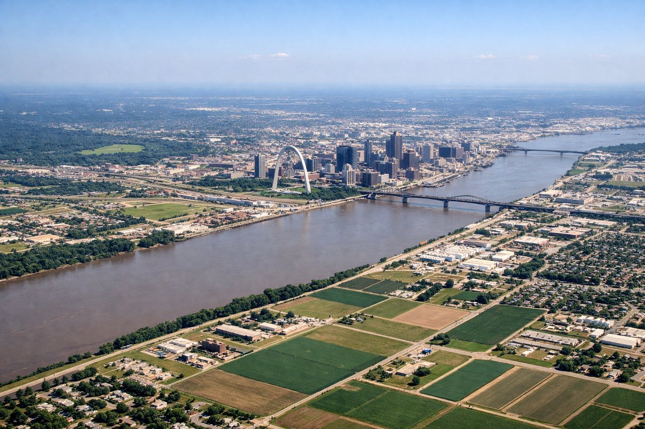
LEFTSTL primarily uses runways 12L/12R for westbound departures, meaning a left-bank turn toward the southwest gives you a clear view back over the St. Louis metro, the Mississippi River, and the Gateway Arch. The right side faces away toward Illinois farmland with little of interest.

Landing at LAX
RIGHTLAX arrivals from the east typically use runways 24L/24R, approaching from the east over Inglewood and touching down heading west toward the ocean. The right side gives you the best view of the Santa Monica Mountains, the LA Basin grid, and the Pacific coastline as you descend. The left side looks south toward less distinctive suburban sprawl.
Landmarks on this routeAll landmarks →
Will your flight be in sunlight?
Pick a date and time in the Sun Map to watch the sun move across your whole flight.
About This Route
Which side of the plane should I sit on flying from Lambert St Louis International (STL) to Los Angeles International (LAX)?
Sit on the Right side of the plane for the best views on flights from St. Louis to Los Angeles. While the left side wins at takeoff for the Arch and Mississippi River views, the right side delivers more consistently across the full flight — you get the Ozark highlands of Missouri and Arkansas early on, the Texas Panhandle plains in the middle, the New Mexico high desert and Sacramento Mountains, and then the spectacular descent into LA with the Santa Monica Mountains and coastline. The right side's landing view is the single most dramatic moment of the flight.
What can I see during takeoff from Lambert St Louis International in St. Louis?
During takeoff from Lambert St Louis International (STL), sit on the Left side for the best views. STL primarily uses runways 12L/12R for westbound departures, meaning a left-bank turn toward the southwest gives you a clear view back over the St. Louis metro, the Mississippi River, and the Gateway Arch. The right side faces away toward Illinois farmland with little of interest. Notable sights include: Gateway Arch and downtown St. Louis skyline, Mississippi River confluence with Missouri River to the north, Forest Park and the broader St. Louis grid, Cahokia Mounds visible across the river in Illinois.
What can I see when landing at Los Angeles International in Los Angeles?
When landing at Los Angeles International (LAX), sit on the Right side for the best views. LAX arrivals from the east typically use runways 24L/24R, approaching from the east over Inglewood and touching down heading west toward the ocean. The right side gives you the best view of the Santa Monica Mountains, the LA Basin grid, and the Pacific coastline as you descend. The left side looks south toward less distinctive suburban sprawl. Notable sights include: Santa Monica Mountains and Griffith Observatory ridge, Los Angeles Basin urban grid stretching to the horizon, Santa Monica Bay and the Pacific coastline, Hollywood Hills and downtown LA skyline to the north.
How long is the flight from St. Louis to Los Angeles?
The flight from Lambert St Louis International (STL) to Los Angeles International (LAX) takes about 4 hours. The shortest flight path between them is 1,589 miles (2,557 km); winds and air traffic control usually add a few percent.
What does the St. Louis to Los Angeles flight path pass over?
The flight tracks southwest over the Ozark Plateau of southern Missouri and Arkansas, then crosses the flat agricultural plains of Oklahoma and the Texas Panhandle. Over New Mexico, the terrain rises noticeably with the Sacramento Mountains and Guadalupe Mountains visible to the south. The flight then crosses the Sonoran Desert of Arizona before entering California over the Colorado Desert near the Salton Sea, which is a large, distinctive inland body of water visible from altitude. The San Bernardino and San Gabriel Mountains mark the final approach into the LA Basin.