While takeoff offers compelling Kashmir Valley scenery on the left, the landing approach on the right provides more dramatic and visually distinctive geography—the Western Ghats escarpment is a major geological feature far more striking than the relatively gentle Himalayan foothills visible at takeoff. The right side captures the most memorable moment of the flight.
Flight Path
The flight path crosses the Deccan Plateau, passing over central India's elevated terrain. Notable features include the Ajanta Range and surrounding plateau landscape (visible around the midpoint), transitioning from the cooler northern highlands to the warmer coastal plains. The terrain gradually descends from approximately 2,000-3,000 feet elevation on the plateau to sea level at Mumbai. No major water bodies are crossed; the route is entirely overland until the final approach to the Arabian Sea coast.
Great circle distance and headings ›Phase by phase
Takeoff from SXR
LEFTLeft-side seats offer immediate views of the Kashmir Valley floor and the surrounding Himalayan foothills as the aircraft climbs northwestward from Srinagar. You'll see the patchwork of agricultural fields and Dal Lake receding below, with the Pir Panjal Range rising distinctly to the west.
Landing at BOM
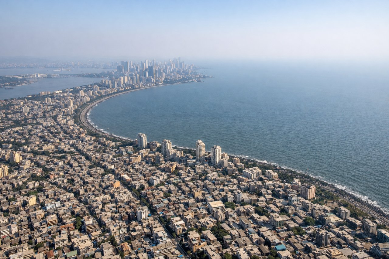
RIGHTRight-side seats provide excellent views during the descent into Mumbai, particularly of the Western Ghats escarpment and the transition from the Deccan Plateau to the coastal plains. As you approach from the northeast, the right side captures the dramatic elevation change and the sprawl of Mumbai's urban area against the Arabian Sea.
Landmarks on this routeAll landmarks →
Will your flight be in sunlight?
See exactly which side of the plane gets sun and shade at your departure time.
About This Route
Which side of the plane should I sit on flying from Srinagar (SXR) to Chhatrapati Shivaji International (BOM)?
Sit on the Right side of the plane for the best views on flights from Srinagar to Bombay. While takeoff offers compelling Kashmir Valley scenery on the left, the landing approach on the right provides more dramatic and visually distinctive geography—the Western Ghats escarpment is a major geological feature far more striking than the relatively gentle Himalayan foothills visible at takeoff. The right side captures the most memorable moment of the flight.
What can I see during takeoff from Srinagar in Srinagar?
During takeoff from Srinagar (SXR), sit on the Left side for the best views. Left-side seats offer immediate views of the Kashmir Valley floor and the surrounding Himalayan foothills as the aircraft climbs northwestward from Srinagar. You'll see the patchwork of agricultural fields and Dal Lake receding below, with the Pir Panjal Range rising distinctly to the west. Notable sights include: Dal Lake, Kashmir Valley agricultural plains, Pir Panjal Range, Zabarwan Range to the east.
What can I see when landing at Chhatrapati Shivaji International in Bombay?
When landing at Chhatrapati Shivaji International (BOM), sit on the Right side for the best views. Right-side seats provide excellent views during the descent into Mumbai, particularly of the Western Ghats escarpment and the transition from the Deccan Plateau to the coastal plains. As you approach from the northeast, the right side captures the dramatic elevation change and the sprawl of Mumbai's urban area against the Arabian Sea. Notable sights include: Western Ghats mountain range, Deccan Plateau edge, Mumbai metropolitan sprawl, Arabian Sea coastline.
How long is the flight from Srinagar to Bombay?
The flight from Srinagar (SXR) to Chhatrapati Shivaji International (BOM) takes Approximately 2 hours 15 minutes to 2 hours 45 minutes.
What does the Srinagar to Bombay flight path pass over?
The flight path crosses the Deccan Plateau, passing over central India's elevated terrain. Notable features include the Ajanta Range and surrounding plateau landscape (visible around the midpoint), transitioning from the cooler northern highlands to the warmer coastal plains. The terrain gradually descends from approximately 2,000-3,000 feet elevation on the plateau to sea level at Mumbai. No major water bodies are crossed; the route is entirely overland until the final approach to the Arabian Sea coast.