Tallahassee to Atlanta is 224 miles (360 km), a flight of about 50 minutes.
The left side misses the best of the Tallahassee departure but wins decisively on landing with the Atlanta skyline and Stone Mountain view. Since the Atlanta approach is the visual highlight of this short flight, left side edges it overall. If you care most about departure, swap to right.
Flight Path
The flight crosses the Georgia-Florida state line over the Valdosta-Thomasville corridor, passing over the Alapaha River and Withlacoochee River drainages in south Georgia. The terrain transitions from Florida flatwoods and longleaf pine savanna to the slightly more rolling red clay Piedmont of central Georgia. The Flint River valley is visible to the west as you approach Atlanta. The landscape is predominantly agricultural and forested with few major urban centers until the Atlanta metro sprawl begins around Griffin and Newnan.
Great circle distance and headings ›Phase by phase
Takeoff from TLH
RIGHTTallahassee's primary departure runway 36 (northbound) means a right-side seat looks east over the city center and the Florida State University campus area as you climb out. You also get views of Lake Jackson to the northwest on the left, but the urban core and the rolling red clay hills transitioning into Georgia terrain are more interesting on the right.
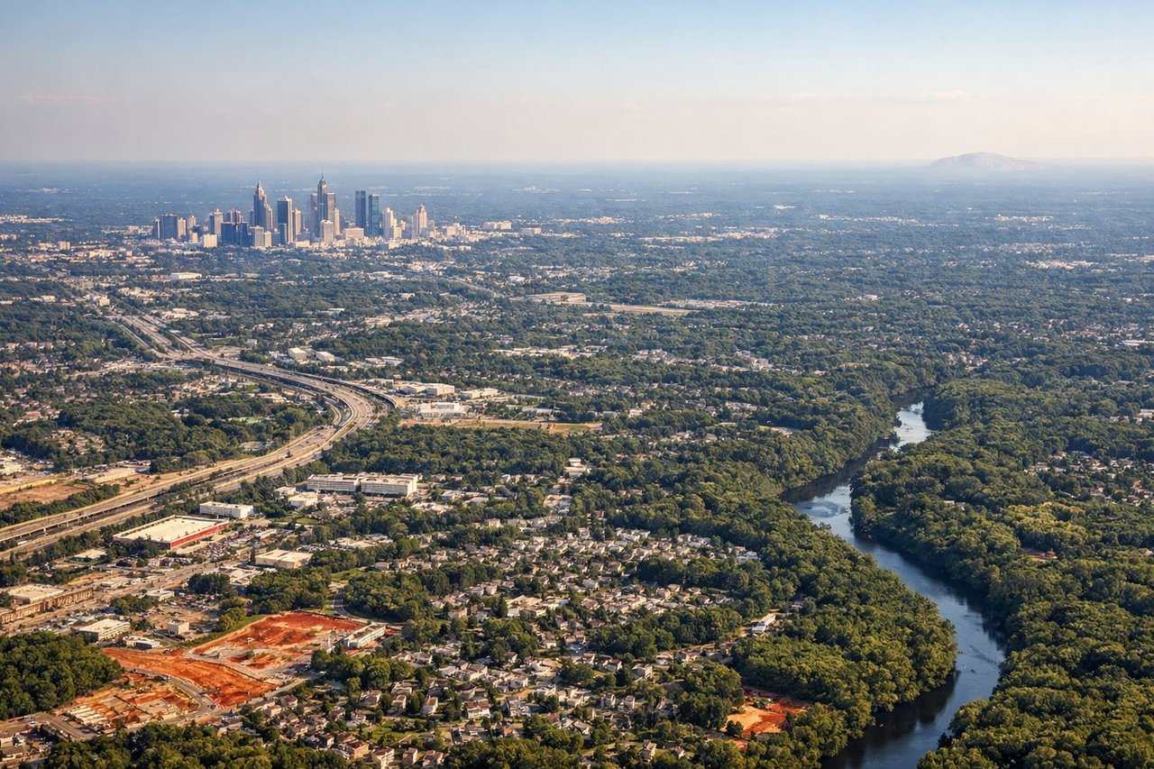
Landing at ATL
LEFTAtlanta Hartsfield typically uses runways 26L/26R or 27L/27R for arrivals from the south, meaning the aircraft approaches from the southeast. A left-side seat gives you the Atlanta downtown skyline, Midtown, and Stone Mountain in the distance to the northeast as you descend. The right side faces south toward less distinctive suburban sprawl.
Landmarks on this routeAll landmarks →
Will your flight be in sunlight?
Pick a date and time in the Sun Map to watch the sun move across your whole flight.
About This Route
Which side of the plane should I sit on flying from Tallahassee Rgnl (TLH) to The William B Hartsfield Atlanta International (ATL)?
Sit on the Left side of the plane for the best views on flights from Tallahassee to Atlanta. The left side misses the best of the Tallahassee departure but wins decisively on landing with the Atlanta skyline and Stone Mountain view. Since the Atlanta approach is the visual highlight of this short flight, left side edges it overall. If you care most about departure, swap to right.
What can I see during takeoff from Tallahassee Rgnl in Tallahassee?
During takeoff from Tallahassee Rgnl (TLH), sit on the Right side for the best views. Tallahassee's primary departure runway 36 (northbound) means a right-side seat looks east over the city center and the Florida State University campus area as you climb out. You also get views of Lake Jackson to the northwest on the left, but the urban core and the rolling red clay hills transitioning into Georgia terrain are more interesting on the right. Notable sights include: Tallahassee city center and Capitol building, Florida State University campus, Lake Talquin to the west visible from either side during turn, red clay hill terrain of the Florida-Georgia border.
What can I see when landing at The William B Hartsfield Atlanta International in Atlanta?
When landing at The William B Hartsfield Atlanta International (ATL), sit on the Left side for the best views. Atlanta Hartsfield typically uses runways 26L/26R or 27L/27R for arrivals from the south, meaning the aircraft approaches from the southeast. A left-side seat gives you the Atlanta downtown skyline, Midtown, and Stone Mountain in the distance to the northeast as you descend. The right side faces south toward less distinctive suburban sprawl. Notable sights include: Atlanta downtown skyline and Midtown towers, Stone Mountain visible to the northeast, Lake Lanier faintly on the far horizon, I-285 perimeter highway loop visible in the suburbs.
How long is the flight from Tallahassee to Atlanta?
The flight from Tallahassee Rgnl (TLH) to The William B Hartsfield Atlanta International (ATL) takes about 50 minutes. The shortest flight path between them is 224 miles (360 km); winds and air traffic control usually add a few percent.
What does the Tallahassee to Atlanta flight path pass over?
The flight crosses the Georgia-Florida state line over the Valdosta-Thomasville corridor, passing over the Alapaha River and Withlacoochee River drainages in south Georgia. The terrain transitions from Florida flatwoods and longleaf pine savanna to the slightly more rolling red clay Piedmont of central Georgia. The Flint River valley is visible to the west as you approach Atlanta. The landscape is predominantly agricultural and forested with few major urban centers until the Atlanta metro sprawl begins around Griffin and Newnan.