Tallahassee to Charlotte is 387 miles (623 km), a flight of about 1 hour 45 minutes.
Right-side seats dominate both segments of this flight. Takeoff offers Gulf coastal views, and the landing approach provides the most dramatic scenery with Lake Norman and Charlotte's skyline. Left seats would see mostly inland forest and less distinctive features.
Flight Path
The flight path crosses central Georgia and into South Carolina, passing over the Piedmont region. Notable features include the Ocmulgee River valley in Georgia, the transition from coastal plain to Piedmont foothills around the Georgia-South Carolina border, and the Savannah River drainage basin. The landscape gradually transitions from flat, forested terrain to rolling hills with increasing elevation as you approach the Piedmont of North Carolina. No major mountain ranges are visible on this route, but the subtle topographic rise becomes apparent as you progress northeast.
Great circle distance and headings ›Phase by phase
Takeoff from TLH
RIGHTRight-side seats offer views of the Apalachee Bay coastline and the Gulf of Mexico to the south and west as you climb out. The flight path typically heads northeast, so right seats capture the water and barrier islands before the aircraft turns inland toward Charlotte.
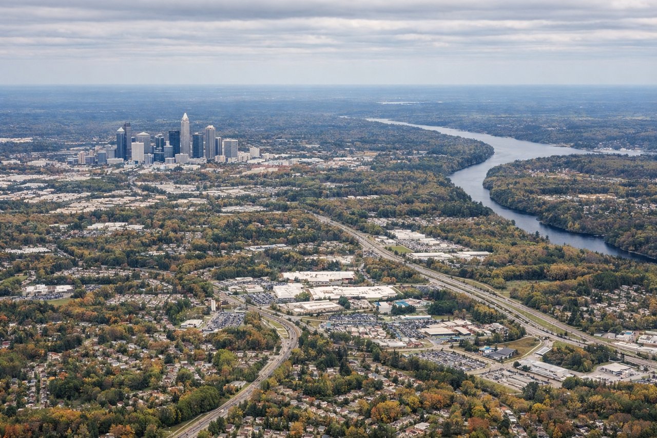
Landing at CLT
RIGHTRight-side seats provide excellent views of the Piedmont landscape and the approach into Charlotte. You'll see the rolling terrain of central North Carolina, the Catawba River valley, and Charlotte's skyline as you descend from the northwest.
Will your flight be in sunlight?
Pick a date and time in the Sun Map to watch the sun move across your whole flight.
About This Route
Which side of the plane should I sit on flying from Tallahassee Rgnl (TLH) to Charlotte Douglas International (CLT)?
Sit on the Right side of the plane for the best views on flights from Tallahassee to Charlotte. Right-side seats dominate both segments of this flight. Takeoff offers Gulf coastal views, and the landing approach provides the most dramatic scenery with Lake Norman and Charlotte's skyline. Left seats would see mostly inland forest and less distinctive features.
What can I see during takeoff from Tallahassee Rgnl in Tallahassee?
During takeoff from Tallahassee Rgnl (TLH), sit on the Right side for the best views. Right-side seats offer views of the Apalachee Bay coastline and the Gulf of Mexico to the south and west as you climb out. The flight path typically heads northeast, so right seats capture the water and barrier islands before the aircraft turns inland toward Charlotte. Notable sights include: Apalachee Bay, St. Marks National Wildlife Refuge, Gulf of Mexico coastline, Tallahassee urban area receding behind.
What can I see when landing at Charlotte Douglas International in Charlotte?
When landing at Charlotte Douglas International (CLT), sit on the Right side for the best views. Right-side seats provide excellent views of the Piedmont landscape and the approach into Charlotte. You'll see the rolling terrain of central North Carolina, the Catawba River valley, and Charlotte's skyline as you descend from the northwest. Notable sights include: Catawba River and Lake Norman, Piedmont foothills, Charlotte downtown skyline, suburban sprawl of the Charlotte metropolitan area.
How long is the flight from Tallahassee to Charlotte?
The flight from Tallahassee Rgnl (TLH) to Charlotte Douglas International (CLT) takes about 1 hour 45 minutes. The shortest flight path between them is 387 miles (623 km); winds and air traffic control usually add a few percent.
What does the Tallahassee to Charlotte flight path pass over?
The flight path crosses central Georgia and into South Carolina, passing over the Piedmont region. Notable features include the Ocmulgee River valley in Georgia, the transition from coastal plain to Piedmont foothills around the Georgia-South Carolina border, and the Savannah River drainage basin. The landscape gradually transitions from flat, forested terrain to rolling hills with increasing elevation as you approach the Piedmont of North Carolina. No major mountain ranges are visible on this route, but the subtle topographic rise becomes apparent as you progress northeast.