Charlotte to Tallahassee is 387 miles (623 km), a flight of about 1 hour 15 minutes.
The right side captures the Charlotte skyline and Catawba River system on departure, and during cruise offers views of the South Carolina Midlands and Georgia red-clay farmland. Though the left side wins at landing, the departure views on the right are more visually rewarding overall for this short flight.
Flight Path
The flight crosses the South Carolina Midlands — flat Piedmont farmland giving way to the Sandhills region near Columbia. Over Georgia the route passes north of Augusta and crosses the Savannah River watershed, then transitions into the flat coastal plain pine forests of south Georgia before entering the Florida Panhandle. No significant terrain changes — this is a low, flat route throughout.
Great circle distance and headings ›Phase by phase
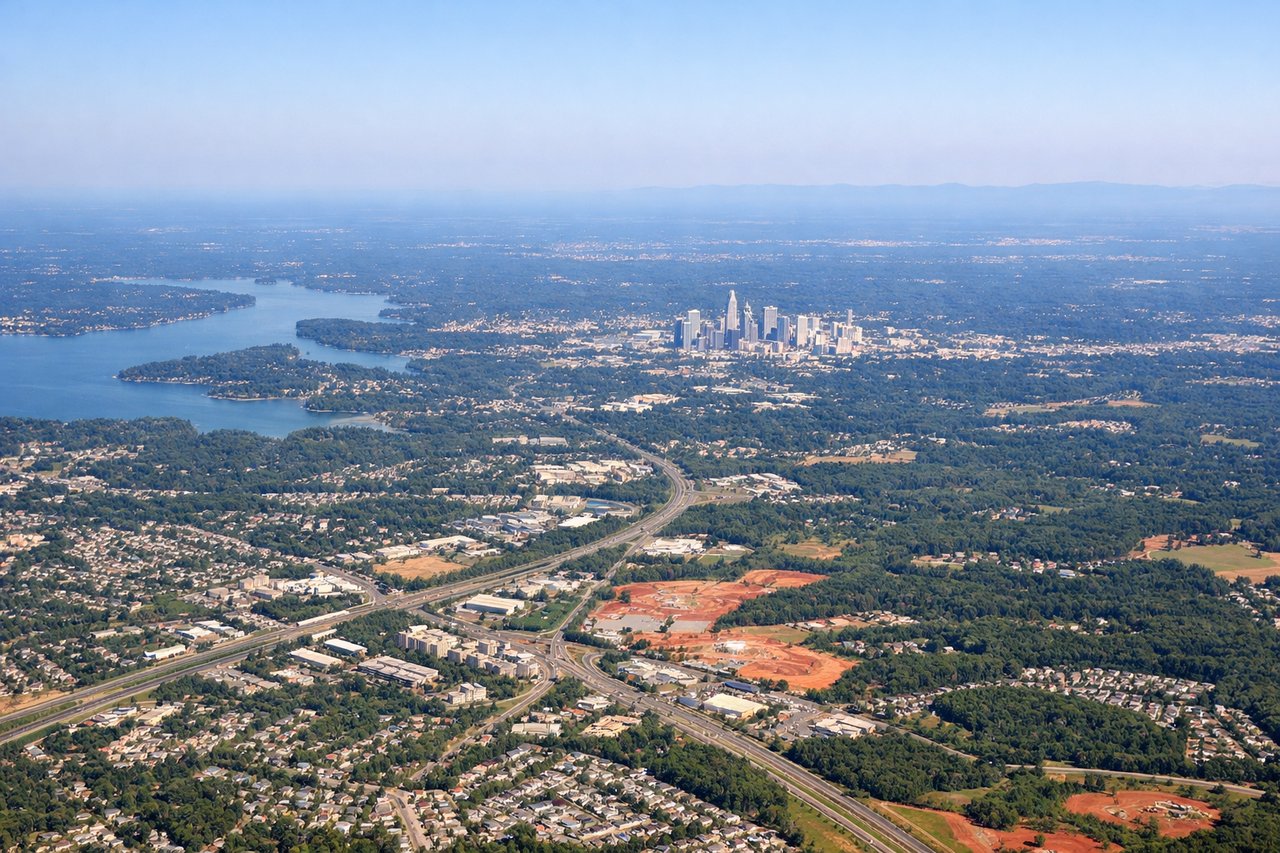
Takeoff from CLT
RIGHTCLT's primary departure runways (18C/36C and 18L/36L) oriented north-south mean southbound departures swing southeast. The right side picks up the Charlotte skyline and the Catawba River corridor as the aircraft climbs out heading southwest toward South Carolina.
Landing at TLH
LEFTTLH's primary runway 27 means aircraft approach from the east, putting the left side facing south toward Tallahassee's urban core, Florida State University campus, and the broad flat canopy of the Apalachicola National Forest to the southwest. The right side faces north into Georgia pine barrens with little of interest.
Will your flight be in sunlight?
Pick a date and time in the Sun Map to watch the sun move across your whole flight.
About This Route
Which side of the plane should I sit on flying from Charlotte Douglas International (CLT) to Tallahassee Rgnl (TLH)?
Sit on the Right side of the plane for the best views on flights from Charlotte to Tallahassee. The right side captures the Charlotte skyline and Catawba River system on departure, and during cruise offers views of the South Carolina Midlands and Georgia red-clay farmland. Though the left side wins at landing, the departure views on the right are more visually rewarding overall for this short flight.
What can I see during takeoff from Charlotte Douglas International in Charlotte?
During takeoff from Charlotte Douglas International (CLT), sit on the Right side for the best views. CLT's primary departure runways (18C/36C and 18L/36L) oriented north-south mean southbound departures swing southeast. The right side picks up the Charlotte skyline and the Catawba River corridor as the aircraft climbs out heading southwest toward South Carolina. Notable sights include: Charlotte skyline to the northeast, Catawba River winding south, Lake Wylie reservoir, suburban sprawl of South Charlotte transitioning to Piedmont farmland.
What can I see when landing at Tallahassee Rgnl in Tallahassee?
When landing at Tallahassee Rgnl (TLH), sit on the Left side for the best views. TLH's primary runway 27 means aircraft approach from the east, putting the left side facing south toward Tallahassee's urban core, Florida State University campus, and the broad flat canopy of the Apalachicola National Forest to the southwest. The right side faces north into Georgia pine barrens with little of interest. Notable sights include: Tallahassee urban core and Florida State University campus, Lake Jackson to the northwest, Apalachicola National Forest canopy to the southwest, Lake Talquin reservoir visible to the west.
How long is the flight from Charlotte to Tallahassee?
The flight from Charlotte Douglas International (CLT) to Tallahassee Rgnl (TLH) takes about 1 hour 15 minutes. The shortest flight path between them is 387 miles (623 km); winds and air traffic control usually add a few percent.
What does the Charlotte to Tallahassee flight path pass over?
The flight crosses the South Carolina Midlands — flat Piedmont farmland giving way to the Sandhills region near Columbia. Over Georgia the route passes north of Augusta and crosses the Savannah River watershed, then transitions into the flat coastal plain pine forests of south Georgia before entering the Florida Panhandle. No significant terrain changes — this is a low, flat route throughout.