Charlotte to Los Angeles is 2,120 miles (3,413 km), a flight of about 5 hours 5 minutes.
The right side stays north-facing for almost the entire flight, delivering a consistent string of landmarks: the Blue Ridge foothills at departure, the Great Smoky Mountains and Sandia Mountains near Albuquerque during cruise, the San Francisco Peaks near Flagstaff, and finally the San Gabriel Mountains and LA skyline on arrival. The left side spends most of the flight over flat Southern plains and high desert with far fewer distinctive features.
Flight Path
The route crosses the Texas Panhandle near Amarillo, passing close to Palo Duro Canyon, then continues over the high desert of eastern New Mexico toward Albuquerque before the terrain rises again near Flagstaff, Arizona.
Great circle distance and headings ›.jpeg?width=600)

.jpg?width=600)


.jpeg?width=600)
.jpg?width=600)
Phase by phase
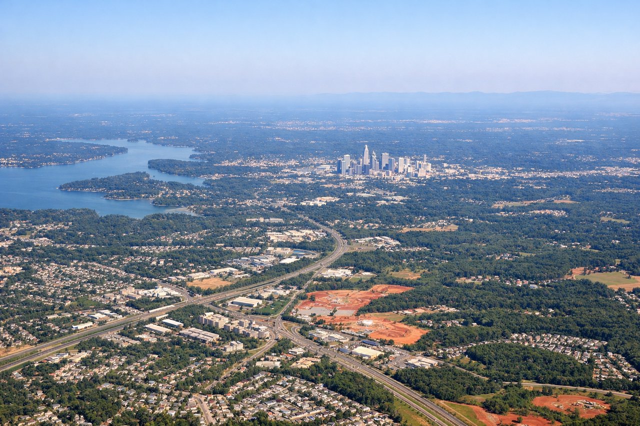
Takeoff from CLT
RIGHTCLT's south-flow departures climb out heading south before banking right onto the westbound track, and that turn sweeps Charlotte's uptown skyline into view on the right side. As the aircraft levels off westbound, the Blue Ridge foothills appear on the horizon ahead-right, giving the north side a livelier sequence than the flat Piedmont farmland visible to the south.

Landing at LAX
RIGHTLAX's typical west-flow landings mean the final approach faces west, putting the San Gabriel Mountains and the Los Angeles basin's urban sprawl on the right side of the cabin. Passengers get a strong closing sequence of mountains-to-city scenery, while the left side mostly sees the flatter South Bay and harbor area.
Landmarks on this routeAll landmarks →
Will your flight be in sunlight?
Pick a date and time in the Sun Map to watch the sun move across your whole flight.
About This Route
Which side of the plane should I sit on flying from Charlotte Douglas International (CLT) to Los Angeles International (LAX)?
Sit on the Right side of the plane for the best views on flights from Charlotte to Los Angeles. The right side stays north-facing for almost the entire flight, delivering a consistent string of landmarks: the Blue Ridge foothills at departure, the Great Smoky Mountains and Sandia Mountains near Albuquerque during cruise, the San Francisco Peaks near Flagstaff, and finally the San Gabriel Mountains and LA skyline on arrival. The left side spends most of the flight over flat Southern plains and high desert with far fewer distinctive features.
What can I see during takeoff from Charlotte Douglas International in Charlotte?
During takeoff from Charlotte Douglas International (CLT), sit on the Right side for the best views. CLT's south-flow departures climb out heading south before banking right onto the westbound track, and that turn sweeps Charlotte's uptown skyline into view on the right side. As the aircraft levels off westbound, the Blue Ridge foothills appear on the horizon ahead-right, giving the north side a livelier sequence than the flat Piedmont farmland visible to the south. Notable sights include: Uptown Charlotte skyline, Catawba River, Blue Ridge foothills, Piedmont countryside.
What can I see when landing at Los Angeles International in Los Angeles?
When landing at Los Angeles International (LAX), sit on the Right side for the best views. LAX's typical west-flow landings mean the final approach faces west, putting the San Gabriel Mountains and the Los Angeles basin's urban sprawl on the right side of the cabin. Passengers get a strong closing sequence of mountains-to-city scenery, while the left side mostly sees the flatter South Bay and harbor area. Notable sights include: San Gabriel Mountains, Hollywood Hills, San Fernando Valley, downtown Los Angeles skyline.
How long is the flight from Charlotte to Los Angeles?
The flight from Charlotte Douglas International (CLT) to Los Angeles International (LAX) takes about 5 hours 5 minutes. The shortest flight path between them is 2,120 miles (3,413 km); winds and air traffic control usually add a few percent.
What does the Charlotte to Los Angeles flight path pass over?
The route crosses the Texas Panhandle near Amarillo, passing close to Palo Duro Canyon, then continues over the high desert of eastern New Mexico toward Albuquerque before the terrain rises again near Flagstaff, Arizona.